Èvre
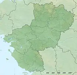
The Èvre (French pronunciation: [ɛvʁ]) is a 91.8 km (57.0 mi) long river in western France, left tributary of the Loire.[1] Its source is at Vezins, 1.5 km (0.93 mi) northeast of the village. It flows into the Loire at Le Marillais, 3 km (1.9 mi) east of the village.
| Èvre | |
|---|---|
 The Èvre in Montrevault | |
  | |
| Native name | L'Èvre (French) |
| Location | |
| Country | France |
| Physical characteristics | |
| Source | |
| • location | Vezins |
| • coordinates | 47°07′50″N 00°41′39″W |
| • elevation | 161 m (528 ft) |
| Mouth | |
• location | Loire |
• coordinates | 47°21′49″N 1°02′00″W |
• elevation | 10 m (33 ft) |
| Length | 91.8 km (57.0 mi) |
| Basin size | 573 km2 (221 sq mi) |
| Discharge | |
| • average | 3.38 m3/s (119 cu ft/s) |
| Basin features | |
| Progression | Loire→ Atlantic Ocean |
The Èvre flows through the following communes in the Maine-et-Loire département, ordered from source to mouth: Vezins, La Tourlandry, Trémentines, Le May-sur-Èvre, La Jubaudière, Jallais, La Poitevinière, Beaupréau, La Chapelle-du-Genêt, Le Fief-Sauvin, Montrevault, Saint-Pierre-Montlimart, Saint-Rémy-en-Mauges, La Boissière-sur-Èvre, La Chapelle-Saint-Florent, Botz-en-Mauges, Saint-Florent-le-Vieil, Le Marillais
This article is issued from Wikipedia. The text is licensed under Creative Commons - Attribution - Sharealike. Additional terms may apply for the media files.