Moldova Nouă
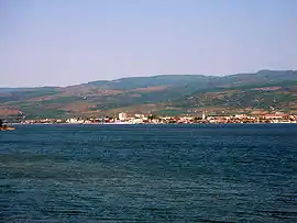
Moldova Nouă (Romanian pronunciation: [molˌdova ˈnowə] ⓘ; Hungarian: Újmoldova; German: Neumoldowa; Czech: Nová Moldava or Bošňák; Serbian: Нова Молдава) is a town in southwestern Romania in Caraș-Severin County (the historical region of Banat), in an area known as Clisura Dunării. The town administers three villages: Măcești (Hungarian: Macsevics, Serbian: Мачевић), Moldova Veche (Ómoldova, Стара Молдава), and Moldovița (Kiskárolyfalva, Молдавица).
Moldova Nouă | |
|---|---|
 | |
 Coat of arms | |
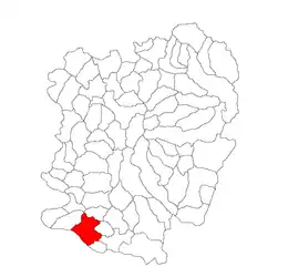
 Location in Caraș-Severin County | |
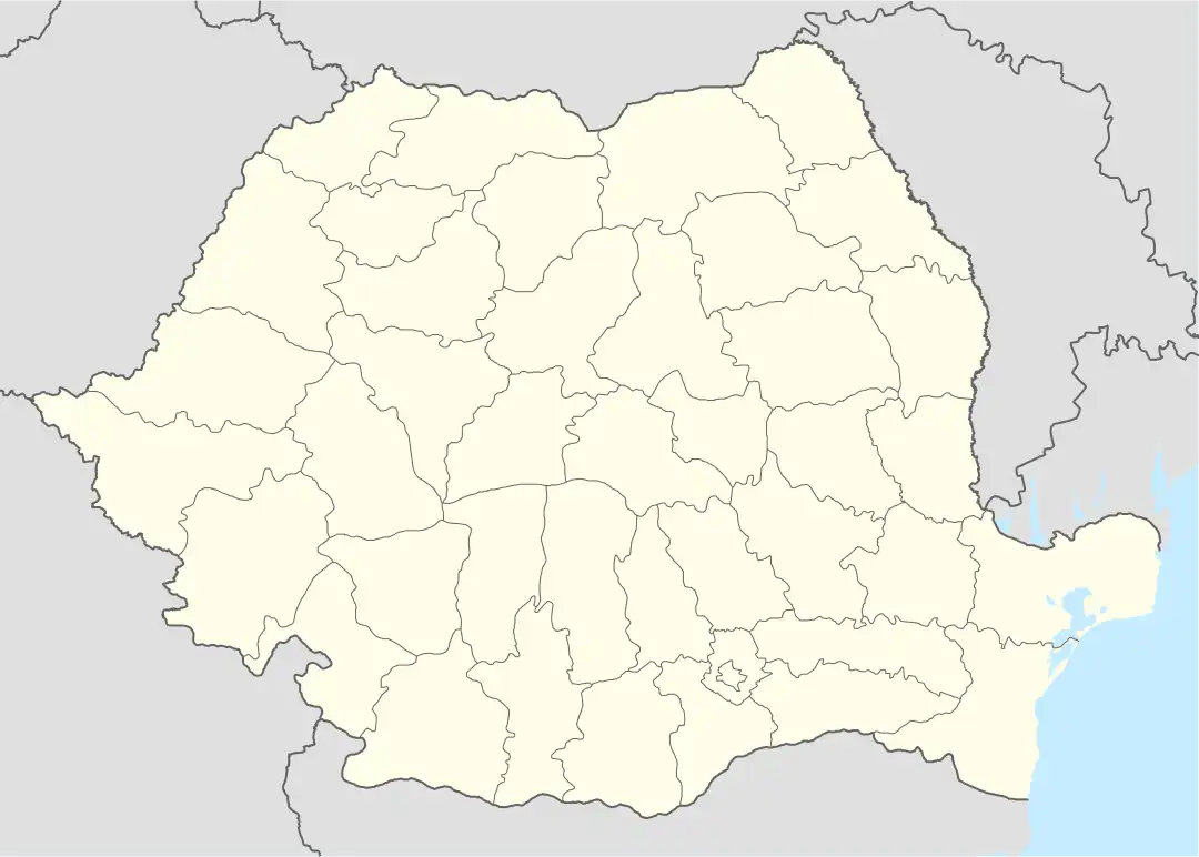
 Moldova Nouă Location in Romania | |
| Coordinates: 44°43′4″N 21°39′50″E | |
| Country | Romania |
| County | Caraș-Severin |
| Government | |
| • Mayor (2020–2024) | Ion Chisăliță[1] (PNL) |
| Area | 145.84 km2 (56.31 sq mi) |
| Elevation | 114 m (374 ft) |
| Population (2021-12-01)[2] | 9,278 |
| • Density | 64/km2 (160/sq mi) |
| Time zone | EET/EEST (UTC+2/+3) |
| Postal code | 325500 |
| Area code | (+40) 02 55 |
| Vehicle reg. | CS |
| Website | www |

The town lies on the shores of the river Danube, which separates it from Serbia. It is located at the southern extremity of Caraș-Severin County, 107 km (66 mi) from the county capital, Reșița. It is crossed by national road DN57, which connects it to Oravița, 53 km (33 mi) to the north, and Orșova, 103 km (64 mi) to the east.
Moldova Veche
In Moldova Veche village, evidence of human habitation dating to the transition between the Neolithic and the Bronze Age has been found. Additionally, there exist traces of an unfortified Dacian settlement, similar to several others in the area. In Roman Dacia, a castrum located in the village supervised mining and navigation on the Danube. Vestiges from the Dark Ages and the Early Middle Ages have been found; during the 10th and 11th centuries, the area was controlled by Glad and later Ahtum.[3] Serbs have been living there since their replacement of the Gepids in the 5th century. [4]
In 1552, when the Banat fell under Ottoman rule, Moldova Veche became the capital of a sanjak within the Temeşvar Eyalet.[3] In 1566, at the end of Suleiman the Magnificent's reign, coins of gold (altâni) and silver (aspri) were minted there.[5] A document of 1588 records the place under the name Mudava; this is the earliest written mention. The Slavicizied Germanic-origin toponym is still used by locals. Bogdan Petriceicu Hasdeu and the majority of Romanian philologists and historians claim that the name comes from the term of Germanic origin mulde (i.e., "hollow", "quarry" or "drainage").[6] In 1718, the area came under the Habsburg monarchy's control.[3]
The village was absorbed into Moldova Nouă in 1956. It is the site of a Danube port.[7] There is a Baptist church; the community was established in 1927, its first church built in 1967 and the present structure in 2001.[8] Adherents are both Romanian and Serbian, with services conducted in Romanian.[9]
Demographics
At the 2011 census, 81.2% of inhabitants were Romanians, 12.8% Serbs, 3.2% Roma, 1.3% Hungarians, and 0.8% Czechs. At the 2002 census, 88.4% were Romanian Orthodox, 4.5% Baptist, 4% Roman Catholic, and 2% Pentecostal.
| Year | Pop. | ±% |
|---|---|---|
| 1956 | 3,582 | — |
| 1966 | 6,192 | +72.9% |
| 1977 | 15,973 | +158.0% |
| 1992 | 16,874 | +5.6% |
| 2002 | 15,112 | −10.4% |
| 2011 | 12,350 | −18.3% |
| Source: Census data | ||
Natives
- Ștefan Blănaru (born 1989), Romanian footballer
- Alin Dobrosavlevici (born 1994), Romanian footballer
- Emilijan Josimović (1823–1897), Serbian urbanist
- Iasmin Latovlevici (born 1986), Romanian footballer
- Mihăiță Pleșan (born 1983), Romanian footballer
- Anca Pop (1984–2018), Romanian-Canadian singer-songwriter
- Cosmin Sârbu (born 1996), Romanian footballer
- Deian Sorescu (born 1997), Romanian footballer
- Clara Vădineanu (born 1986), Romanian handballer
- Ella Zeller (born 1933), Romanian table tennis player
Climate
Moldova Nouă has a humid continental climate (Cfb in the Köppen climate classification).
| Climate data for Moldova Nouă | |||||||||||||
|---|---|---|---|---|---|---|---|---|---|---|---|---|---|
| Month | Jan | Feb | Mar | Apr | May | Jun | Jul | Aug | Sep | Oct | Nov | Dec | Year |
| Average high °C (°F) | 2.4 (36.3) |
4.4 (39.9) |
10.1 (50.2) |
15.9 (60.6) |
20.5 (68.9) |
24.1 (75.4) |
26.2 (79.2) |
26.4 (79.5) |
21.1 (70.0) |
15.3 (59.5) |
9.6 (49.3) |
3.9 (39.0) |
15.0 (59.0) |
| Daily mean °C (°F) | −0.6 (30.9) |
0.9 (33.6) |
5.7 (42.3) |
11.2 (52.2) |
16 (61) |
19.7 (67.5) |
21.8 (71.2) |
21.8 (71.2) |
16.9 (62.4) |
11.4 (52.5) |
6.2 (43.2) |
1 (34) |
11.0 (51.8) |
| Average low °C (°F) | −3.3 (26.1) |
−2.3 (27.9) |
1.3 (34.3) |
6.2 (43.2) |
11 (52) |
14.8 (58.6) |
16.9 (62.4) |
17.1 (62.8) |
12.9 (55.2) |
7.8 (46.0) |
3.4 (38.1) |
−1.5 (29.3) |
7.0 (44.7) |
| Average precipitation mm (inches) | 62 (2.4) |
58 (2.3) |
61 (2.4) |
80 (3.1) |
78 (3.1) |
83 (3.3) |
70 (2.8) |
56 (2.2) |
65 (2.6) |
58 (2.3) |
59 (2.3) |
68 (2.7) |
798 (31.5) |
| Source: https://en.climate-data.org/europe/romania/caras-severin/moldova-noua-37211/ | |||||||||||||
Notes
- Aleksandra Djurić-Milovanović, "Serbs in Romania: Relationship between Ethnic and Religious Identity", Balcanica XLIII (2012), pp. 117–142
References
- "Results of the 2020 local elections". Central Electoral Bureau. Retrieved 8 June 2021.
- "Populaţia rezidentă după grupa de vârstă, pe județe și municipii, orașe, comune, la 1 decembrie 2021" (XLS). National Institute of Statistics.
- (in Romanian) Short history at the Moldova Nouă Town Hall site
- Georgiev, Pavel (2014). The Abodriti-Praedenecenti between the Tisza and the Danube in the 9th Century. Archaeolingua. pp. 107–120. ISBN 978-963-9911-55-0.
- Octavian Iliescu, The History of Coins in Romania (ca. 1500 BC – 2000 AD), p. 48. Bucharest: Editura Enciclopedică, 2002
- Maximean, Doina (2014). "A new theory on the etymology of the name of "Moldova"". Annals of the Academy of Romanian Scientists Series on History and Archaeology. 6: 2–7.
- Hinnerk Dreppenstedt, Flusskreuzfahrten Donau, p. 304. Berlin: Trescher Verlag 2017. ISBN 978-389794-373-5
- (in Romanian) History at the Grace Church site
- Djurić-Milovanović, p. 128
