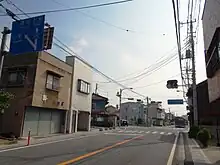
Ōme Kaidō
Ōme Kaidō (青梅街道) is one of the main roads leading westwards out of Tokyo. It begins in Shinjuku, passes through Ōme, and ends in Kōfu, Yamanashi.[1]


The road was originally developed in 1606 to transport lime from Ome during the land reclamation efforts in Edo during the Tokugawa era and was known by different names in different eras and regions over the course of time, as "Ogawa-michi" and "Hakonegasaki-michi" in Edo, "Afume-michi" or "Mitake-michi" in Ome, and "Haraedo-michi" in Hakonegasaki. It was identified as 'Ōme Kaidō' on a survey map created in 1880 and formally designated as such in 1962.[2]
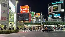
Ōme Kaidō overbridge

The Ōme Kaidō overbridge in Shinjuku currently serves as the eastern terminus of the Ōme Kaidō, approximately 560 m (1,840 ft) northwest of the historical starting point at the intersection of Meiji-dōri and Shinjuku-dōri.
The Chuō, Saikyō, Shōnan-Shinjuku, and Yamanote train lines pass over the highway, with 10 lanes of roadway and sidewalks beneath.[3]
It is frequently featured in popular culture as the unofficial western gate to Kabukichō, most recently featured in the opening titles of Midnight Diner on Netflix.
Stations of the Ōme Kaidō
There are 9 post stations along the Ōme Kaidō. They are listed below with the corresponding modern-day municipality listed in parentheses.
- Nakano-juku(Nakano, Tokyo)
- Tanashi-juku(Nishitōkyō, Tokyo)
- Ogawa-juku(Kodaira, Tokyo)
- Hakonegasaki-juku(Mizuho, Nishitama District, Tokyo)
- Ōme-juku(Ōme, Tokyo)
- Hikawa-shuku(Okutama, Nishitama District, Tokyo)
- Taba-shuku(Tabayama, Kitatsuru District, Yamanashi)
- Enzan-juku(Kōshū, Yamanashi)
- Kobara-juku(Yamanashi, Yamanashi)
 Marker indicating the historic starting point of Ōme Kaidō at Meiji-dori and Shinjuku-dori
 Historic starting point of Ōme Kaidō at Meiji-dori and Shinjuku-dori
 Closer view of the map at the historic starting point of Ōme Kaidō
See also
References
- Enjoy Walking Highways - Ome Kaido Archived 2020-04-29 at the Wayback Machine. kimamanikaidouaruki. Accessed April 29, 2020.
- 歴史の道調査報告書 第三集 青梅街道. 東京都教育委員会. 1995.
- "新宿駅構内青梅街道架道橋拡築工事" (PDF) (in Japanese). 土木建築工事画報. October 1936.