Deleni, Constanța
Deleni is a commune in Constanța County, Northern Dobruja, Romania. It is situated in the southern part of the county, 59 km (37 mi) west of Constanța.
Deleni | |
|---|---|
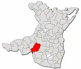 Location in Constanța County | |
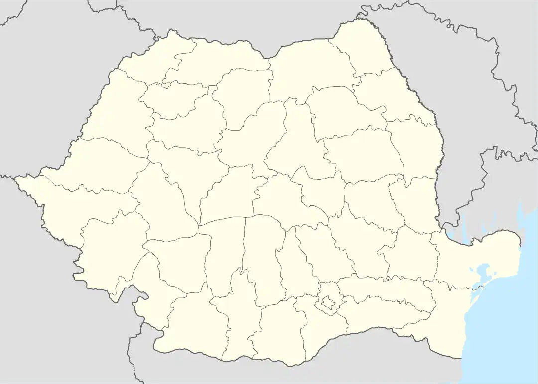 Deleni Location in Romania | |
| Coordinates: 44°6′N 28°1′E | |
| Country | Romania |
| County | Constanța |
| Subdivisions | Deleni, Petroșani, Pietreni, Șipotele |
| Government | |
| • Mayor (2020–2024) | Marian Dan[1] (PSD) |
| Area | 178.88 km2 (69.07 sq mi) |
| Elevation | 122 m (400 ft) |
| Population (2011-10-31)[2] | 2,388 |
| • Density | 13/km2 (35/sq mi) |
| Time zone | EET/EEST (UTC+2/+3) |
| Postal code | 907110 |
| Vehicle reg. | CT |
| Website | www |
The villages comprising the commune are:
- Deleni (historical name: Ienidja, Enigea or Enige; Turkish: Yenice)
- Petroșani (historical names: Chioseler, Turkish: Köseler)
- Pietreni (historical names: Cocargea until 1964, Turkish: Kokarca)
- Șipotele (historical names: Ghiolpunar, Turkish: Gölpınar)
The territory of the commune also includes the former villages of Poenița (historical name: Borungea, Turkish: Borunca), located at 44°0′55″N 28°0′38″E, disestablished by Presidential Decree in 1977, and Furca (historical name: Becter), located at 43°59′51″N 28°4′18″E.
Demographics
At the 2021 census, Deleni had 2,388 inhabitants. At the 2011 census, there were 2,272 Romanians (98.31%), 10 Turks (0.43%), 28 Tatars (1.21%), 1 other (0.04%).
Climate
Deleni has a Humid Subtropical Climate (Cfa). It receives the most abundant rainfall in June, with an average precipitation of 69 mm; and the most scarce rainfall in February, with an average precipitation of 38 mm.
| Climate data for Pietreni | |||||||||||||
|---|---|---|---|---|---|---|---|---|---|---|---|---|---|
| Month | Jan | Feb | Mar | Apr | May | Jun | Jul | Aug | Sep | Oct | Nov | Dec | Year |
| Average high °C (°F) | 4.0 (39.2) |
6.7 (44.1) |
11.5 (52.7) |
16.5 (61.7) |
22.0 (71.6) |
26.0 (78.8) |
28.6 (83.5) |
28.9 (84.0) |
23.5 (74.3) |
17.2 (63.0) |
12.0 (53.6) |
6.3 (43.3) |
16.9 (62.5) |
| Daily mean °C (°F) | 0.4 (32.7) |
2.4 (36.3) |
6.5 (43.7) |
11.3 (52.3) |
16.7 (62.1) |
21.2 (70.2) |
23.6 (74.5) |
23.5 (74.3) |
18.5 (65.3) |
12.7 (54.9) |
8.0 (46.4) |
2.5 (36.5) |
12.3 (54.1) |
| Average low °C (°F) | −3.0 (26.6) |
−1.5 (29.3) |
1.9 (35.4) |
6.1 (43.0) |
11.3 (52.3) |
15.8 (60.4) |
18.2 (64.8) |
18.1 (64.6) |
13.8 (56.8) |
8.7 (47.7) |
4.6 (40.3) |
−0.7 (30.7) |
7.8 (46.0) |
| Average rainfall mm (inches) | 47 (1.9) |
38 (1.5) |
51 (2.0) |
50 (2.0) |
63 (2.5) |
69 (2.7) |
50 (2.0) |
42 (1.7) |
55 (2.2) |
50 (2.0) |
44 (1.7) |
46 (1.8) |
605 (24) |
| Source: Climate-Data.org[3] | |||||||||||||
Pietreni
At the 2021 census, Pietreni village had a population of 799.[4]
Pietreni is situated along National Road 3, about 47 km (29 mi) west of the county seat, Constanța. It has an average elevation of 122 m (400 ft) above sea level.[5]
References
- "Results of the 2020 local elections". Central Electoral Bureau. Retrieved 15 June 2021.
- "Populaţia stabilă pe judeţe, municipii, oraşe şi localităti componenete la RPL_2011" (XLS). National Institute of Statistics.
- "Pietreni climate: Temperature Pietreni & Weather By Month - Climate-Data.org". en.climate-data.org. Retrieved 9 March 2023.
- "Pietreni (Deleni, Constanța County, Romania) - Population Statistics, Charts, Map, Location, Weather and Web Information". www.citypopulation.de. Retrieved 9 August 2023.
- "Pietreni topographic map, elevation, terrain". en-gb.topographic-map.com. Retrieved 9 August 2023.