't Waar
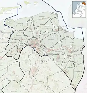
't Waar (Dutch pronunciation: [ət ʋaːr]) is a village in the province of Groningen in the Netherlands. It is located in the municipality of Oldambt, just north of the village of Nieuw-Scheemda.[3]
't Waar | |
|---|---|
 Windmill De Dellen in 1977 | |
 't Waar Location of 't Waar in the province of Groningen  't Waar 't Waar (Netherlands) | |
| Coordinates: 53°13′31″N 6°57′7″E | |
| Country | Netherlands |
| Province | Groningen |
| Municipality | Oldambt |
| Area | |
| • Total | 0.49 km2 (0.19 sq mi) |
| Elevation | 0.1 m (0.3 ft) |
| Population (2021)[1] | |
| • Total | 115 |
| • Density | 230/km2 (610/sq mi) |
| Postal code | 9942[1] |
| Dialing code | 0598 |
History
The villages was first mentioned in 1781 as 't Waar, and means sluice.[4] It refers to a sluice constructed in 1622 in the Termunterzijldiep to regulate the water flow.[5]
't Waar was home to 451 people in 1840.[5] Between 1910 and 1934, there was a joint railway station with Nieuw-Scheemda on the Zuidbroek to Delfzijl railway line.[6] On 15 April 1945, the village celebrate its liberation when German soldiers threw handgrenades into the crowd killing five civilians and one Polish soldier. In 1995, a memorial was placed on the site.[7][5]
't Waar was part of the municipality of Scheemda until 1990 when it became part of Nieuwolda. Since 2010, it is part of Oldambt.[5]
References
- "Kerncijfers wijken en buurten 2021". Central Bureau of Statistics. Retrieved 9 April 2022.
two entries
- "Postcodetool for 9942PA". Actueel Hoogtebestand Nederland (in Dutch). Het Waterschapshuis. Retrieved 8 April 2022.
- ANWB Topografische Atlas Nederland, Topografische Dienst and ANWB, 2005.
- "Waar - (geografische naam)". Etymologiebank (in Dutch). Retrieved 9 April 2022.
- "'t Waar". Plaatsengids (in Dutch). Retrieved 9 April 2022.
- "stopplaats Nieuw Scheemda- t Waar". Stationweb (in Dutch). Retrieved 9 April 2022.
- "Oorlogsmonument 't Waar". Traces of War (in Dutch). Retrieved 9 April 2022.