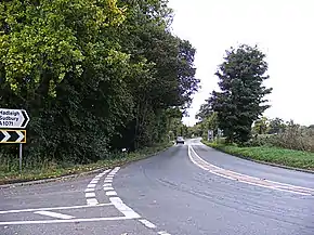
A1071 road
The A1071 road is 16.5 miles (26.6 km) long and runs from the A134 near Sudbury to Ipswich.
 | ||||
|---|---|---|---|---|
 A1071 Ipswich Road, Hintlesham | ||||
| Route information | ||||
| Length | 16.5 mi (26.6 km) | |||
| Major junctions | ||||
| West end | A134 near Sudbury | |||
| East end | A1214 in Ipswich | |||
| Location | ||||
| Country | United Kingdom | |||
| Road network | ||||
| ||||
Route
It by-passes Boxford, Calais Street, Bower House Tye, Hadleigh Heath, Hadleigh, where it comes to a staggered junction for the A1141 road (left) and the B1070 (right) and goes through Hintlesham. Then it comes to a T-Junction at the A1214 road (London Road) at Chantry. Then the A1214 turns into the A1071 again after the River Orwell and runs into the centre of Ipswich.
Sources
Template:Attached KML/A1071 road
KML is from Wikidata
This article is issued from Wikipedia. The text is licensed under Creative Commons - Attribution - Sharealike. Additional terms may apply for the media files.