Aatunselkä
Aatunselkä is a lake in the municipality of Äänekoski in the Central Finland Province in Finland.[1]
| Aatunselkä | |
|---|---|
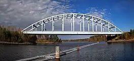 Ison Pörri bridge | |
| Location | Äänekoski |
| Coordinates | 62°32′42″N 25°49′08″E |
| Basin countries | Finland |
| Surface area | 1,11383 km² |
| Water volume | 0,00464322 km³ |
| Shore length1 | 10,41 km |
| Surface elevation | 91,7 m |
| Islands | Verkkosaari Tuppisaari Luijansaari |
| 1 Shore length is not a well-defined measure. | |
Details
The lake is 91.7 m above sea level. The area is 1.05 square km and the Coast is 10.41 km long. The lake is part of the Kymi (river)'s main catchment area. It is located about 33 km north of Jyväskylä and about 270 km north of Helsinki.[2] In the lake there are the islands of Verkkosaari, Tuppisaari, Luijansaari. The lake is connected to Kuhnamo in the north.[3][4]
References
- "Aatunselkä (14.332.1.007)". Järvi-meriwiki (in Finnish). 2011-02-01. Retrieved 2023-10-06.
- "Karttapaikka - Maanmittauslaitos". asiointi.maanmittauslaitos.fi. Retrieved 2023-10-06.
- "Avoimet ympäristötietojärjestelmät - syke.fi". www.syke.fi (in Finnish). Retrieved 2023-10-06.
- "Karttapaikka - Maanmittauslaitos". asiointi.maanmittauslaitos.fi. Retrieved 2023-10-06.
This article is issued from Wikipedia. The text is licensed under Creative Commons - Attribution - Sharealike. Additional terms may apply for the media files.