Abadi Creek
Abadi Creek is a stream located in the U.S. state of California. It is located in Santa Barbara County.[6][7]
| Abadi Creek Tributary to Sespe Creek | |
|---|---|
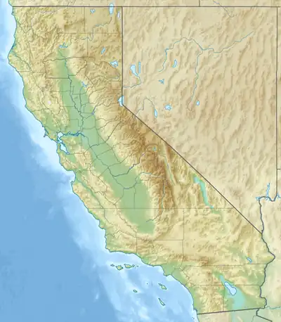 Location of Abadi Creek mouth  Abadi Creek (the United States) | |
| Location | |
| Country | United States |
| State | California |
| County | Ventura Santa Barbara |
| Physical characteristics | |
| Source | Lacusca Creek divide |
| • location | about 10 miles southeast of Don Victor Valley |
| • coordinates | 34°36′35″N 119°27′14″W[1] |
| • elevation | 5,110 ft (1,560 m)[2] |
| Mouth | Sespe Creek |
• location | about 6 miles southeast of Potrero Seco |
• coordinates | 34°36′35″N 119°27′14″W[1] |
• elevation | 4,232 ft (1,290 m)[3] |
| Length | 6.57 mi (10.57 km)[4] |
| Basin size | 7.20 square miles (18.6 km2)[5] |
| Discharge | |
| • location | Sespe Creek |
| • average | 6.82 cu ft/s (0.193 m3/s) at mouth with Sespe Creek[5] |
| Basin features | |
| Progression | Sespe Creek → Santa Clara River → Pacific Ocean |
| River system | Santa Clara River |
| Tributaries | |
| • left | unnamed tributaties |
| • right | unnamed tributaries |
| Bridges | NF-6NO3, Upper Hartman Ranch Road |
See also
References
- "GNIS Detail - Abadi Creek". geonames.usgs.gov. US Geological Survey. Retrieved 10 June 2021.
- "Get Maps". USGS Topoview. US Geological Survey. Retrieved 10 June 2021.
- "Get Maps". USGS Topoview. US Geological Survey. Retrieved 10 June 2021.
- "ArcGIS Web Application". epa.maps.arcgis.com. US EPA. Retrieved 10 June 2021.
- "Abadi Creek Watershed Report". US EPA Geoviewer. US EPA. Retrieved 10 June 2021.
- "Abadi Creek (in Santa Barbara County, CA)". California.hometownlocator.com. Retrieved December 6, 2015.
- "GNIS Detail - Abadi Creek". Geonames.usgs.gov. Retrieved December 6, 2015.
This article is issued from Wikipedia. The text is licensed under Creative Commons - Attribution - Sharealike. Additional terms may apply for the media files.