Abriès
Abriès (Vivaro-Alpine: Abrièrs) is a former commune in the Hautes-Alpes department in southeastern France. On 1 January 2019, it was merged into the new commune of Abriès-Ristolas.[2]
Abriès | |
|---|---|
Part of Abriès-Ristolas | |
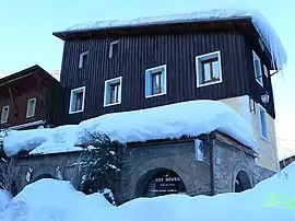 Town hall | |
Location of Abriès | |
 Abriès 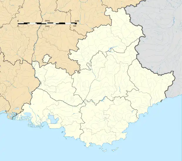 Abriès | |
| Coordinates: 44°47′46″N 6°55′40″E | |
| Country | France |
| Region | Provence-Alpes-Côte d'Azur |
| Department | Hautes-Alpes |
| Arrondissement | Briançon |
| Canton | Guillestre |
| Commune | Abriès-Ristolas |
| Area 1 | 77 km2 (30 sq mi) |
| Population (2019)[1] | 292 |
| • Density | 3.8/km2 (9.8/sq mi) |
| Time zone | UTC+01:00 (CET) |
| • Summer (DST) | UTC+02:00 (CEST) |
| Postal code | 05460 |
| Elevation | 1,513–3,305 m (4,964–10,843 ft) (avg. 1,547 m or 5,075 ft) |
| 1 French Land Register data, which excludes lakes, ponds, glaciers > 1 km2 (0.386 sq mi or 247 acres) and river estuaries. | |
It belongs to the Queyras Regional Park. It is located in the valley of the Guil and is appreciated for its position along long and medium distance footpaths in a rural and preserved environment. It also hosts a small ski resort.
Geography
The elevation of Abriès is between 1,513 and 3,305 meters, and before the second half of the 20th century, it was difficult to access because of its location in the end of the Guil valley. It has always has been a path between Italy and the southern Alps in France.
Population
|
| ||||||||||||||||||||||||||||||||||||||||||||||||||||||||||||||||||||||||||||||||||||||||||||||||||||||||||||||||||||||||||||||||||||||||||||||||
| Source: EHESS (1793-2004)[3] and INSEE[4] | |||||||||||||||||||||||||||||||||||||||||||||||||||||||||||||||||||||||||||||||||||||||||||||||||||||||||||||||||||||||||||||||||||||||||||||||||
References
- Téléchargement du fichier d'ensemble des populations légales en 2019, INSEE
- "Arrêté préfectoral portant création de la commune nouvelle d'Abriès-Ristolas" (PDF) (in French). Recueil des actes administratifs spécial n°05-2018-161. 17 October 2018. pp. 79–80.
- Des villages de Cassini aux communes d'aujourd'hui: Commune data sheet Abriès, EHESS (in French).
- Population en historique depuis 1968, INSEE
This article is issued from Wikipedia. The text is licensed under Creative Commons - Attribution - Sharealike. Additional terms may apply for the media files.