Administrative divisions of Thailand
Thailand is a unitary state, which means the territories are separated into central co-dependencies, with the central government deciding everything for the provinces.[1] The kingdom is separated into multiple levels including regions, provinces, and many more. Though, formally, Thailand is separated into three levels: provinces, districts, and sub-districts, there are also informal divisions such as parimonthon, and phak.[2] Furthermore, there are administrative divisions of the same level with different names such as the first-level divisions of the province and the special administrative region.
| Administrative divisions of Thailand | ||||||||
|---|---|---|---|---|---|---|---|---|
| Provincial divisions | ||||||||
|
||||||||
| Local divisions | ||||||||
|
||||||||
| Note: † Special administrative area | ||||||||
The governance is separated into two branches, regular and municipal administration.[3] The regular administration is governed by the central government directly, with the municipal administration being given more autonomy by the central government, though still heavily restricted due to the over centralization of the Thai administrative system. This system arose during Rama V's reign where the governing system of the Kingdom of Siam was changing rapidly due to westernization.[4]
Provincial administrative divisions
Provinces
Changwat (Thai: จังหวัด) or provinces is the first level of administration, the highest level, of Thailand. Thailand is separated into 76 provinces, though commonly mistaken as 77 provinces due to Bangkok's former status as a province itself. This is the highest level of administrative division within the kingdom. Each of the provinces are led by governor. The changwat is responsible for implementing state policy and enforcing laws.[5]
Governance
The provinces are governed by a governor appointed by the central government. Specifically, the Ministry of the Interior is a part of the Bangkok Government. The norm for naming the provinces is using the provincial capital as the name, which is why they are called namesake cities. A notable difference from history was during the post-Franco-Siamese War period when there was a DMZ around the border which falls on the Mekong river. During this time, there was a province called Nong Khai but the capital was in Ban Makkhaeng. A province is administered by a governor (ผู้ว่าราชการจังหวัด) who is appointed by the Minister of Interior. The provinces are named after their namesake cities, a cities which were the "capital" at the time of its founding. Also, in several provinces the administration has been moved into a new building outside the city.
Ayutthaya Kingdom
Most provinces date back to the time of subservient city-states, chiefdoms, and even vassal kingdoms. The polity was called muangs, not to be confused with modern muangs which means cities, which had their own satellite muangs. Traditionally ruled by a local ruling family, these muangs had a high level of autonomy. The highest king of these muangs, phaya or khun luang, though the titles changes over history, ruled these muangs through a system of tributes. The king did not have much control over these muangs which lead to uprisings and rebellions. During the war, these muangs often switched sides which leads to the downfall of the Ayutthaya Kingdom.
The provinces were separated into two classes and four different levels.[6]
| Levels | First | Second | Third | Forth |
|---|---|---|---|---|
| Central | Wiang (เวียง) | Wang (วัง) | Khlang (คลัง) | Na (นา) |
| Vassal | Muang Luk Luang (เมืองลูกหลวง) | Inner Hua Muang (หัวเมืองชั้นใน) | Outer Hua Muang (หัวเมืองชั้นนอก) | Muang Prathetsarat (เมืองประเทศราช) |
Rattanakosin Kingdom
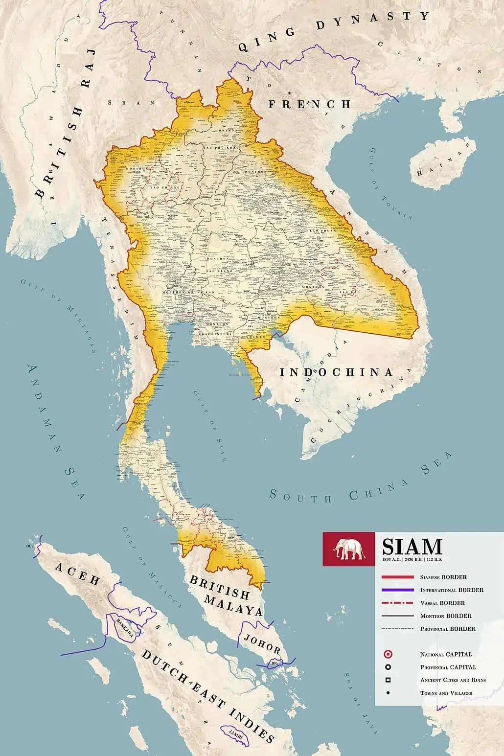
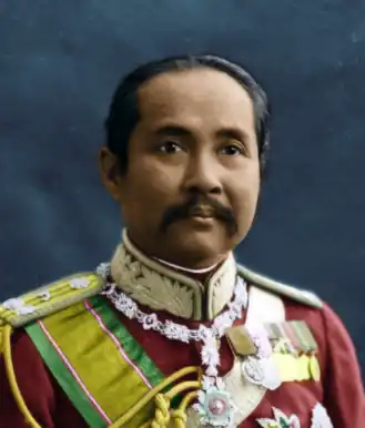
During this era, nothing changed much at the beginning. But when the western colonial powers started to eye the region, The Siamese government took to reform their administrative division into a form that much resembles the modern structure. In 1882, much of the current political geography of Siam had changed drastically. Rama V, who had been ramping up the reformation of Siam, had devised a plan to divide Siam into several levels of administration. During this era, the province wasn't the highest level of division. This falls to the monthon and the vassal kingdoms. At the time, Siam was a minor power, controlling several minor kingdoms on their frontiers with the major colonial powers. By, 1892, much of the divisions had already been formed, though this is far from modern Thailand's divisional structure, and by 1900 most of the territory gained during the rule of Rama III were lost to France and Britain.
In 1908, a new division called boriwen was introduced, though later abolished due to its overlapping duties with other local governments, and the bureaucratic costs to maintain the divisions.
In 1932, there were major reforms all over the kingdom, monthon was abolished, provinces merged, and several other divisions dissolved into higher divisions to cut costs. The former provinces that were lost are merged into other provinces or ceded to western powers.
During the 20th century, a massive reform occurred gradually over the century, which saw the formation of several provinces through partitions. The newest province is Bueng Kan which split from Nong Khai on 23 March 2011.
Former Provinces of Thailand
| Provinces | จังหวัด | Fate | Today Part of |
|---|---|---|---|
| Attapue | อัตตะปือ | ceded to France | Attapeu |
| Borikhan Nikhom | บริคัณฑ์นิคม | ceded to France | Bolikhamxai |
| Uthai | อุทัย | ceded to France | Sainyabuli and Luang Prabang |
| Phon Phisai | โพนพิสัย | merged with Nong Khai | Nong Khai and Bueng Kan |
| Tha Uthen | ท่าอุเทน | merged with Nakhon Phanom | Nakhon Phanom |
| Chaiburi | ซายบุรี | merged with Nong Khai | Bueng Kan |
| Pra Pradaeng | พระประแดง | merged with Samut Prakan, partitioned from Pra Nakhon and Samut Prakan, merged between Samut Prakan and Thonburi | Samut Prakan and Bangkok |
| Kabinburi | กะบิ่นบุรี | merged with Prachinburi | Prachinburi and Sa Kaeo |
| Thalang | ถลาง | destroyed during the Burmese–Siamese War (1809–1812) | Phuket |
| Phichai | พิชัย | capital moved to Uttaradit | Uttaradit, Phitsanulok, and Loei |
| Chiang Khaeng | เชียงแขง | partitioned between France and Britain | Shan State |
| Chiang Khouang | เชียงขวาง | ceded to France | Xiangkhouang |
| Chiang Taeng | เชียงแตง | ceded to France | Kratié, Stung Treng, Ratanakiri, and Mondulkiri |
| Kalantan | กลันตัน | partitioned between Siam and Britain, merged with Narathiwat, regained and ceded to Britain again | Narathiwat |
| Kham Kert | คำเกิด | ceded to France | Khammouane |
| Kham Muan | คำม่วน | ceded to France | Khammouane |
| Kham Thong Luang | คำทองหลวง | ceded to France | Stung Teng |
| Khemmarat | เขมราฐ | partitioned between Siam and France, merged into Ubon Ratchathani | Ubon Ratchathani and Yasothon |
| Khukhan | ขุขันธ์ | partitioned between Siam and France, merged into Sisaket | Ubon Ratchathani and Sisaket |
| Lan Chang | ลานช้าง | ceded to France | Sainyabuli and Luang Prabang |
| Luang Phrabang | หลวงพระบาง | ceded to France | Luang Prabang, Oudomxay, Phongsaly, and Vientiane |
| Phibunsongkhram | พิบูลสงคราม | ceded to France | Banteay Meanchey, Siem Reap, Oddar Meanchey, and Preah Vihear |
| Phongsa | พงสา | ceded to France | Phongsaly |
| Phra Tabong | พระตะบอง | ceded to France | Banteay Meanchey, Siem Reap, Pailin, and Battambang |
| Prachan Khiri Khet | ประจันตคีรีเขตร | partitioned between Siam and France, merged into Trat | Koh Kong |
| Saen Pang | แสนปาง | ceded to France | Kratié, Stung Treng, Ratanakiri, and Mondulkiri |
| Saharat Thai Doem | สหรัฐไทยเดิม | ceded to Britain | Shan State |
| Salawan | สาละวัน | ceded to France | Salavan and Sekong |
| Sangkha | สังขะ | partitioned between Siam and France, merged into Surin | Surin |
| Siemmarat | เสียมราฐ | ceded to France | Siem Reap |
| Nakhon Champassak | นครจัมปาศักดิ์ | ceded to France | Preah Vihear and Stung Teng |
| Palit | ปะลิส | ceded to Britain, regained and ceded to Britain again | Perlis |
| Phanom Sok | พนมสก | ceded to France | Banteay Meanchey, Siem Reap, and Oddar Meanchey |
| Sisophon | ศรีโสภณ | ceded to France | Banteay Meanchey |
| Syburi | ไทรบุรี | ceded to Britain, regained and ceded to Britain again | Kedah |
| Trangkanu | ตรังกานู | ceded to Britain, regained and ceded to Britain again | Terengganu |
| Lang Suan | หลังสวน | merged into Chumphon | Chumphon |
| Lom Sak | หล่มสัก | partitioned between Phetchabun and Loei | Phetchabun and Loei |
| Min Buri | มีนบุรี | merged into Phra Nakhon | Bangkok |
| Phra Nakhon | พระนคร | merged with Thonburi to form Bangkok | Bangkok |
| Nakhon Khuan Khan | นครเขื่อนขันธ์ | renamed Phra Pradaeng | Bangkok and Samut Prakan |
| Phra Pradaeng | พระประแดง | partitioned between Phra Nakhon and Samut Prakan | Bangkok and Samut Prakan |
| Nakhon Chai Si | นครชัยศรี | capital moved to Nakhon Pathom | Nakhon Pathom |
| Sai Buri | สายบุรี | partitioned between Pattani and Narathiwat | Chumphon |
| Takua Pa | ตะกั่วป่า | merged into Pang Nga | Pang Nga |
| Thanyaburi | ธัญบุรี | merged into Pathum Thani | Pathum Thani |
| Thonburi Si Mahasamut | ธนบุรีศรีมหาสมุทร | merged with Phra Nakhon to form Bangkok | Bangkok |
| Thoen | เถิน | merged into Lampang | Lampang |
| Sawankhalok | สวรรคโลก | merge with Sukhothai to form Sawankhalok, later changing the name to Sukhothai | Sukhothai |
| Phu Len Chang | ภูแล่นช้าง | merged into Kalasin | Kalasin |
| Chonnabot | ชนบท | partitioned between Chaiyaphum and Khon Kaen | Chaiyaphum and Khon Kaen |
| Phu Khiao | ภูเขียว | merged into Chaiyaphum | Chaiyaphum |
| Khon San | คอนสาร | partitioned between Chaiyaphum and Khon Kaen | Chaiyaphum and Khon Kaen |
| Kamalasai | กมลาไสย | partitioned between Kalasin and Roi Et | Kalasin and Roi Et |
| Suwannaphum | สุวรรณภูมิ | partitioned between Maha Sarakham and Roi Et | Maha Sarakham and Roi Et |
| Wichianburi | วิเชียรบุรี | merged into Phetchabun | Phetchabun |
| Chaibadan | ชัยบาดาล | merged into Wichianburi | Phetchabun |
| Phayu Ha Khiri | พยุหะคีรี | merged into Nakhon Sawan | Nakhon Sawan |
| Manorom | มโนรมย์ | merged into Chai Nat | Chai Nat |
| San'khaburi | สรรคบุรี | merged into Chai Nat | Chai Nat |
| Inburi | อินทร์บุรี | merged into Singburi | Singburi |
| Phromburi | พรหมบุรี | merged into Singburi | Singburi |
| Nang Rong | นางรอง | merged into Buriram | Buriram |
| Pra Khon Chai | ประโคนชัย | merged into Buriram | Buriram |
| Sitandon | สี่ตันดอน | ceded to France | Stung Teng |
| Khlung | ขลุง | partitioned between Chanthaburi and Trat | Chanthaburi and Trat |
| Kraburi | กระบุรี | merged into Ranong | Ranong |
| Chiaya | ไชยา | merged into Kanchanadit | Surat Thani |
| Khirirat Nikhom | คีรีรัฐนิคม | merged into Kanchanadit | Surat Thani |
| Takua Thung | ตะกั่วทุ่ง | merged into Pang Nga | Pang Nga |
| Yaring | ยะหริ่ง | merged into Pattani | Pattani |
| Nong Chik | หนองจิก | merged into Pattani | Pattani |
| Raman | รามัน | partitioned between Siam and Britain, merged into Yala | Yala |
| Ra'Ngae | ระแงะ | partitioned between Siam and Britain, merged into Narathiwat | Narathiwat |
| Kubang Pasu | กะปังปาสู | merged into Syburi | Kedah |
| Besut | เบอซุต | merged into Terengganu | Terengganu |
| Palien | ปะเหลียน | merged into Kantang | Trang |
| Phutthaisong | พุทไธสง | merged into Buriram | Buriram |
| Rattanaburi | รัตนบุรี | merged into Buriram | Surin |
| Phanom Sarakham | พนมสารคาม | merged into Chachoengsao | Chachoengsao |
| Phanat Nikhom | พนัสนิคม | merged with Bang Pla Soi | Chonburi |
| Bang Lamung | บางละมุง | merged with Bang Pla Soi | Chonburi |
| Bang Pla Soi | บางปลาสร้อย | merged with Bang Lamung and Phanat Nikhom to form Chonburi | Chonburi |
| Na Wang | นาวัง | merged with Nakhon Phanom | Khammouane |
| Phin | พีน | merged with Mukdahan | Savannakhet |
| Wang | วัง | merged with Mukdahan | Savannakhet |
| Chepon | เชโปน | merged with Mukdahan | Savannakhet |
- these provinces were formed in different periods but lost during 19th and 20th century
Historical Populations
| Provinces[7] | จังหวัด | 1947-05-23 | 1960-04-25 | 1970-04-01 | 1980-04-01 | 1990-04-01 | 2000-04-01 | 2010-09-01 | 2021[8] |
|---|---|---|---|---|---|---|---|---|---|
| Amnat Charoen | อำนาจเจริญ | 356,556 | 283,732 | 376,350 | |||||
| Ang Thong | อ่างทอง | 150,304 | 198,000 | 217,000 | 255,240 | 279,032 | 269,419 | 254,292 | 274,763 |
| Bangkok | กรุงเทพมหานคร | 827,290 | 2,132,000 | 5,153,902 | 5,546,937 | 6,355,144 | 8,305,218 | 5,527,994 | |
| Bueng Kan | บึงกาฬ | 421,995 | |||||||
| Buri Ram | บุรีรัมย์ | 339,496 | 584,000 | 797,000 | 1,132,980 | 1,441,517 | 1,493,359 | 1,274,921 | 1,579,805 |
| Chachoengsao | ฉะเชิงเทรา | 240,410 | 323,000 | 338,000 | 498,148 | 582,783 | 635,153 | 715,603 | 724,178 |
| Chai Nat | ชัยนาท | 171,918 | 245,000 | 256,000 | 330,385 | 356,297 | 359,829 | 305,587 | 320,432 |
| Chaiyaphum | ชัยภูมิ | 293,738 | 486,000 | 626,000 | 857,692 | 1,059,549 | 1,095,360 | 963,907 | 1,122,265 |
| Chanthaburi | จันทบุรี | 110,808 | 158,000 | 211,000 | 330,610 | 439,273 | 480,064 | 485,611 | 536,557 |
| Chiang Mai | เชียงใหม่ | 534,623 | 798,000 | 1,024,000 | 1,166,123 | 1,376,120 | 1,500,127 | 1,737,041 | 1,789,385 |
| Chiang Rai | เชียงราย | 476,118 | 812,000 | 1,086,000 | 922,850 | 1,039,388 | 1,129,701 | 1,172,928 | 1,298,425 |
| Chon Buri | ชลบุรี | 210,329 | 392,000 | 542,000 | 725,407 | 910,570 | 1,040,865 | 1,555,358 | 1,583,672 |
| Chumphon | ชุมพร | 118,427 | 175,000 | 235,000 | 330,455 | 397,679 | 446,206 | 467,801 | 509,479 |
| Kalasin | กาฬสินธุ์ | 427,000 | 573,000 | 755,274 | 894,985 | 921,366 | 824,538 | 975,570 | |
| Kamphaeng Phet | กำแพงเพชร | 65,742 | 173,000 | 333,000 | 559,223 | 668,001 | 674,027 | 797,391 | 712,143 |
| Kanchanaburi | กาญจนบุรี | 140,164 | 233,000 | 321,000 | 518,927 | 697,750 | 734,394 | 801,519 | 894,054 |
| Khon Kaen | ขอนแก่น | 590,664 | 844,000 | 1,025,000 | 1,354,855 | 1,681,479 | 1,733,434 | 1,741,980 | 1,790,863 |
| Krabi | กระบี่ | 59,483 | 94,000 | 148,000 | 218,814 | 298,406 | 336,210 | 362,203 | 479,351 |
| Lampang | ลำปาง | 332,276 | 472,000 | 616,000 | 659,433 | 772,635 | 782,152 | 743,143 | 724,678 |
| Lamphun | ลำพูน | 180,781 | 250,000 | 318,000 | 353,607 | 417,565 | 413,299 | 412,741 | 401,139 |
| Loei | เลย | 134,202 | 211,000 | 326,000 | 449,535 | 551,892 | 607,083 | 546,028 | 638,732 |
| Lop Buri | ลพบุรี | 203,313 | 336,000 | 433,000 | 655,537 | 747,154 | 745,506 | 769,925 | 739,473 |
| Mae Hong Son | แม่ฮ่องสอน | 66,280 | 81,000 | 104,000 | 132,391 | 172,825 | 210,537 | 209,153 | 285,916 |
| Maha Sarakham | มหาสารคาม | 698,087 | 499,000 | 613,000 | 764,509 | 900,906 | 947,313 | 827,639 | 948,310 |
| Mukdahan | มุกดาหาร | 288,151 | 310,718 | 357,339 | 351,484 | ||||
| Nakhon Nayok | นครนายก | 117,547 | 154,000 | 161,000 | 201,230 | 228,981 | 241,081 | 246,868 | 260,433 |
| Nakhon Pathom | นครปฐม | 268,958 | 370,000 | 411,000 | 561,346 | 657,182 | 815,122 | 943,892 | 922,171 |
| Nakhon Phanom | นครพนม | 307,172 | 436,000 | 561,000 | 760,319 | 634,966 | 684,444 | 583,726 | 717,040 |
| Nakhon Ratchasima | นครราชสีมา | 723,237 | 1,095,000 | 1,547,000 | 1,916,681 | 2,384,252 | 2,556,260 | 2,525,975 | 2,634,154 |
| Nakhon Sawan | นครสวรรค์ | 373,006 | 648,000 | 758,000 | 976,971 | 1,088,213 | 1,090,379 | 992,749 | 1,035,028 |
| Nakhon Si Thammarat | นครศรีธรรมราช | 494,261 | 730,000 | 927,000 | 1,261,408 | 1,427,001 | 1,519,811 | 1,450,466 | 1,549,344 |
| Nan | น่าน | 204,499 | 240,000 | 310,000 | 378,999 | 449,257 | 458,041 | 452,814 | 475,875 |
| Narathiwat | นราธิวาส | 166,487 | 266,000 | 326,000 | 441,803 | 565,456 | 662,350 | 670,002 | 809,660 |
| Nong Bua Lam Phu | หนองบัวลำภู | 482,207 | 485,974 | 509,001 | |||||
| Nong Khai | หนองคาย | 144,201 | 257,000 | 442,000 | 673,884 | 879,215 | 883,704 | 821,526 | 516,843 |
| Nonthaburi | นนทบุรี | 135,537 | 196,000 | 254,000 | 386,741 | 668,760 | 816,614 | 1,334,083 | 1,288,637 |
| Pathum Thani | ปทุมธานี | 139,339 | 190,000 | 233,000 | 324,468 | 452,693 | 677,649 | 1,327,147 | 1,190,060 |
| Pattani | ปัตตานี | 199,253 | 282,000 | 330,000 | 457,760 | 537,542 | 595,985 | 609,015 | 729,581 |
| Phangnga | พังงา | 61,077 | 93,000 | 135,000 | 174,973 | 212,923 | 234,188 | 258,535 | 268,016 |
| Phatthalung | พัทลุง | 149,431 | 234,000 | 298,000 | 412,265 | 460,626 | 498,471 | 480,976 | 522,541 |
| Phayao | พะเยา | 461,620 | 503,711 | 502,780 | 417,380 | 464,505 | |||
| Phetchabun | เพชรบูรณ์ | 162,730 | 320,000 | 513,000 | 785,238 | 955,467 | 965,784 | 940,076 | 978,372 |
| Phetchaburi | เพชรบุรี | 180,509 | 238,000 | 278,000 | 366,612 | 427,985 | 435,377 | 472,589 | 482,875 |
| Phichit | พิจิตร | 237,241 | 389,000 | 440,000 | 534,481 | 558,818 | 572,989 | 548,242 | 529,395 |
| Phitsanulok | พิษณุโลก | 202,249 | 352,000 | 492,000 | 709,073 | 786,509 | 792,678 | 912,827 | 847,384 |
| Phrae | แพร่ | 213,351 | 299,000 | 365,000 | 446,431 | 493,530 | 492,561 | 427,398 | 434,580 |
| Phra Nakhon Si Ayutthaya | พระนครศรีอยุธยา | 362,761 | 479,000 | 501,000 | 623,242 | 685,394 | 727,277 | 870,671 | 820,512 |
| Phuket | ภูเก็ต | 49,324 | 76,000 | 100,000 | 133,669 | 168,429 | 249,446 | 525,709 | 418,785 |
| Prachin Buri | ปราจีนบุรี | 217,395 | 335,000 | 421,000 | 631,276 | 877,491 | 406,732 | 546,996 | 495,325 |
| Prachuap Khiri Khan | ประจวบคีรีขันธ์ | 72,343 | 152,000 | 249,000 | 377,212 | 424,766 | 449,467 | 467,466 | 553,171 |
| Ranong | ระนอง | 21,488 | 38,000 | 59,000 | 83,707 | 117,440 | 161,210 | 249,017 | 194,573 |
| Ratchaburi | ราชบุรี | 295,534 | 411,000 | 464,000 | 644,746 | 720,157 | 791,217 | 796,748 | 868,281 |
| Rayong | ระยอง | 84,197 | 148,000 | 250,000 | 358,896 | 453,850 | 522,133 | 821,072 | 751,343 |
| Roi Et | ร้อยเอ็ด | 535,662 | 668,000 | 780,000 | 1,061,085 | 1,228,834 | 1,256,458 | 1,084,985 | 1,296,013 |
| Sa Kaeo | สระแก้ว | 485,632 | 555,961 | 561,992 | |||||
| Sakon Nakhon | สกลนคร | 273,262 | 427,000 | 598,000 | 776,510 | 974,008 | 1,040,766 | 941,810 | 1,146,286 |
| Samut Prakan | สมุทรปราการ | 164,227 | 235,000 | 325,000 | 535,858 | 854,883 | 1,028,401 | 1,828,694 | 1,356,449 |
| Samut Sakhon | สมุทรสาคร | 111,479 | 166,000 | 158,000 | 265,464 | 358,155 | 466,281 | 887,191 | 586,789 |
| Samut Songkhram | สมุทรสงคราม | 124,894 | 162,000 | 159,000 | 196,659 | 206,506 | 204,177 | 185,564 | 190,842 |
| Saraburi | สระบุรี | 203,562 | 304,000 | 342,000 | 470,655 | 535,160 | 575,053 | 717,054 | 643,963 |
| Satun | สตูล | 46,514 | 70,000 | 131,000 | 164,740 | 222,768 | 247,875 | 274,863 | 324,835 |
| Sing Buri | สิงห์บุรี | 116,227 | 154,000 | 162,000 | 202,605 | 230,913 | 232,766 | 199,982 | 204,526 |
| Si Sa Ket | ศรีสะเกษ | 451,576 | 601,000 | 790,000 | 1,082,121 | 1,336,161 | 1,405,500 | 1,055,980 | 1,457,556 |
| Songkhla | สงขลา | 349,392 | 500,000 | 621,000 | 849,601 | 1,090,083 | 1,255,662 | 1,481,021 | 1,431,536 |
| Sukhothai | สุโขทัย | 193,696 | 316,000 | 394,000 | 531,624 | 592,658 | 593,264 | 629,707 | 585,352 |
| Suphan Buri | สุพรรณบุรี | 340,872 | 491,000 | 561,000 | 709,364 | 827,951 | 855,949 | 845,561 | 835,360 |
| Surat Thani | สุราษฎร์ธานี | 208,390 | 325,000 | 434,000 | 593,095 | 738,350 | 869,410 | 1,009,351 | 1,072,464 |
| Surin | สุรินทร์ | 435,370 | 582,000 | 747,000 | 1,035,577 | 1,288,503 | 1,327,901 | 1,122,900 | 1,376,230 |
| Tak | ตาก | 102,193 | 168,000 | 217,000 | 276,994 | 353,803 | 486,146 | 526,382 | 676,583 |
| Thonburi | ธนบุรี | 289,352 | 2,136,000 | 919,000 | |||||
| Trang | ตรัง | 148,591 | 240,000 | 326,000 | 427,055 | 519,155 | 595,110 | 598,877 | 639,788 |
| Trat | ตราด | 44,819 | 66,000 | 94,000 | 138,185 | 197,155 | 219,345 | 247,876 | 228,376 |
| Ubon Ratchathani | อุบลราชธานี | 849,451 | 1,131,000 | 1,480,000 | 1,560,272 | 1,932,052 | 1,691,441 | 1,746,790 | 1,868,519 |
| Udon Thani | อุดรธานี | 382,564 | 744,000 | 1,118,000 | 1,448,066 | 1,825,337 | 1,467,158 | 1,288,365 | 1,566,510 |
| Uthai Thani | อุทัยธานี | 104,852 | 146,000 | 177,000 | 259,464 | 304,776 | 304,122 | 297,493 | 325,116 |
| Uttaradit | อุตรดิตถ์ | 170,844 | 260,000 | 321,000 | 432,995 | 460,516 | 464,474 | 438,578 | 446,148 |
| Yala | ยะลา | 81,471 | 149,000 | 199,000 | 273,866 | 356,904 | 415,537 | 433,167 | 542,314 |
| Yasothon | ยโสธร | 458,535 | 527,134 | 561,430 | 487,976 | 533,394 | |||
| Total | ยอดรวม | 17,256,840 | 26,260,000 | 34,152,000 | 46,961,338 | 56,303,273 | 60,913,637 | 65,981,659 | 66,171,439[8] |
Amphoe (Districts)

Amphoe (Thai: อำเภอ) or districts are the second level of administration. There are 878 amphoe throughout Thailand. They are led by a Nai Amphoe (Thai: นายอำเภอ) or district chief who is appointed by the central government. These districts vary greatly in size and population. Amphoe mueang )Thai: อำเภอเมือง) are a term for amphoe that serve as or contain the capital of the province. Within these amphoe, there is either a thesaban nakhon or a thesaban mueang. Amphoe are responsible for general administrative work, clerical work and archives, and the public relations operations of the district. Furthermore, they are responsible for operations related to receptions, ceremonies, government ceremonies, religious ceremonies and various traditional events, operations of the Thai Red Cross Society and other charitable activities.[9]
History
Amphoe originated from the RS115(1896) bill named Local Governing Regulations R.E. 115.[10] At this time, the method for determining the area of an amphoe was to assign 10,000 citizens to a district.
Previously, another administrative division called king amphoe (Thai: กิ่งอำเภอ) or minor districts was in use. These were set up when a district was too large and became inconvenient to govern. In practice, these districts were effectively identical to normal amphoe. A king amphoe could have been promoted to an amphoe proper if it met sufficient requirements regarding infrastructure and population. The opposite was also possible, where an amphoe lost influence and was further downgraded into a king amphoe. In 2007, all king amphoe were upgraded to amphoe proper in order to streamline governance. There were 81 king amphoe in 2007 at the time.
Tambon (sub-districts)

Tambon (Thai: ตำบล) or sub-districts are the third-level of administration. There are 7,255 tambon in Thailand. Tambon are responsible for the economic, societal, and cultural development of the area, organizing public services for the benefit of the people of their own locality.[11] In addition, under the 2001-2006 Thaksin Shinawatra government, the OTOP (One Tambon One Product) program was launched, aiming to promote and recognize unique traditions, cultures, and products from every tambon.[12]
History
Tambon were previously the second-level of administration before the establishment of amphoe. They were previously governed by a provincial capital who appointed a kamnan or phan as its leader. In 1892, they were downgraded into the third-level of administration.
Muban (villages)
Muban (Thai: หมู่บ้าน) or Villages are the fourth-level of administration in Thailand. There are 74,944 muban[13] in Thailand. A muban is led by a phuyaiban (Thai: ผู้ใหญ่บ้าน), who is chosen through local elections. All elected phuyaiban must be approved by the central government. Once in office, they can serve for a 5-year term with no limits on re-election. In cities, the term chumchon (Thai: ชุมชน) is used, although this is an unofficial title and is unrelated to the central government.
Local administrative divisions
Thesaban (municipalities)
Thesaban (Thai: เทศบาล) or municipalities is the second level of administration. There are three types of municipalities: thesaban nakhon, thesaban muang, and thesaban tambon.
- Thesaban nakhon (เทศบาลนคร) is the highest of these municipalities and there are 30 of them. To qualify for a thesaban nakhon, an area needs to have at least 50,000 citizens and the necessary infrastructure for a city.
- Thesaban muang (เทศบาลเมือง) needs to have at least 10,000 citizens.
- Thesaban tambon (เทศบาลตำบล) is the lowest administrative level for a municipality. In order to qualify as a thesaban tambon, there needs to be an income of 5 million baht, 5,000 citizens, and a density of 1,500 per square km.
They are known for being complicated geographically. It can extend over a few tambons or be contained within a tambon. Their responsibility are to maintain public order, provide and maintain land and waterways, maintain cleanliness of roads. or corridors and public places Including the disposal of solid waste and sewage, and prevent and suppress contagious diseases.[14]
Originally thesaban were sanitation districts called sukhaphiban (Thai: สุขาภิบาล) created to manage waste. Sukhaphiban used to co-exist with thesaban until it was abolished in 1999.
Special local administrative divisions
There are two special administrative regions within Thailand: Bangkok and Pattaya. The SAR is an autonomous region governed separately from the central government. The mayor of the SARs is elected directly by the citizen of their respective SARs. The SAR category is an exclusive administration category where the central government had to have a bill passed exclusively to make a city a SAR. Note that the degree of autonomy is different between these two SARs. Bangkok is recognized as its own polity while Pattaya is under the administration of Chonburi province. Bangkok has its own khaet-khwang system and Pattaya uses the tambon-muban system. This makes Pattaya closer to a thesaban nakhon than a SAR, still, it is classified as a SAR.
Currently, there are plans to make Chiang Mai and Mae Sot a special local administrative area.[15] Though the plans for Chiang Mai is controversial due to the extreme centralization of the government. Especially within the parliament, conservatives called it separatism. A recent bill passed in 2005 and withdrawn in 2007 proposed a new province, Nakhon Suvarnabhumi, and was planned to be structured as a special local administrative area. As a result of a coup, the project was cancelled and withdrawn.
Khet and Khwang (special districts and sub-districts)

Only used in Bangkok, the khet-khwang system acts similarly to the amphoe-tambon system, with the Bangkok government (not to be confused with the central Thai government) appointing the governors of these districts. There are 50 khet and 180 khwang within Bangkok.
Catholic Dioceses
These are ecclesiastical provinces created by the catholic church. It is made up of archdiocese and smaller dioceses. There are two archdioceses within Thailand: Bangkok and Thare-Nonseng.
Informal administrative division
Krungthepmahanakhon lae Parimonthon (Bangkok Metropolitan Region)


Bangkok Metropolitan Region (Thai: กรุงเทพมหานครและปริมณฑล) refers to the surrounding provinces of Bangkok SAR. This division is used to refer to the whole Bangkok and its suburb. Since Bangkok has outgrown its own SAR borders, neighboring provinces’ city is being absorbed into the Bangkok metropolis, though retaining their respective local government. The polity is defined as Bangkok and the five surrounding provinces of Nakhon Pathom, Pathum Thani, Nonthaburi, Samut Prakan, and Samut Sakhon. This definition of Bangkok is commonly used in radio, news, and everyday life when people refer to Bangkok.
Phak (region)
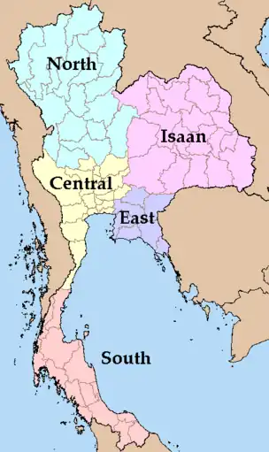
Phak (Thai: ภาค) refers to the grouping of multiple provinces with regard to history, culture, and geography. There are ten types of phak divisions: 6-regions, 5-4-regions, meteorological, tourism, economic, highway, landlines, postal, electoral, and scouts. In everyday life, one would expect to be using the 4-regions system due to its simplicity and wide understanding of this system.
The four regions system is composed of:
- North
- Isan
- Central
- South
The northern region closely resembles the former Kingdom of Lanna. This kingdom was split into five minor kingdoms in the 1800s and fully absorbed into Siam. Owing to their cultural differences, people from the central plains discriminate against the people of the frontiers regions of Siam. This ingrained the division between us and them within the Siamese psyche.
The Isan region resembles the old territory annexed from the Kingdom of Vientiane and Champassak. The southern region resembles the former territories of the Malay sultanates and the Kingdom of Nakhon Si Thammarat.
Populations
| Regions[8] | Male | Female | Total | ||||||||
|---|---|---|---|---|---|---|---|---|---|---|---|
| Central | 10,984,989 | 11,857,239 | 22,842,228 | ||||||||
| Bangkok Metropolitan Area | 5,126,677 | 5,745,423 | 10,872,100 | ||||||||
| Bangkok Special Administrative Area | 2,592,292 | 2,935,702 | 5,527,994 | ||||||||
| Pattaya Special Administrative Area[16] | 47,773 | 50,598 | 98,372 | ||||||||
| North | 5,871,707 | 6,138,317 | 12,010,024 | ||||||||
| Isan | 10,814,540 | 11,012,380 | 21,826,920 | ||||||||
| South | 4,667,882 | 4,824,385 | 9,492,267 | ||||||||
| Total | 32,339,118 | 33,960,884 | 66,171,439 | ||||||||
Unorganized Administrative Region
During the reign of Rama III, there was a massive settlement effort, in which many city and town were created during this time. This caused a "great reshuffling" of the provinces' territory. This ended up leading to the creation of the unorganized region of Promthep. This region was the result of the breaking up of the Kingdom of Cambodia's northern region and annexing it as a part of Siam. Later, this region was partitioned and merged into the Kingdom of Champassak, Kingdom of Cambodia, Khukhan and Siemmarat.
Abolished administrative divisions
Monthon

Monthon (Thai: มณฑล) were administrative subdivisions of Thailand at the beginning of the 20th century. The Thai word monthon is a translation of the word mandala (maṇḍala, literally "circle"). The monthon were created as a part of the Thesaphiban (เทศาภิบาล, literally "local government") bureaucratic administrative system, introduced by Prince Damrong Rajanubhab which, together with the monthon, established step-by-step today's present provinces (changwat), districts (amphoe), and communes (tambon) throughout Thailand. Each monthon was led by a royal commissioner called Thesaphiban (เทศาภิบาล), later renamed to Samuhathesaphiban (สมุหเทศาภิบาล). The system was officially adopted by the 1897 Local Administration Act.
In 1915 there were 19 monthons containing 72 provinces. Due to economic problems, several monthon were merged in 1925. Monthon Phetchabun had been dissolved in 1915. Only 14 monthon remained: Ayutthaya, Bangkok (Krung Thep), Chanthaburi, Nakhon Chaisi, Nakhon Ratchasima, Nakhon Sawan, Nakhon Si Thammarat, Pattani, Phayap, Phitsanulok, Phuket, Prachinburi, Ratchaburi, and Udon Thani. In 1932 another four were abolished: Chanthaburi, Nakhon Chaisi, Nakhon Sawan, and Pattani. Finally in 1933 the whole monthon system was abolished by the Provincial Administration Act 2476 B.E./A.D. 1933, part of the changes made after the coup d'état, which changed from an absolute to a constitutional monarchy.
| Monthon | มณฑล | Established | Fate |
|---|---|---|---|
| Lao Klang | ลาวกลาง | 1890 | 1893 - renamed Monthon Nakhon Ratchasima |
| Lao Tawan Ok | ลาวตะวันออก | 1890 | 1891 - merged with Monthon Lao Tawan Ok Chiang Nua becoming Monthon Lao Kao |
| Lao Tawan Ok Chiang Nua | ลาวตะวันออกเฉียงเหนือ | 1890 | 1891 - merged with Monthon Lao Tawan Ok becoming Monthon Lao Kao |
| Lao Phuan | ลาวพวน | 1890 | 1893 - renamed Monthon Udon after ceding the west bank of the Mekong. |
| Lao Kao | ลาวกาว | 1891 | 1893 - renamed Monthon Isan |
| Lao Phung Khao | ลาวพุงขาว | 1893 | 1893 - abolished, due to the annexation of territory to French Third Republic |
| Lao Chiang | ลาวเฉียง | 1893 | 1900 - renamed into Monthon Tawan Ok Chiang Neua |
| Krung Kao | กรุงเก่า | 1893 | 1933 - abolished, abolishment of the monthon system |
| Prachinburi | ปราจิณบุรี | 1893 | 1933 - abolished, abolishment of the monthon system |
| Khamen | เขมร | 1893 | 1899 - renamed Monthon Burapha |
| Nakhon Ratchasima | นครราชสีมา | 1893 | 1933 - abolished, abolishment of the monthon system |
| Isan | อีสาน | 1893 | 1912 - partitioned into Monthon Roi Et and Monthon Ubon |
| Phitsanulok | พิษณุโลก | 1894 | 1933 - abolished, abolishment of the monthon system |
| Nakhon Sawan | นครสวรรค์ | 1895 | 1932 - merged into Monthon Krung Kao - Ayutthaya |
| Ratchaburi | ราชบุรี | 1895 | 1933 - abolished, abolishment of the monthon system |
| Nakhon Chai Si | นครไชยศรี | 1895 | 1932 - merged into Monthon Ratchaburi |
| Chumphon | ชุมพร | 1896 | 1925 - merged into Monthon Nakhon Si Thammarat |
| Nakhon Si Thammarat | นครศรีธรรมราช | 1896 | 1933 - abolished, abolishment of the monthon system |
| Syburi | ไทรบุรี | 1897 | 1909 - abolished, due to the annexation of territory to British Empire |
| Krung Thep | กรุงเทพ | 1897 | 1922 - merged into Monthon Krung Kao - Ayutthaya |
| Phuket | ภูเก็จ | 1898 | 1933 - abolished, abolishment of the monthon system |
| Phetchabun | เพชรบูรณ์ | 1899
1907 |
1903 - merged into Monthon Phitsanulok
1916 - merged into Monthon Phitsanulok |
| Burapha | บูรพา | 1899 | 1906 - abolished, due to the annexation of territory to French Third Republic |
| Tawan Ok Chiang Neua | ตะวันตกเฉียงเหนือ | 1900 | 1901 - renamed into Monthon Phayap |
| Phayap | พายัพ | 1901 | 1933 - abolished, abolishment of the monthon system |
| Udon | อุดร | 1901 | 1933 - abolished, abolishment of the monthon system |
| Pattani | ปัตตานี | 1906 | 1932 - merged into Monthon Nakhon Si Thammarat |
| Chanthaburi | จันทบุรี | 1906 | 1933 - merged into Prachinburi |
| Roi Et | ร้อยเอ็จ | 1912 | 1932 - merged into Nakhon Ratchasima |
| Ubon | อุบล | 1912 | 1932 - merged into Nakhon Ratchasima |
| Maharat | มหาราษฎร์ | 1915 | 1926 - merged into Monthon Phayap |

- Monthon Lao Chiang is the same as Monthon Phayap, to ease understanding in this table but in all cases, they are the same.
- Monthon Lao Kao which became Monthon Isan, and Monthon Lao Phuan which became Monthon Udon.
- The use of the name is up to interpretation and use on case-by-case basis, but name changes occurs due to Rama V integration policy of minorities and achieving assimilation.
- Province merger not shown, only monthon partition and merger are
Boriwen
Boriwen (Thai: บริเวณ) was created due to the size of the three largest monthon hence a subdivision of monthons. Several provinces were grouped together into one boriwen. In 1908 the boriwen were renamed to changwat, which became the name of provinces in 1916. The monthon with between three and five boriwen were Phayap, Udon Thani and Isan. Each boriwen was administered by a commissioner (khaluang boriwen, ข้าหลวงบริเวณ).
Sukhaphiban
Sukhaphiban (Thai: สุขาภิบาล) were administrative divisions of Thailand. Sukhaphiban were the first sub-autonomous entities established in Thailand. A first such district was created in Bangkok by a royal decree of King Chulalongkorn in 1897. Tha Chalom District became the second such district, created in 1906 and responsible for parts of Mueang Samut Sakhon District, Samut Sakhon Province.
In 1907 the act on operations of sanitary districts codified the regulations, and with the Local Administration Act of 1914 two levels of sukhaphiban were introduced, the sukhaphiban mueang for towns and sukhaphiban tambon for rural areas.
The number of sanitary districts grew to 35 in 1935, when these however were converted into municipalities (thesaban). New sanitary district were again established starting in 1952 by prime minister Phibun Songkhram. With the Act to Upgrade Sanitary Districts to Thesaban of May 1999 they were again abolished, and all became thesaban tambon.
Muang Prathetsarat
Vassal states (Thai: เมืองประเทศราช) existed within Thailand for centuries since the founding of Sukhothai. Though not directly part of the country or even arguably an administrative division. Nonetheless, these states deserve a mention which is due to the fact that they are an entity within a certain polity.
Describing past vassals of Thailand requires the understanding of the mandala system. The mandala system is a largely diffused and dispersed power structure. This means that a vassal is largely independent to the central state, with the vassal also retaining sub-servient city-state-vassals. To explain this power structure, imagine if the United States is the central state, and Washington DC is the central state with 50 surrounding vassal states giving tributes to the central state and having open borders within these polities. These state-vassals also have subservient counties with autonomy in their internal affairs with these counties having their own autonomous sub-divisions. Thus, creating a pyramid of subservient cities and polities. It is not the current political structure of the United States due to the fact that the individual states could not just declare independence, which these vassal could, and had more autonomy from the central state. If the vassal states were to declare independence, it would incur the wrath of the central state. In history this was seen even when the Kingdom of Vientiane, a vassal, rebelled and lost which then was dissolved and absorbed into the central state.
The relationships between Thailand and its vassal varies over the centuries. It could be as amicable and the relationship that of the Kingdom of Nakhon Si Thammarat. Compared with the less amicable, aforementioned, Kingdom of Vientiane, which started a rebellion in 1826 under King Anouvong (Xaiya Setthathirath V). The last vassal state to be subservient to Thailand was the Malay states, which was subsequently dissolved, ceded, and merged into provinces and British Malaya in 1909, and the Kingdom of Champassak, which was downgraded into a province.
| Vassal States and Dependencies | เมืองประเทศราช | Period Under Suzerainty | Today Part of | Fate | |||||||||
|---|---|---|---|---|---|---|---|---|---|---|---|---|---|
| Kingdom | อาณาจักรหงสาวดี | 1287–1298
1307–1317 1330 |
Gained independence due to the declining influence of the Kingdom of Sukhothai | ||||||||||
| Kingdom of Sukhothai | อาณาจักรสุโขทัย | 1378–1438 | One of the first Thai states to form in the post-classical era, formed by King Si Inthrathit. Later, the Sukhothai Kingdom was overtaken by both military and cultural influences by the Ayutthaya Kingdom. The Sukhothai Kingdom became a vassal of Ayutthaya in 1378 and was fully integrated into the Kingdom of Ayutthaya in 1438. Later, a branch of the old royal family of Sukhothai gained influence in the royal court of Ayutthaya and established the Sukhothai Dynasty within the Ayutthayan court with King Maha Thammarachathirat being the founder. | ||||||||||
| Kingdom of Cambodia | อาณาจักรกัมพูชา | 1594–1831
1845–1863 |
During the First Siamese-Ngyuen Dynasty War, Cambodia was invaded by Vietnamese forces, which then led to the subsequent transfer of Cambodia to Vietnam. Later during the Second Siamese-Ngyuen Dynasty War, both Siam and Nguyễn Dynasty came to a compromise with Cambodia coming under joint suzerainty. Cambodia was then transferred to the French Third Republic. | ||||||||||
| Kingdom of Nakhon | อาณาจักรนครศรีธรรมราช | 1238–1767
1769–1784 |
Briefly gain independence after the Second Fall of Ayutthaya, and later was integrated fully into the Kingdom of Rattanakosin. | ||||||||||
| Kingdom of Vientiane | อาณาจักรเวียงจันทน์ | 1779–1828 | Annexed as a result of the Lao Rebellion in 1826 | ||||||||||
| Principality of Phuan | เมืองพวน | 1779–1888 | Transferred to Siam then transferred the French Third Republic | ||||||||||
| Federation of the Six Hua Phan Cantons | หัวพันทั้งห้าทั้งหก | 1779–1888 | Transferred to Siam then transferred the French Third Republic | ||||||||||
| Canton of Hiam-Son | เมืองเหียม-เมืองซ่อน | 1779–1888 | |||||||||||
| Canton of Cham Neua | เมืองชำเหนือ | 1779–1888 | |||||||||||
| Canton of Cham Tai | เมืองชำใต้ | 1779–1888 | |||||||||||
| Canton of Soi | เมืองโสย | 1779–1888 | |||||||||||
| Canton of | เมืองเชียงฆอ-เมืองสบแอด | 1779–1888 | |||||||||||
| Canton of | เมืองหัวเมือง | 1779–1888 | |||||||||||
| Kingdom of Champasak | อาณาจักรหลวงพระบาง | 1779–1904 | Downgraded to a province | ||||||||||
| Kingdom of | อาณาจักรจำปาศักดิ์ | 1779–1893 | Transferred to the French Third Republic | ||||||||||
| Principality | เมืองพงสาลี | 1779–1893 | Transferred to the French Third Republic | ||||||||||
| Federation of the Twelve Tai Cantons* | สิบสองจุไทย | 1779–1888 | Transferred to the French Third Republic | ||||||||||
| Canton of Lai | เมืองไล | 1779–1888 | |||||||||||
| Canton of Te | เมืองแต่ | 1779–1888 | |||||||||||
| Canton of Jian | เมืองเจียน | 1779–1888 | |||||||||||
| Canton of Mun | เมืองมุน | 1779–1888 | |||||||||||
| Canton of Bang | เมืองบาง | 1779–1888 | |||||||||||
| Canton of Thaeng | เมืองแถง | 1779–1888 | |||||||||||
| Canton of Khwai | เมืองควาย | 1779–1888 | |||||||||||
| Canton of Dung | เมืองดุง | 1779–1888 | |||||||||||
| Canton of Muai | เมืองม่วย | 1779–1888 | |||||||||||
| Canton of La | เมืองลา | 1779–1888 | |||||||||||
| Canton of Moh | เมืองโมะ | 1779–1888 | |||||||||||
| Canton of Wat | เมืองหวัด | 1779–1888 | |||||||||||
| Canton of Sang | เมืองซาง | 1779–1888 | |||||||||||
| Canton of So | เมืองสอ | 1779–1888 | |||||||||||
| Canton of Than | เมืองถาน | 1779–1888 | |||||||||||
| Canton of Lo | เมืองลอ | 1779–1888 | |||||||||||
| Kingdom of Chiang Mai | นครเชียงใหม่ | 1775–1894 | Downgraded to a province | ||||||||||
| Principality of Lampang | นครเมืองลำปาง | 1775–1894 | Downgraded to a province | ||||||||||
| Principality of Nan | นครเมืองน่าน | 1775–1894 | Downgraded to a province | ||||||||||
| Principality of Lamphun | นครลำพูน | 1775–1894 | Downgraded to a province | ||||||||||
| Principality of Phrae | เมืองแพร่ | 1775–1894 | Downgraded to a province | ||||||||||
| Sultanate of Kedah | เมืองสตูลไทรบุรี | 1821–1909 | Transferred to the British Empire | ||||||||||
| Kingdom of Setul | เมืองสตูล | 1808–1909 | Downgraded to a province | ||||||||||
| Kingdom of Perlis | เมืองปะลิส | 1843–1909 | Transferred to the British Empire | ||||||||||
| Kingdom of Kubang Pasu | เมืองกุปังปาสู | 1839–1864 | Merged into Syburi | ||||||||||
| Sultanate of Pattani | อาณาจักรปัตตานี | 1786–1902 | Downgraded to a province, and partitioned into seven autonomous townships | ||||||||||
| Kingdom of Reman | อาณาจักรรามัน | 1810–1902 | partitioned and merged into surrounding provinces: Pattani, Narathiwat, and Yala. The southern part is transferred to the British Empire | ||||||||||
| Sultanate of Terengganu | อาณาจักรตรังกานู | 1786–1909 | Transferred to the British Empire | ||||||||||
| Kingdom of Besut Darul Iman | อาณาจักเบอซุต | 1780–1899 | annexed by the Sultanate of Terengganu | ||||||||||
| Sultanate of Kelantan | อาณาจักรกลันตัน | 1786–1909 | Transferred to the British Empire | ||||||||||
| Kingdom of Chiang Tung | เมืองเชียงตุง | 1802–1812 | Declared Independence, Submitted to Konbaung Dynasty (Third Burmese Empire) | ||||||||||
| Principality of Hà Tiên | เมืองบันทายมาศ | 1785–1809 | Declared Independence, Submitted to Nguyễn Dynasty | ||||||||||
| Federation of Sipsong Panna | สิบสองปันนา | 1802–1812 |
|
Declared Independence, Submitted to Konbaung Dynasty (Third Burmese Empire) | |||||||||
| Canton of | นครเชียงรุ่ง | 1802–1812 | |||||||||||
| Chiang Rung | เชียงรุ่ง | 1802–1812 | |||||||||||
| Muang Yang | เมืองยาง | 1802–1812 | |||||||||||
| Muang Ham | เมืองฮำ | 1802–1812 | |||||||||||
| Canton of Je | นครเมืองแจ | 1802–1812 | |||||||||||
| Muang Je | เมืองแจ | 1802–1812 | |||||||||||
| Muang Mang
(Western) |
เมืองมาง(ตะวันตก) | 1802–1812 | |||||||||||
| Chiang Lu | เชียงลู | 1802–1812 | |||||||||||
| Muang Ong | เมืองออง | 1802–1812 | |||||||||||
| Canton of Luang | นครเมืองลวง | 1802–1812 | |||||||||||
| Canton of Hon | นครเมืองหน | 1802–1812 | |||||||||||
| Muang Hon | เมืองหน | 1802–1812 | |||||||||||
| Muang Phan | เมืองพาน | 1802–1812 | |||||||||||
| Muang Lo | เมืองลอ | 1802–1812 | |||||||||||
| Canton of Rai | นครเมืองราย | 1802–1812 | |||||||||||
| Muang Rai | เมืองราย | 1802–1812 | |||||||||||
| Muang Juang | เมืองเจือง | 1802–1812 | |||||||||||
| Canton of Ngad | นครเมืองงาด | 1802–1812 | |||||||||||
| Muang Ngad | เมืองงาด | 1802–1812 | |||||||||||
| Muang Khang | เมืองขาง | 1802–1812 | |||||||||||
| Muang Wang | เมืองวัง | 1802–1812 | |||||||||||
| Canton of Lah | นครเมืองหล้า | 1802–1812 | |||||||||||
| Muang Lah | เมืองหล้า | 1802–1812 | |||||||||||
| Muang Ban | เมืองบาน | 1802–1812 | |||||||||||
| Canton of Hing | นครเมืองฮิง | 1802–1812 | |||||||||||
| Muang Hing | เมืองฮิง | 1802–1812 | |||||||||||
| Muang Pang | เมืองปาง | 1802–1812 | |||||||||||
| Canton of La | นครเมืองลา | 1802–1812 | |||||||||||
| Chiang Neua | เชียงเหนือ | 1802–1812 | |||||||||||
| Muang La | เมืองลา | 1802–1812 | |||||||||||
| Canton of Phong | นครเมืองพง | 1802–1812 | |||||||||||
| Muang Phong | เมืองพง | 1802–1812 | |||||||||||
| Muang Mang
(Eastern) |
เมืองมาง(ตะวันออก) | 1802–1812 | |||||||||||
| Muang Yuan | เมืองหย่วน | 1802–1812 | |||||||||||
| Canton of Ou Neua | นครเมืองอูเหนือ | 1802–1812 | |||||||||||
| Muang Ou Neua | เมืองอูเหนือ | 1802–1812 | |||||||||||
| Muang Ou Tai | เมืองอูใต้ | 1802–1812 | |||||||||||
| Canton of Tho | นครเมืองทอ | 1802–1812 | |||||||||||
| Chiang Tho | เชียงทอ | 1802–1812 | |||||||||||
| Muang I-Ngou | เมืองอีงู | 1802–1812 | |||||||||||
| Muang I-Pang | เมืองอีปาง | 1802–1812 | |||||||||||
| Canton of
Phuthaen Luang |
นครเมืองภูแถนหลวง | 1802–1812 | |||||||||||
| Muang
Phuthaen Luang |
เมืองภูแถนหลวง | 1802–1812 | |||||||||||
| Muang Kham Thaen | เวียงคำแถน | 1802–1812 | |||||||||||
| Principality of Chiang Khaeng | เมืองเชียงแขง | 1802–1812
1892–1893** |
Declared Independence, Submitted to Konbaung Dynasty (Third Burmese Empire), then transferred to Siam merging with the Principality of Nan then transferred to the French Third Republic | ||||||||||
| Principality of Chiang Lap | เมืองเชียงลับ | 1802–1812 | Declared Independence, Submitted to Konbaung Dynasty (Third Burmese Empire) | ||||||||||
*Twelve Cantons were actually composed of twelve to sixteen different cantons. Note that throughout the centuries, different cantons held the same seats. The number of seats range from 12 to 16.
**Chiang Khaeng was merged with the Principality of Nan after the transfer.
Lost Territories
There are various territories which were partitioned and transferred to another political entity over the centuries. This could be either that the central government gave an order, or an independent action acted upon by the individual muang prathetsarat.
| Map | Territory | เขตการปกครอง | Period Under Suzerainty | Fate | Today part of |
|---|---|---|---|---|---|
 |
Salaween Territory | ดินแดนสาละวิน | 1802–1892 | Traded to Karenni State and Shan State, British Burma,
gaining Chiang Khaeng. |
|
 |
Chiang Khaeng Territory | ดินแดนเมืองเชียงแขง | 1892–1893 | Transferred to the French Third Republic | |
 |
Koh Song Territory | ดินแดนเกาะสอง | 1769–1864 | Ceded to the British Empire | |
 |
Miawdi Territory | ดินแดนเมียวดี | 1768–1834 | Gifted to the British Empire, from the Kingdom of Chiang Mai | |
 |
Mohtahmah Territory | ดินแดนเมาะตะมะ | 1287–1548
1594–1613 1662 |
Ceded to the Toungoo Dynasty, regained
Ceded to the Toungoo Dynasty, regained Ceded to the Konbaung Dynasty (Third Burmese Empire) |
|
 |
Thawai Territory | ดินแดนทวาย | 1287–1548
1593–1613 1662 |
Ceded to the Toungoo Dynasty, regained
Ceded to the Toungoo Dynasty, regained Ceded to the Konbaung Dynasty (Third Burmese Empire) |
|
 |
Tanaosi Territory | ดินแดนตะนาวสี | 1287–1564
1593–1614 1756–1760 |
Ceded to the Toungoo Dynasty, regained
Ceded to the Toungoo Dynasty, regained Ceded to the Konbaung Dynasty (Third Burmese Empire) |
Former administrative division maps
 Thonburi Administrative Division in 1780 (Taksin the Great)
 Rattanakosin Administrative Division in 1800 (Rama I the Great)
 Rattanakosin Administrative Division in 1805 (Rama I the Great)
 Rattanakosin Administrative Division in 1824 (Rama II)
 Rattanakosin Administrative Division in 1837 (Rama III)
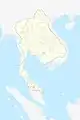 Rattanakosin Administrative Division in 1850 (Rama III)
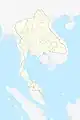 Rattanakosin Administrative Division in 1882 (Rama V the Great)
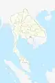 Rattanakosin Administrative Division in 1890 (Rama V the Great)
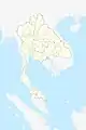 Rattanakosin Administrative Division in 1893 (Rama V the Great)
 Siamese Administrative Division in 1900 (Rama V the Great)
 Siamese Monthon Division in 1900 (Rama V the Great)
 Siamese Administrative Division in 1906 (Rama V)
 Siamese Administrative Division in 1916 (Rama VI)
 Siamese Administrative Division in 1932 (Rama VII)
 Siamese Administrative Division in 1945 (Rama VIII)
 Siamese Administrative Division in 1950 (Rama IX the Great)
 Siamese Administrative Division in 1973 (Rama IX the Great)
 Siamese Administrative Division in 2023 (Rama X)
References
- Paik, Christopher; Vechbanyongratana, Jessica (12 April 2019). "Path to Centralization and Development: Evidence from Siam". World Politics. 71 (2): 289–331. doi:10.1017/S0043887118000321. ISSN 0043-8871. S2CID 159375909.
- "Regions Map of Thailand – Nations Online Project". www.nationsonline.org. Retrieved 7 January 2023.
- "สรุปข้อมูล อปท ทั่วประเทศ". www.dla.go.th. Retrieved 7 January 2023.
- "Thailand – Chulalongkorn's Reforms". countrystudies.us. Retrieved 7 January 2023.
- "หมวด ๑ จังหวัด (มาตรา ๕๒ – ๖๐) | สถาบันนิติธรรมาลัย". www.drthawip.com. Retrieved 7 January 2023.
- "ระเบียบการปกครองสมัยอยุธยา". www.nectec.or.th. Retrieved 7 January 2023.
- "Thailand Provinces". www.statoids.com. Retrieved 3 March 2023.
- "สถิติประชากรศาสตร์ ประชากรและเคหะ". statbbi.nso.go.th. Retrieved 3 March 2023.
- "บทบาทหน้าที่ของที่ทำการปกครองอำเภอ". www.oic.go.th. Retrieved 7 January 2023.
- Bass (30 December 2021). ""อำเภอ" มาจากไหน? ยุคแรกจัดตั้งอำเภออย่างไร กรมการอำเภอทำหน้าที่อะไร". ศิลปวัฒนธรรม (in Thai). Retrieved 7 January 2023.
- "บทบาทหน้าที่ องค์การบริหารส่วนตำบลปากรอ". www.parkrore.go.th. Retrieved 7 January 2023.
- "What is OTOP?". Royal Thai Embassy Singapore.
- "Original PDF". dx.doi.org. doi:10.15438/rr.5.1.7. Retrieved 7 January 2023.
- "อำนาจหน้าที่ เทศบาล". www.isan.go.th. Retrieved 7 January 2023.
- "The Office of Public Relations Advisor to the Prime Minister". Parliamentary Affairs. 1955. doi:10.1093/oxfordjournals.pa.a052896. ISSN 1460-2482.
- th.zhujiworld.com. "พัทยา, ไทย — สถิติ 2023". th.zhujiworld.com (in Thai). Retrieved 3 March 2023.