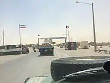
Afghanistan–Iran border
The Afghanistan–Iran border is 921 km (572 mi) in length and runs from the tripoint with Turkmenistan in the north to the tripoint with Pakistan in the south.[1]

Description
The border begins at the tripoint with Turkmenistan in the Harirud river before proceeding overland just to the east of the Iranian town of Taybad. The border then follows a series of short straight lines, passing through the Daryacheh-ye Namakzar and the Daqq-e Patergan salt lakes; two ‘beaks’ of Iranian territory protrude into Afghanistan along this section. The middle ‘Turkish section’ (see below) consists of a series of straight lines through a plain, with some mountains to the south, ending at Kuh Siah mountain, where the border veers sharply to the east. It cuts through Hamun Lake before turning south, where it follows the Juy-e Siksar River down to the confluence with the Helmand River. The border is then formed of a long straight line segment going southwest to the tripoint with Pakistan at the Kuh-i-Malik Salih mountain.
The border traverses a generally arid, inhospitable region with few inhabitants, except in the Zabol-Zaranj area where the main border crossing is located.
History
The border between Persia and Afghanistan was formalised in the period 1872-1935 by a series of third party arbitrations, stemming from the Treaty of Paris (1857) in which Persia and Afghanistan agreed to refer any dispute between them to Britain for arbitration (at this time Britain controlled large parts of India, including what is now Pakistan).[2][3] A series of skirmishes between Afghanistan and Persia in 1860s prompted Persian king Naser al-Din Shah Qajar to request that the British formalise the Afghan-Persia boundary. A rough delimitation was proposed in 1872 by a committee headed by Sir Frederic John Goldsmid following a line from Banda to Kuh-i-Malik Siah (a hill at the modern Afghanistan-Iran-Pakistan tripoint) via the Helmand river. Both parties eventually accepted this proposal however it was not implemented further at that time.[2][3]
The Goldsmid boundary proved to be inadequate, especially given the shifting of the course of the Helmand, and thus a more precise boundary was drawn up in three sections over the following decades: the northern section by General C.S. MacLean, British consul general for Khorasan and Sīstān, in 1888–91, the southern section by Colonel Sir Henry McMahon in 1903-05 and finally the middle section by Turkey’s General Fahrettin Altay in 1934-35.[2][3] After each demarcation boundary pillars were erected, leading to a total of 172 pillars being erected in the non-riverine sections of the border.[2][4]
The boundary itself was not disputed after 1935, however disputes over the allocation of water resources in the region rumbled on for many years and were not finally resolved until 1973.[3]
Border crossings


Afghanistan - Iran border crossings:[6]
| Islam Qala (Herat Province) | Taybad (Razavi Khorasan Province) |
| Abu Nasr Farahi (Farah Province) | Mahirud (South Khorasan Province) |
| Zaranj (Nimruz Province) | Milak (Sistan and Baluchestan Province) |
Settlements near the border
Afghanistan
- Chah Sagak
- Islam Qala
- Kalate-ye Nazar Khan
- Kareyz-e Elyas
- Komisari
- Mirza Abu Bakr
- Pish Robat
- Tahana-e Chah-e Sangar
- Zaranj
Iran
- Jannatabad, Torbat-e Jam
- Kalateh-yeh Kabud
- Kamaneh-ye Mohammad Khan
- Kamareh Yusef
- Katamak, Hirmand
- Malu Pa’in
- Masumabad, Zirkuh
- Musaabad
- Pasgah-e Kurigan
- Qaleh Borj
- Taybad
- Zabol
References
- CIA World Factbook - Iran, retrieved 16 September 2018
- International Boundary Study No. 6 – Afghanistan-Iran Boundary (PDF), 20 June 1961, retrieved 16 September 2018
- Encyclopædia Iranica – Boundaries of Afghanistan, retrieved 16 September 2018
- International Boundary Study No. 6 – Afghanistan-Iran Boundary Map, retrieved 16 September 2018
- "Abresham Crossing Between Afghanistan & Iran Reopens After Nearly Two Weeks". Khaama Press. July 19, 2022. Retrieved 2023-02-02.
- Caravanistan – Iran-Afghanistan border crossings, retrieved 16 September 2018