Aghalurcher
54.23°N 7.444°W Aghalurcher is a civil parish located mainly in the barony of Magherastephana in County Fermanagh and partly in the barony of Clogher in County Tyrone, Northern Ireland.
Aghalurcher | |
|---|---|
Civil parish | |
| Country | Northern Ireland |
| County | County Fermanagh |
| Barony | Magherastephana |

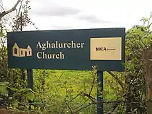
Sign on right side of road indicates entrance to church grounds
Townlands of Aghalurcher in County Fermanagh
The parish comprises the following 239 townlands in County Fermanagh:[1][2]
- Acres
- Aghacramphill
- Aghalurcher Glebe
- Aghamore North
- Aghamore South
- Aghavoory
- Agheeghter
- Aghinure
- Aghnaskew
- Altagoaghan
- Altawark
- Altmartin
- Altnaponer
- Atnamollyboy
- Attybaron
- Attyclannabryan
- Ballymacaffry
- Ballymakenny
- Barnhill
- Bohattan
- Boleyhill
- Brobrohan
- Bunnahesco
- Bunnahola Island
- Carrickawick
- Carrickmacosker
- Carricknabrattoge
- Carrickpolin
- Carrowgarragh
- Carrowhony
- Castle Balfour Demesne
- Cavanagarvan
- Cavanaleck
- Claraghy
- Clay
- Cleen
- Cleenriss
- Clonmacfelimy
- Coalhill
- Colebrook Demesne
- Comaghy
- Congo
- Coolaran
- Coolbeg
- Coolcrannel
- Coollane
- Cooltrane
- Cooneen
- Corfannan
- Corlacky
- Corlough
- Cornakessagh
- Cornarooslan
- Cornashannel
- Cornashee
- Corrachrow
- Corraclare
- Corradillar
- Corralongford
- Corranewy
- Corrard
- Cran
- Creaghamanone Island
- Creaghanameelta Island
- Creaghanarourke Island
- Creaghanchreesty Island
- Creaghawaddy Island
- Croaghan
- Crockadreen
- Crockaness
- Crocknagowan
- Crocknagrally
- Crocknanane
- Crummy
- Curragh
- Curraghfad
- Currogs
- Curryann
- Cushwash
- Derrintony
- Derryasna
- Derrychaan
- Derrychulla
- Derrycorban
- Derrycrum
- Derrycullion
- Derryhurdin
- Derryloman
- Derrynavogy
- Derryree
- Doocharn
- Dooederny
- Doogary
- Dooross
- Drumany
- Drumbad Beg
- Drumbad More
- Drumbaghlin
- Drumbrughas North
- Drumbrughas South
- Drumcon
- Drumcoo
- Drumcramph
- Drumcrin
- Drumcru
- Drumcunny
- Drumgoon
- Drumguiff
- Drumhack
- Drumharriff
- Drumhaw
- Drumleagues Big
- Drumleagues Little
- Drumliff
- Drumlught
- Drummack
- Drummeer
- Drumroo
- Drumroosk
- Ederdacurragh
- Edergole
- Edergole Island
- Erdinagh
- Eshanummer
- Eshbane
- Eshbralley
- Eshcarcoge
- Eshmeen
- Eshnagorr
- Eshnascreen
- Eshnasillog Beg
- Eshnasillog More
- Eshthomas
- Eskeragh
- Farranaconaghy
- Farranacurky
- Farranasculloge
- Foglish
- Forfey
- Friar's Island
- Garvaghy
- Garvoghill
- Geddagh Island
- Glasdrumman
- Gortacharn
- Gortgarran
- Grogey
- Henrystughan
- Hollybrook
- Inishcorkish
- Inishcreenry (Island)
- Inishfausy
- Inishleague (Island)
- Irishcollan
- Inishore
- Inishroosk
- Inishturk
- Keenaghy
- Killarbran
- Killashanbally
- Killybane
- Killycloghy
- Killycrutteen
- Killygullan
- Killynamph
- Killypaddy
- Killyrover
- Kilmore North
- Kilmore South
- Kilronan
- Kiltenamullagh
- Kingstown
- Kinmore
- Knocks
- Knocks
- Lebally
- Legatillida
- Leraw
- Lisadearny
- Lisduff
- Lislea
- Lisnagole
- Lisoneill
- Littlehill
- Longfield
- Lough Hill
- Lurganbane
- Macknagh
- Millwood
- Moneymakinn
- Moneyneddy
- Mongibbaghan
- Moughley
- Mountjoy Island
- Mullaghfad
- Mullaghkeel or Ballymackilroy
- Mullaghmakervy
- Mullaghmore
- Mullynaburtlan
- Mullynascarty
- Mullynavale
- Munville
- Naan Island South
- Oghill
- Owenskerry
- Rabbit Island
- Rafintan
- Ramult
- Raw
- Rossbeg
- Rossgad
- Rossmacaffry
- Rossmacall
- Rossmacole
- Shanaghy
- Sheebeg
- Slush Hill
- Sraharory
- Stripe
- Tatteevagh
- Tattenabuddagh
- Tattenaheglish
- Tattenalee
- Tattinderry
- Tattynuckle
- Tattyreagh
- Tireeghan
- Tirenny
- Toney
- Trahanacarrick Island
- Trannish (Island)
- Tully North
- Tully South
- Tullykenneye
- Tullyneevin
Townlands of Aghalurcher in County Tyrone
The parish comprises the following 17 townlands in County Tyrone:[1][2]
- Alderwood
- Artclea
- Beagh
- Breakly
- Crockacleaven
- Crocknahull
- Cullentra
- Cullynane
- Kill
- Kiltermon
- Loughermore Glebe
- Mullaghmore
- Rahack Glebe
- Relessy
- Tattanellan
- Timpany
- Tircar
See also
References
- "Parishes of Ulster". Ulster Ancestry. Archived from the original on 21 February 2009. Retrieved 31 January 2009.
- "Parish of Aghalurcher". Public Records Office NI. Archived from the original on 27 July 2011. Retrieved 31 January 2009.
This article is issued from Wikipedia. The text is licensed under Creative Commons - Attribution - Sharealike. Additional terms may apply for the media files.