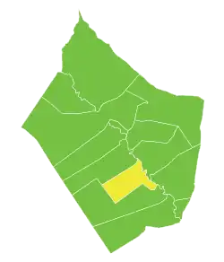
Al-Asharah
Al-Asharah (Arabic: ٱلْعَشَارَة, romanized: al-ʿAšārah, also spelled al-Ashareh or Esharah) is a town in eastern Syria, administratively part of the Deir ez-Zor Governorate, located along the Euphrates River, south of Deir ez-Zor. Nearby localities include al-Quriyah to the northeast, Makhan and Mayadin to the north, Suwaydan Jazirah to the southeast and Dablan to the south. According to the Syria Central Bureau of Statistics, al-Asharah had a population of 17,537 in the 2004 census. It is the administrative seat of a nahiyah ("subdistrict") which consists of seven localities with a total population of 96,001 in 2004. Al-Asharah is the third largest locality in the nahiyah.[1] Its inhabitants are predominantly Sunni Muslims. From Arabians Tribes of Tayy Al-Rahabi and Al Uqaydat.[2]
Al-Asharah
ٱلْعَشَارَة | |
|---|---|
Town | |
 Al-Asharah | |
| Coordinates: 34°55′13″N 40°33′34″E | |
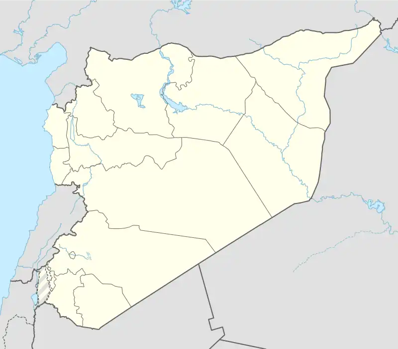
| Country | |
| Governorate | Deir ez-Zor |
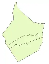
| District | Mayadin |
| Subdistrict | Al-Asharah |
| Population (2004 census)[1] | |
| • Total | 17,537 |
| Time zone | UTC+2 (EET) |
| • Summer (DST) | UTC+3 (EEST) |
History
Al-Asharah is built on the site of the ancient Aramean-Assyrian settlement of Terqa.[3][4] A stele dated to 886 BCE honoring the victory of Assyrian king Tukulti-Ninurta II over the Arameans was found in al-Asharah. The stele is currently located in the National Museum of Aleppo.[3] Terqa was the capital of the Neo-Assyrian kingdom of Khana and continued to develop until the end of the Bronze Age when its decline began. Excavations in al-Asharah revealed evidence that Terqa contained urban institutions and its inhabitants had exploited the area's soil for economic benefit.[4]
In the mid-19th-century, it was noted by the Bombay Geographic Society that al-Asharah was a "little town" that consisted of an unorganized grouping of Arab huts and a population whose traditions suggested the place was ancient.[5] From around that time until the dissolution of the Ottoman Empire in 1917, al-Asharah served as the center of a kaza ("district"), bearing its name, that was part of the larger Sanjak of Zor province. The kaza had two nawahi: al-Asharah and al-Busayrah.[6]
In 1920, a meeting between officials and officers of the Sharifian Army and the nascent Kingdom of Syria was held in al-Asharah and hosted by Emir Faisal. There negotiations over the borders between Syria and Iraq were discussed and it was concluded the Abu Kamal would remain a part of the Deir ez-Zor province of Syria.[7]
In the early 1960s al-Asharah was described as a small village built on an artificial mound where Terqa stood.[8]
In Syrian civil war city was occupied by ISIL until Syrian army captured town in 27 November 2017.[9][10]
References
- General Census of Population and Housing 2004. Syria Central Bureau of Statistics (CBS). Deir az-Zawr Governorate. (in Arabic)
- Smith, 1841, p. 174.
- Nelles Guide, 1999, p. 127.
- Kuhne, p. 134.
- Bombay Geographic Society, 1844, p. 180.
- Zor Mutasarrıflığı. Tarih ve Medeniyet. 2009.
- Rush, p. 263.
- Boulanger, 1966, p. 490.
- "Breaking: Syrian Army liberates another town along the Euphrates River". Archived from the original on 2019-06-22. Retrieved 2017-11-28.
- With the support of the Iraqi, Iranian and Lebanese gunmen and the Russian cover… the regime forces almost end the organization’s presence in the pocket east of al-Mayadin and a town separates them from achieving the goal
Bibliography
- Boulanger, Robert (1966). The Middle East, Lebanon, Syria, Jordan, Iraq, Iran. Hachette.
- Nelles Guide (1999). Syria and Lebanon. Hunter Publishing, Inc. ISBN 3886181057.
- Rush, Alan de Lacy (2001). Records of Iraq, 1914-1966. Vol. 2. Archive Editions. ISBN 1852078200.
- Smith, Eli; Robinson, Edward (1841). Biblical Researches in Palestine, Mount Sinai and Arabia Petraea: A Journal of Travels in the Year 1838. Vol. 3. Crocker and Brewster.
Capital: Deir ez-Zor | |||||||
|  | ||||||
|
| |||||||