Alder Creek (Nevada County, California)
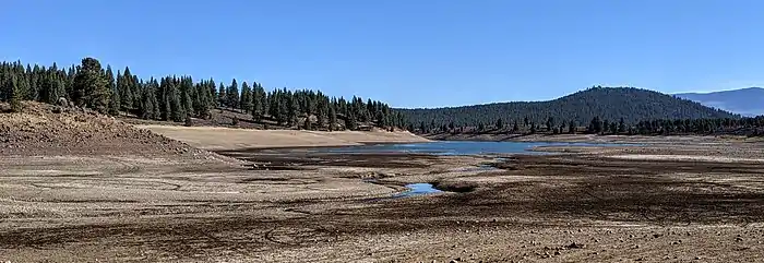
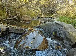
Alder Creek is a perennial stream in Nevada County, California,[6] mostly within the town of Truckee. Its source region near Donner Ridge is west of town, and its mouth at Prosser Creek Reservoir is north of town. It flows to the Truckee River via Prosser Creek.
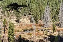
A beaver pond on Alder Creek
| Alder Creek Tributary to Prosser Creek | |
|---|---|
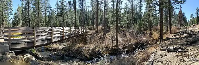
 Alder Creek just below Fjord Road, Truckee | |
 Location of Alder Creek mouth  Alder Creek (Nevada County, California) (the United States) | |
| Location | |
| Country | United States |
| State | California |
| County | Nevada |
| Physical characteristics | |
| Source | Negro Canyon divide |
| • location | Donner Ridge |
| • coordinates | 39°22′59″N 120°37′34″W[1] |
| • elevation | 7,490 ft (2,280 m)[2] |
| Mouth | Prosser Creek |
• location | Prosser Creek Reservoir, about 2 miles north-northwest of Polaris, California |
• coordinates | 39°22′39″N 120°38′42″W[1] |
• elevation | 5,741 ft (1,750 m)[3] |
| Length | 8.89 mi (14.31 km)[4] |
| Basin size | 12.65 square miles (32.8 km2)[5] |
| Discharge | |
| • location | Prosser Creek |
| • average | 15.55 cu ft/s (0.440 m3/s) at mouth with Prosser Creek[5] |
| Basin features | |
| Progression | Prosser Creek → Truckee River → Pyramid Lake |
| River system | Truckee River |
| Tributaries | |
| • left | unnamed tributaries |
| • right | unnamed tributaries |
| Bridges | Skislope Way, Snowpeak Way, Fjord Road, Schussing Way, Alder Creek Road, CA 89 |
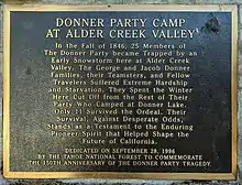
Donner Party camp
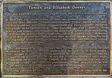
Plaque about the Donner women at the Alder Creek Valley camp memorial
Donner Party camp plaque, at Alder Creek Valley memorial
The Donner Party camped in Alder Creek Valley when stopped by snow in November, 1846. There is a memorial to them off California route 89 just north of the creek.
References
- "GNIS Detail - Alder Creek". geonames.usgs.gov. US Geological Survey. Retrieved 21 June 2021.
- "Get Maps". USGS Topoview. US Geological Survey. Retrieved 21 June 2021.
- "Get Maps". USGS Topoview. US Geological Survey. Retrieved 21 June 2021.
- "ArcGIS Web Application". epa.maps.arcgis.com. US EPA. Retrieved 21 June 2021.
- "Alder Creek Watershed Report". US EPA Geoviewer. US EPA. Retrieved 21 June 2021.
- "Alder Creek". Geographic Names Information System. United States Geological Survey, United States Department of the Interior. Retrieved November 4, 2020.
This article is issued from Wikipedia. The text is licensed under Creative Commons - Attribution - Sharealike. Additional terms may apply for the media files.