Alder Creek (Saguache County, Colorado)
Alder Creek is a stream entirely within Saguache County, Colorado.[6]
| Alder Creek Tributary to San Luis Creek | |
|---|---|
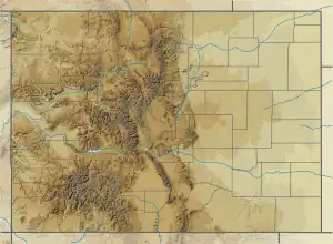 Location of Alder Creek mouth  Alder Creek (Saguache County, Colorado) (the United States) | |
| Location | |
| Country | United States |
| State | Colorado |
| County | Saguache |
| Physical characteristics | |
| Source | Bear Creek divide |
| • location | about 0.5 miles east of Round Mountain |
| • coordinates | 38°20′03″N 106°06′03″W[1] |
| • elevation | 11,080 ft (3,380 m)[2] |
| Mouth | San Luis Creek |
• location | about 0.5 miles east of Alder, Colorado |
• coordinates | 38°22′18″N 106°01′55″W[1] |
• elevation | 8,448 ft (2,575 m)[3] |
| Length | 5.06 mi (8.14 km)[4] |
| Basin size | 5.00 square miles (12.9 km2)[5] |
| Discharge | |
| • location | San Luis Creek |
| • average | 0.80 cu ft/s (0.023 m3/s) at mouth with San Luis Creek[5] |
| Basin features | |
| Progression | San Luis Creek |
| River system | San Luis Creek |
| Tributaries | |
| • left | unnamed tributaries |
| • right | unnamed tributaries |
| Bridges | US 285, County Road UU5 |
Alder Creek was named for the alder trees lining its course.[7]
See also
References
- "GNIS Detail - Alder Creek". geonames.usgs.gov. Retrieved 21 June 2021.
- "Get Maps". USGS Topoview. US Geological Survey. Retrieved 21 June 2021.
- "Get Maps". USGS Topoview. US Geological Survey. Retrieved 21 June 2021.
- "ArcGIS Web Application". epa.maps.arcgis.com. US EPA. Retrieved 21 June 2021.
- "Alder Creek Watershed Report". US EPA Geoviewer. US EPA. Retrieved 21 June 2021.
- U.S. Geological Survey Geographic Names Information System: Alder Creek (Saguache County, Colorado)
- Dawson, John Frank (1954). Place names in Colorado: why 700 communities were so named, 150 of Spanish or Indian origin. Denver, CO: The J. Frank Dawson Publishing Co. p. 5.
This article is issued from Wikipedia. The text is licensed under Creative Commons - Attribution - Sharealike. Additional terms may apply for the media files.