Alexis 133
Alexis 133 is an Indian reserve of the Alexis Nakota Sioux Nation in Alberta, located within Lac Ste. Anne County.[3][4] It is 70 kilometres northwest of Edmonton.[1] In the 2016 Canadian Census, it recorded a population of 755 living in 173 of its 209 total private dwellings.[2]
Alexis 133 | |
|---|---|
| Alexis Indian Reserve No. 133 | |
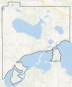 Boundaries of Alexis 133 | |
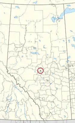 Location in Alberta | |
| First Nation | Alexis Nakota Sioux |
| Treaty | 6 |
| Country | Canada |
| Province | Alberta |
| Municipal district | Lac Ste. Anne |
| Area | |
| • Total | 6,175.2 ha (15,259.3 acres) |
| Population (2016)[2] | |
| • Total | 755 |
| • Density | 12/km2 (32/sq mi) |
The reserve has the name of Alexis, a tribal leader.[5]
References
- "Reserve/Settlement/Village Detail". Crown–Indigenous Relations and Northern Affairs Canada. Government of Canada. Retrieved August 12, 2019.
- "Census Profile, 2016 Census". Statistics Canada. February 8, 2017. Retrieved 2019-08-10.
- "Lac Ste. Anne County Map" (PDF). Lac Ste. Anne County. 2012. Retrieved August 10, 2013.
- Government of Alberta (May 25, 2019). Municipal Boundaries (Map). AltaLIS.
- Place-names of Alberta. Ottawa: Geographic Board of Canada. 1928. p. 10.
| Ethnolinguistic groups (by language family) | |||||||||||||||||||||||||||||
|---|---|---|---|---|---|---|---|---|---|---|---|---|---|---|---|---|---|---|---|---|---|---|---|---|---|---|---|---|---|
| Historical polities | |||||||||||||||||||||||||||||
| Numbered Treaties | |||||||||||||||||||||||||||||
| Tribal councils and band governments |
| ||||||||||||||||||||||||||||
This article is issued from Wikipedia. The text is licensed under Creative Commons - Attribution - Sharealike. Additional terms may apply for the media files.