Algarkirk
Algarkirk (/ˈældʒərkɜːrk/ AL-jər-kurk) is a village and civil parish in the Borough of Boston in Lincolnshire, England. It is situated 6 miles (9.7 km) south-south-west from Boston and near the A16 road. It has a population of 406,[1] falling to 386 at the 2011 census.[2] An alternative village spelling is 'Algakirk'.
| Algarkirk | |
|---|---|
| Village and civil parish | |
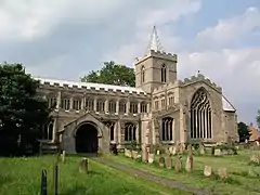
 Ss Peter and Paul Church, Algarkirk | |
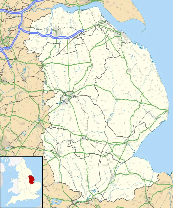
 Algarkirk Location within Lincolnshire | |
| Population | 386 (2011) |
| OS grid reference | TF291352 |
| • London | 95 mi (153 km) S |
| District | |
| Shire county | |
| Region | |
| Country | England |
| Sovereign state | United Kingdom |
| Post town | Boston |
| Postcode district | PE20 |
| Dialling code | 01205 |
| Police | Lincolnshire |
| Fire | Lincolnshire |
| Ambulance | East Midlands |
| UK Parliament | |
History
Before the Roman conquest the area was home to the Coritani; after Roman departure it became part of the Anglo Saxon kingdom of Mercia.[3] Algarkirk has been claimed to be named after Ælfgar, Earl of Mercia, a son of Lady Godiva;[4] he is reputedly buried in the graveyard[5] of the parish church of St Peter and St Paul. The "kirk" element of the name comes from the Old English "circe" meaning church, which was later replaced by the Old Norse "kirk".[6]
The 9th-century church itself is Early English and Norman with a double-aisle transept and a font of Purbeck marble. Under the tower are kneeling brass effigies of Nicholas Robertson (d. 1498), Merchant of the Staple of Calais, and his two wives Alice and Isabella. In 1492, he and Isabella glazed the church clerestorey.[7] The church was heavily restored in 1851.[4]

Hitherto, the parish had formed part of Boston Rural District, in the Parts of Holland. Holland was one of the three divisions (formally known as parts) of the traditional county of Lincolnshire. Since the Local Government Act of 1888, Holland had been, in most respects, a county in itself until the creation of Lincolnshire County Council in April 1974 by the combination of Holland, Lindsey (except for those areas transferred to Humberside) and Kesteven County Councils.
The Algarkirk Woad mill closed down after the 1932 crop. The mill owner was Mr George Nussey Snr.[8]
Demography
The population was recorded as 386 in the 2011 Census,[1] a drop from 406 on the 2001 Census.[2]
|
| ||||||||||||||||||||||||||||||||||||
| Source: [1][2] | |||||||||||||||||||||||||||||||||||||
Geography
The village was once served by Algarkirk and Sutterton railway station on the now-closed line connecting Boston and Spalding. The A16 has been rebuilt on the former railway, so Algarkirk village lies between this and the old road, now the B1397. The Boston-Algarkirk Diversion opened in October 1991. The village primary school, the Fourfields school, is shared with Sutterton.
The village lies hard against the parish boundary with Sutterton, so that the two parish churches are six or seven hundred metres apart. While most of the parishes in Holland are more or less long and narrow so as to include both saltmarsh and fen, this was originally achieved in Algarkirk by having a detached fen about 12 kilometres away, in Holland Fen. This is now part of Amber Hill parish and ward.
It constitutes part of Five Villages electoral ward, one of eighteen rural wards in the borough, each comprising one or more parishes.
References
- Census 2001
- "Civil Parish population 2011". Neighbourhood Statistics. Office for National Statistics. Retrieved 20 April 2016.
- "Algarkirk" Genuki.org.uk. Retrieved 25 April 2011
- Cox, J. Charles (1916); Lincolnshire pp.42, 43; Methuen & Co. Ltd.
- "Algarkirk" UK Genealogy Archives. Retrieved 25 April 2011
- "Algarkirk". Institute for Name Studies. University of Nottingham. Retrieved 18 September 2011.
- Hegbin-Barnes, Penny (1996); The medieval stained glass of the county of Lincolnshire p. 350 Oxford University Press ISBN 0-19-726156-6
- Norman T.Wills (1979). Woad in the Fens. N.T.Wills.
Further reading
- "Peculiarities of a Vicar - A Remarkable Interview" paperspast.natlib.govt.nz - Hawera & Normanby Star p. 3; 16 February 1907. Retrieved 25 April 2011
External links
 Media related to Algarkirk at Wikimedia Commons
- Algarkirk in the Domesday Book