Alger Creek
Alger Creek is a stream in Mono County, California, in the United States.[6]
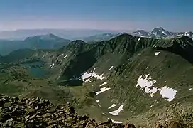
Alger creek basin as seen from Koip peak
| Alger Creek Tributary to Rush Creek | |
|---|---|
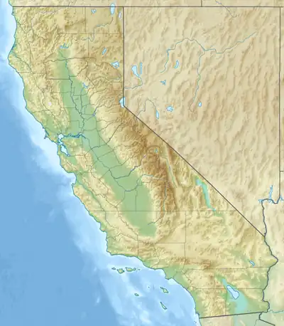 Location of Alger Creek mouth  Alger Creek (the United States) | |
| Location | |
| Country | United States |
| State | California |
| County | Mono |
| Physical characteristics | |
| Source | Parker Creek divide |
| • location | about 1.5 miles south of Parker Peak |
| • coordinates | 37°48′35″N 119°11′31″W[1] |
| • elevation | 11,090 ft (3,380 m)[2] |
| Mouth | Rush Creek |
• location | about 4 miles west of June Lake, California |
• coordinates | 37°46′51″N 119°07′38″W[1] |
• elevation | 7,231 ft (2,204 m)[3] |
| Length | 4.70 mi (7.56 km)[4] |
| Basin size | 5.73 square miles (14.8 km2)[5] |
| Discharge | |
| • location | Rush Creek |
| • average | 6.95 cu ft/s (0.197 m3/s) at mouth with Rush Creek[5] |
| Basin features | |
| Progression | Rush Creek → Mono Lake |
| River system | Rush Creek |
| Tributaries | |
| • left | unnamed tributaries |
| • right | unnamed tributaries |
| Bridges | CA 158 |
Alger Creek took its name from Alger Lakes.[7]
See also
References
- "GNIS Detail - Alger Creek". geonames.usgs.gov. US Geological Survey. Retrieved 21 June 2021.
- "Get Maps". USGS Topoview. US Geological Survey. Retrieved 21 June 2021.
- "Get Maps". USGS Topoview. US Geological Survey. Retrieved 21 June 2021.
- "ArcGIS Web Application". epa.maps.arcgis.com. US EPA. Retrieved 21 June 2021.
- "Alger Creek Watershed Report". US EPA Geoviewer. US EPA. Retrieved 21 June 2021.
- U.S. Geological Survey Geographic Names Information System: Alger Creek
- Browning, Peter (2005). Yosemite Place Names: The Historic Background of Geographic Names in Yosemite National Park. Great West Books. p. 3. ISBN 978-0-944220-19-1.
This article is issued from Wikipedia. The text is licensed under Creative Commons - Attribution - Sharealike. Additional terms may apply for the media files.