Alkun
Alkun (Ingush: Оалкам, romanized: Oalkam)[5] is a rural locality (a selo) in Sunzhensky District of the Republic of Ingushetia, Russia, located on the left bank of the river Fortanga. It forms the municipality of the rural settlement of Alkun as the only settlement in its composition.[6][7]
Alkun
Алкун | |
|---|---|
| Other transcription(s) | |
| • Ingush | Оалкам |
Location of Alkun | |
 Alkun Location of Alkun 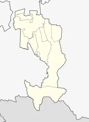 Alkun Alkun (Republic of Ingushetia) | |
| Coordinates: 42°58′15″N 45°01′19″E | |
| Country | Russia |
| Federal subject | Ingushetia |
| Government | |
| • Head | Khairov Bakhit Khasanovich |
| Population | |
| • Total | 1,072 |
| • Estimate (2018)[2] | 1,169 (+9%) |
| • Subordinated to | Sunzhensky District |
| Time zone | UTC+3 (MSK |
| Postal code(s)[4] | 386243 |
| OKTMO ID | 26610435 |
Geography
Alkun is located on both banks of the Assa river, at the entrance to the Assinsky Gorge, 42 km south-west of the city of Sunzha, the regional center.[8]
The nearest settlements: in the northwest - the villages of Muzhichi and Galashki, in the northeast - the village of Dattykh.[9]
History
The village of Upper Alkun was founded by the Tsechoy clan (teip) back in the 18th century.[10]
In 1860–1861, the village, together with its neighbors (Galashki, Dattykh), were settled by Cossacks and transformed into villages. At the end of the 19th century, the Cossacks left these villages, and the lands were returned to the Ingush. Subsequently, there were two separate villages - Upper Alkun (on the right bank of the Assa river) and Lower Alkun (on the left bank of the Assa River).
In 1944, after the Deportation of the Chechens and Ingush and the abolition of the Checheno-Ingush ASSR, the village of Upper Alkun was renamed Dachnoye, and Lower Alkun - Lesogorie.[11] After the restoration of the Chechen-Ingush Autonomous Soviet Socialist Republic, in 1958, their former names were returned to the settlements. In 2010, both villages were merged into one village - Alkun.
Infrastructure
The village has a secondary school named "Alkun municipal secondary school".[12]
References
- Russian Federal State Statistics Service (2011). Всероссийская перепись населения 2010 года. Том 1 [2010 All-Russian Population Census, vol. 1]. Всероссийская перепись населения 2010 года [2010 All-Russia Population Census] (in Russian). Federal State Statistics Service.
- "26. Численность постоянного населения Российской Федерации по муниципальным образованиям на 1 января 2018 года". Federal State Statistics Service. Retrieved 23 January 2019.
- "Об исчислении времени". Официальный интернет-портал правовой информации (in Russian). 3 June 2011. Retrieved 19 January 2019.
- Почта России. Информационно-вычислительный центр ОАСУ РПО. (Russian Post). Поиск объектов почтовой связи (Postal Objects Search) (in Russian)
- Мальсагов 1963, p. 147.
- "Закон Республики Ингушетия от 23 февраля 2009 года № 5-рз «Об установлении границ муниципальных образований Республики Ингушетия и наделении их статусом сельского поселения, муниципального района и городского округа»".
- "Алкунская сельский округ (сельсовет)* (Сунженский район)" [Alkunskaya Rural District (village council)* (Sunzhensky District)]. www.ocato.ru (in Russian). Archived from the original on February 28, 2018.
- "Map of Chechnya and Ingushetia".(rar) (not earlier than 1995). Volume 8 MB
- "Map of Chechnya and Ingushetia".(rar) (not earlier than 1995). Volume 8 MB
- Мальсагова 2011.
- "Указ Президиума Верховного Совета РСФСР о переименовании некоторых сельских советов и населённых пунктов Грозненской области" [www.ingusheti.ge] (in Russian). (See the document № 100)
- "СОШ с. Алкун" [SES v. Alkun]. www.k-agent.ru (in Russian).
Bibliography
Russian sources
- Куркиев, А. С. (1979). Основные вопросы лексикологии ингушского языка [The main questions of the lexicology of the Ingush language] (in Russian). Грозный: Чеч.-Инг. кн. изд-во. pp. 1–254.
- Мальсагов, З. К. (1963). Оздоева, Ф. (ed.). Грамматика ингушского языка [Grammar of the Ingush language] (in Ingush and Russian). Vol. 5 (2nd ed.). Грозный: Чечено-Ингушское Книжное Издательство. pp. 1–164.
- Мальсагова, Р. (2011-03-30). "Докку Умаров убит" [Dokku Umarov killed]. Кавказский Дневник. Archived from the original on 2013-11-05. Retrieved 2012-02-08.