Alport
Alport is a hamlet in the White Peak area of Derbyshire, England. It lies east of Youlgreave, at the confluence of the River Bradford and the River Lathkill. The oldest house in the hamlet is Monks Hall. There also used to be a pub, which was demolished thanks the construction of a main road, which leads to the A6 and towards Buxton.
| Alport | |
|---|---|
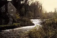 River Lathkill at the millpond, Alport. | |
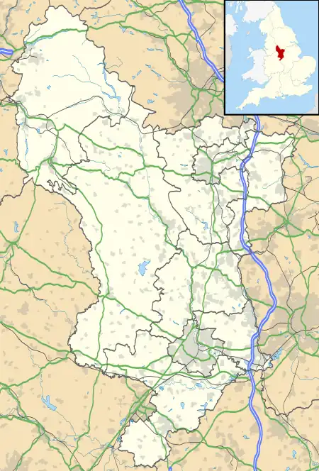 Alport Location within Derbyshire | |
| OS grid reference | SK2264 |
| Civil parish | |
| District | |
| Shire county | |
| Region | |
| Country | England |
| Sovereign state | United Kingdom |
| Police | Derbyshire |
| Fire | Derbyshire |
| Ambulance | East Midlands |
A Grade-II listed stone bridge crosses the River near the centre of the hamlet, close to the 18th century mill.[1]
There are lead mines in the area, and at the Alport mine, an early steam-powered Nutating disc engine was installed.[2]
In chronostratigraphy, the British sub-stage of the Carboniferous period, the 'Alportian' derives its name from study of a core from a borehole drilled at Alport.[3]
The name Alport means "Old town", possibly with market trading connotations.[4] The hamlet lies on the line of the Derbyshire Portway, an ancient trading route.
Governance
Alport is within the civil parish of Youlgreave which, in turn, is part of the Derbyshire Dales district.
External links
See also
- Derbyshire lead mining history
- Alport Height near Wirksworth, Derbyshire
- Alport Castles in the High Peak Estate
- Listed buildings in Harthill, Derbyshire
- Listed buildings in Youlgreave
References
- Historic England. "Mill Bridge, Harthill (Grade II) (1334977)". National Heritage List for England. Retrieved 16 March 2021.
- Nixon, Frank (1969). The Industrial Archaeology of Derbyshire. David & Charles. ISBN 0715343513.
- Cleal, C.J.; Thomas, B.A. (1996). British Upper Carboniferous Stratigraphy. Geological Conservation Review. Vol. 11.
- Richards, Mark (1985). White Peak Walks: The Northern Dales. ISBN 0-902363-53-0.