Altachullion Upper
.jpg.webp)
Altachullion Upper (from Irish: Alt an Chuilinn Uachtarach, meaning The Upper Glen of the Holly) is a townland in the civil parish of Templeport, County Cavan, Ireland. It lies in the Roman Catholic parish of Corlough and barony of Tullyhaw.[1] A sub-division is called The Tebente - a name given to a field which in 1938 was the property of Mrs McGoldrick.
.jpg.webp)
Geography
Altachullion Upper is bounded on the north by Altachullion Lower townland, on the south by Altateskin townland, on the west by Legnaderk and Altnadarragh townlands and on the east by Altinure, Tullyloughfin and Tullynamoltra townlands. Its chief geographical features are mountain streams, gravel pits, springs and dug wells. Altachullion Upper is traversed by minor public roads and rural lanes. The townland covers 271 statute acres,.[2]
History
In earlier times the townland was probably uninhabited as it consists mainly of bog and poor clay soils. It was not seized by the English during the Plantation of Ulster in 1610, nor in the Cromwellian Settlement of the 1660s; so some dispossessed Irish families moved there and began to clear and farm the land.
The earliest reference to the townland is on a map dated 1813 where it is called "Altaghullen".
In the 19th century the landlord was Lord John Beresford, the Protestant Archbishop of Armagh. The muddled previous land history of the area is described in the 1838 Exchequer case, "Attorney General of Ireland v The Lord Primate".[3] The maps used in the case are viewable online at Tullyhaw.[4]
The Tithe Applotment Books for 1826 list twelve tithepayers in the townland.[5]
The Ordnance Survey Name Books for 1836 give the following description of the townland: It is bounded on the north side by a large stream which rises in the mountain and runs towards the southeast. ...a flax kiln.
The Altachullion Upper Valuation Office Field books are available for August 1839.[6][7]
Griffith's Valuation of 1857 lists seven landholders in the townland.[8]
| Year | Population | No. of houses (all inhabited) | Ref. | ||
|---|---|---|---|---|---|
| M | F | Total | |||
| 1841 | 28 | 20 | 48 | 9 | [9] |
| 1851 | 30 | 20 | 50 | 5 | [9] |
| 1861 | 18 | 14 | 32 | 6 | [10] |
| 1871 | 27 | 26 | 53 | 8 | [11] |
| 1881 | 13 | 20 | 33 | 7 | [12] |
| 1891 | 17 | 23 | 40 | 7 | [13] |
| 1901 | 7 families | [14] | |||
| 1911 | 7 families | [15] | |||
Antiquities
The only structure of historical interest in the townland is
- A footbridge over the stream
References
- "Placenames Database of Ireland". Retrieved 29 February 2012.
- "IreAtlas". Retrieved 29 February 2012.
- Jebb, Robert; Symes, Arthur R. (1840). "Reports of Cases Argued and Determined in the Courts of Queen's Bench and Exchequer Chamber in Ireland: With Tables of the Names of the Cases and the Principal Matters".
- Search Results - tullyhaw
- SearchTithe Applotment Books 1826
- Ireland Census data National Archives
- Ireland Census data National Archives
- "Griffith's Valuation". www.askaboutireland.ie. Retrieved 2 June 2023.
- "Accounts and Papers of the House of Commons". 1853.
- The census of Ireland for the year 1861. Printed by A. Thom for H.M. Stationery Off.
- "Census of Ireland 1871 : Part I, Area, Population, and Number of Houses; Occupations, Religion and Education volume III, Province of Ulster; Summary Tables, Indexes". 1874.
- "Census of Ireland 1881 : Area, Population and Number of Houses; Occupations, Religion and Education volume III, Province of Ulster". 1882.
- "Browse > Census > Ireland > 1891 > Area, houses, and population, Vol. III, Ireland, 1891 Page 294". Histpop.Org. 1 July 2004. Retrieved 16 August 2022.
- "National Archives: Census of Ireland 1911". www.census.nationalarchives.ie. Retrieved 2 June 2023.
- "National Archives: Census of Ireland 1911". www.census.nationalarchives.ie. Retrieved 2 June 2023.
External links
Places in County Cavan | ||
|---|---|---|
| Towns | 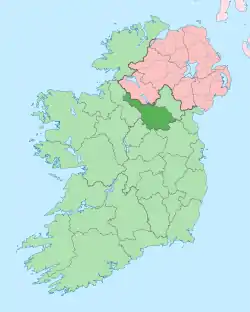 | |
| Villages |
| |
| Townlands | ||
| ||