Andover, Tasmania
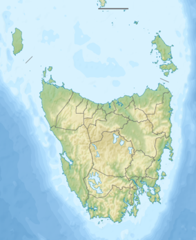
Andover is a rural locality in the local government area (LGA) of Southern Midlands in the Central LGA region of Tasmania. The locality is about 16 kilometres (9.9 mi) east of the town of Oatlands. The 2021 census recorded a population of 39 for Andover.[1] It consists of mostly farming land and several historic pastoral properties.[2] Andover covers an area of 73.446 square kilometres.[3]
| Andover Tasmania | |||||||||||||||
|---|---|---|---|---|---|---|---|---|---|---|---|---|---|---|---|
 Andover | |||||||||||||||
| Coordinates | 42°20′06″S 147°31′08″E | ||||||||||||||
| Population | 39 (2021 census)[1] | ||||||||||||||
| Postcode(s) | 7120 | ||||||||||||||
| Location | 16 km (10 mi) E of Oatlands | ||||||||||||||
| LGA(s) | Southern Midlands | ||||||||||||||
| Region | Central | ||||||||||||||
| State electorate(s) | Lyons | ||||||||||||||
| Federal division(s) | Lyons | ||||||||||||||
| |||||||||||||||
History
Andover was gazetted as a locality in 1974.[4]
Eastern Marshes Siding Post Office opened in 1888, and was renamed Andover in 1893. It closed in 1966.[5]
It was historically a village on the Little Swan River, in the county of Somerset, Tasmania about 62 km (50 miles) from Hobart.[6] It was named by Lieutenant Francis Tabart in 1831.[2]
Geography
The Little Swanport River rises in the locality and flows through to the south-eastern boundary.[7]
Road infrastructure
Route C310 (Inglewood Road) passes through from west to south-east. Route C307 (Lemont Road) starts at an intersection with C310 and runs east until it exits. Route C309 (Nala Road) starts at an intersection with C310 and runs north and east until it exits.[4][8]
References
- Australian Bureau of Statistics (28 June 2022). "Andover". 2021 Census QuickStats. Retrieved 5 August 2022.
- "Andover". Southern Midlands Council. Retrieved 3 May 2019.
- "Andover". Tasmania - Australias.guide. Retrieved 3 May 2019.
- "Placenames Tasmania – Andover". Placenames Tasmania. Select “Search”, enter "225F", click “Search”, select row, map is displayed, click “Details”. Retrieved 13 September 2020.
- "Post Office List". Premier Postal Auctions. Retrieved 21 September 2020.
- Rev. John West, History of Tasmania.
- Google (13 September 2020). "Andover, Tasmania" (Map). Google Maps. Google. Retrieved 13 September 2020.
- "Tasmanian Road Route Codes" (PDF). Department of Primary Industries, Parks, Water & Environment. May 2017. Archived from the original (PDF) on 1 August 2017. Retrieved 13 September 2020.