Ankobra River
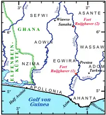
The Ankobra River is primarily situated in Ghana. Rising north east of Wiawso, it flows about 190 kilometres (120 mi) south to the Gulf of Guinea. Its entire course is in south Ghana.[1][2] Near its mouth are the remains of Fort Elize Carthago, a Dutch trading post abandoned in 1711,
| Ankobra River | |
|---|---|
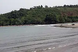
 The estuary of Ankobra River | |
| Location | |
| Country | Ghana |
| Physical characteristics | |
| Mouth | Gulf of Guinea |
• location | Atlantic Ocean |
• coordinates | 4°53′55″N 2°16′17″W |
| Basin size | 1,900 km2 (730 sq mi) |
| Discharge | |
| • location | Mouth |
The Ankobra River is fed by the Nini River. Small ships can navigate 80 kilometres (40 nmi; 50 mi) inland, whilst the upper reaches contain rapids. Several hydro electric schemes have been proposed for the upper reaches.[1][2]
Mercury and arsenic was reported in 2003 to be found in the gold mining area of the Ankobra River Basin.[3][4]
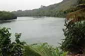
 The course of Ankobra River |
 Looking north from the southern end of the Ankobra River |
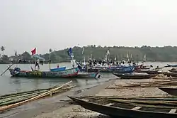
 Fishing boats at Ankobra River |
 Fishing boats at the estuary of Ankobra River |
References
- Ankobra River. secsd.com.
- Rivers and Lakes
- Bannerman, W.; Potin-Gautier, M.; Amoureux, D.; Tellier, S.; Rambaud, A.; Babut, M.; Adimado, A.; Beinhoff, C. (2003). "Mercury and arsenic in the gold mining regions of the Ankobra River basin in Ghana". Journal de Physique IV (Proceedings). 107: 107–110. doi:10.1051/jp4:20030255.
- Asare-Donkor, Noah Kyame; Adimado, Anthony Apeke (2016). "Influence of mining related activities on levels of mercury in water, sediment and fish from the Ankobra and Tano River basins in South Western Ghana". Environmental Systems Research. 5. doi:10.1186/s40068-016-0055-4.
This article is issued from Wikipedia. The text is licensed under Creative Commons - Attribution - Sharealike. Additional terms may apply for the media files.