Aoi-ku, Shizuoka
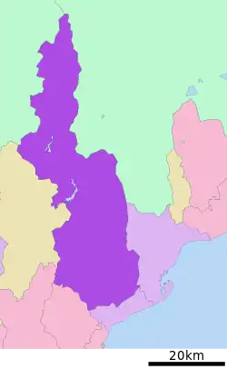
Aoi-ku (葵区, Aoi-ku) is one of three wards of the city of Shizuoka in Shizuoka Prefecture, Japan, located in the northern part of the city. Aoi-ku borders Suruga-ku in the south and Shimizu-ku to the southeast; the west faces Shimada, Fujieda and Kawanehon and its northern tip extends into the border between Nagano Prefecture and Yamanashi Prefecture. It is the largest ward in Japan in terms of geographic area.
Aoi
葵区 | |
|---|---|
| Aoi Ward | |
 Location of Aoi-ku in Shizuoka | |
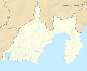
 Aoi  Aoi Aoi (Japan) | |
| Coordinates: 34°58′30″N 138°23′1″E | |
| Country | Japan |
| Region | Tōkai Koshin'etsu region (Chūbu) |
| Prefecture | Shizuoka |
| City | Shizuoka |
| Area | |
| • Total | 1,411.90 km2 (545.14 sq mi) |
| Population (January 10, 2020) | |
| • Total | 249,451 |
| • Density | 180/km2 (460/sq mi) |
| Time zone | UTC+9 (Japan Standard Time) |
| Phone number | 054-254-2115 |
| Address | 5-1 Otemachi, Aoi-ku Shizuoka-shi, Shizuoka-ken 420-8602 |
| Climate | Cfa |
| Website | Aoi-ku home page |

Aoi-ku was created on April 1, 2003, when Shizuoka became a city designated by government ordinance (a "designated city"). It consists of the area of Shizuoka prior to its merger with Shimizu, north of the Tōkaidō Main Line rail tracks.
The ward is home to both the Shizuoka city offices as well as the Shizuoka prefectural offices.
Geography
Climate
Aoi-ku has a climate characterized by hot and humid summers, and relatively mild winters (Köppen climate classification Cfa). The average annual temperature in Aoi-ku is 11.6 °C (52.9 °F). The average annual rainfall is 3,258.6 mm (128.29 in) with September as the wettest month. The temperatures are highest on average in August, at around 22.4 °C (72.3 °F), and lowest in January, at around 1.2 °C (34.2 °F).[1]
| Climate data for Aoi-ku (1991−2020 normals, extremes 1978−present) | |||||||||||||
|---|---|---|---|---|---|---|---|---|---|---|---|---|---|
| Month | Jan | Feb | Mar | Apr | May | Jun | Jul | Aug | Sep | Oct | Nov | Dec | Year |
| Record high °C (°F) | 18.2 (64.8) |
21.8 (71.2) |
24.2 (75.6) |
27.5 (81.5) |
29.9 (85.8) |
34.4 (93.9) |
35.7 (96.3) |
34.7 (94.5) |
33.2 (91.8) |
28.4 (83.1) |
22.4 (72.3) |
19.4 (66.9) |
35.7 (96.3) |
| Average high °C (°F) | 6.6 (43.9) |
7.8 (46.0) |
11.0 (51.8) |
16.1 (61.0) |
20.5 (68.9) |
23.1 (73.6) |
27.0 (80.6) |
28.0 (82.4) |
24.4 (75.9) |
19.2 (66.6) |
14.2 (57.6) |
9.1 (48.4) |
17.2 (63.1) |
| Daily mean °C (°F) | 1.2 (34.2) |
1.9 (35.4) |
5.1 (41.2) |
10.0 (50.0) |
14.4 (57.9) |
17.9 (64.2) |
21.7 (71.1) |
22.4 (72.3) |
19.2 (66.6) |
13.8 (56.8) |
8.4 (47.1) |
3.5 (38.3) |
11.6 (52.9) |
| Average low °C (°F) | −3.0 (26.6) |
−2.7 (27.1) |
0.2 (32.4) |
4.9 (40.8) |
9.5 (49.1) |
14.0 (57.2) |
18.0 (64.4) |
18.7 (65.7) |
15.5 (59.9) |
9.8 (49.6) |
4.0 (39.2) |
−0.8 (30.6) |
7.3 (45.2) |
| Record low °C (°F) | −11.5 (11.3) |
−11.4 (11.5) |
−8.6 (16.5) |
−3.9 (25.0) |
0.5 (32.9) |
5.9 (42.6) |
11.7 (53.1) |
11.7 (53.1) |
5.2 (41.4) |
0.0 (32.0) |
−3.5 (25.7) |
−9.5 (14.9) |
−11.5 (11.3) |
| Average precipitation mm (inches) | 108.6 (4.28) |
133.3 (5.25) |
253.0 (9.96) |
263.7 (10.38) |
276.3 (10.88) |
344.0 (13.54) |
442.1 (17.41) |
318.9 (12.56) |
507.4 (19.98) |
322.7 (12.70) |
183.6 (7.23) |
111.2 (4.38) |
3,258.6 (128.29) |
| Average precipitation days (≥ 1.0 mm) | 6.3 | 7.3 | 11.0 | 11.5 | 12.4 | 14.6 | 15.0 | 13.3 | 13.8 | 11.7 | 8.4 | 6.7 | 132 |
| Mean monthly sunshine hours | 206.3 | 184.4 | 177.4 | 177.3 | 176.9 | 122.3 | 142.4 | 160.9 | 127.1 | 147.1 | 173.1 | 204.0 | 1,995.3 |
| Source: Japan Meteorological Agency[2][1] | |||||||||||||
Economy
Vic Tokai has its headquarters in Aoi-ku.[3] Fuji Dream Airlines was headquartered in Aoi-ku;[4] it now has its headquarters in Makinohara.[5]
Notes
- 気象庁 / 平年値(年・月ごとの値). JMA. Retrieved April 26, 2022.
- 観測史上1~10位の値(年間を通じての値). JMA. Retrieved April 26, 2022.
- "会社概要 Archived 2006-07-19 at the Wayback Machine." Vic Tokai. Retrieved on November 19, 2010. "本社所在地 静岡県静岡市葵区常磐町2丁目6番地の8 TOKAIビル."
- "会社概要." Fuji Dream Airlines. Retrieved on May 20, 2009.
- "会社概要." Fuji Dream Airlines. Retrieved on November 19, 2010. "〒421-0411 静岡県牧之原市坂口2053番地1."
 Geographic data related to Aoi-ku, Shizuoka at OpenStreetMap