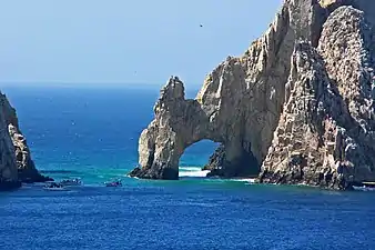
Arch of Cabo San Lucas
The arch of Cabo San Lucas is a distinctive granitic rock formation at the southern tip of Cabo San Lucas, which is itself the extreme southern end of Mexico's Baja California Peninsula.[1] The arch is locally known as "El Arco," which means "the arch" in Spanish, or "Land's End."[2] It is here that the Pacific Ocean becomes the Gulf of California.
| Arch of Cabo San Lucas | |
|---|---|
 | |
 The Arch of Cabo San Lucas | |
| Location | Cabo San Lucas, Mexico |
| Nearest city | Cabo San Lucas |
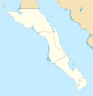
| Coordinates | 22.8760°N 109.8947°W |
| Elevation | 200 ft (61 m) |
This area is widely used in hotel advertising in the Los Cabos Corridor. This spot is a popular gathering area for sea lions and is frequented by tourists.[3] The Arch of Cabo San Lucas is adjacent to Lovers Beach on the Sea of Cortez side and Divorce Beach on the rougher Pacific Ocean side.[2]
Access
The Arch is accessible by land or boat from the beach of the last hotel on the Pacific. Access to the arch requires climbing large rocks.[2][3][4]
Geology
Basement rock in Los Cabos formed through intrusive igneous processes c. 115 million years ago, during the Cretaceous period.[5] The arch is three stories tall and was formed from natural erosion.
References
- "Head to La Paz rather than overdeveloped Los Cabos for the real Baja California". The Washington Post. Archived from the original on 2019-10-04.
- "The Arch of Cabo San Lucas". Atlas Obscura. Retrieved 2020-01-08.
- "El Arco de Cabo San Lucas - 2020 All You Need to Know BEFORE You Go (with Photos)". TripAdvisor. Retrieved 2020-01-08.
- "El Arco". Travel + Leisure. Archived from the original on 2017-04-12. Retrieved 2020-01-08.
- Fletcher, John; Kohn, Barry; Foster, David; Gleadow, Andrew (2000). "Heterogeneous Neogene cooling and exhumation of the Los Cabos block, southern Baja California: Evidence from fission-track thermochronology". Geology. 28 (2): 107–110. Bibcode:2000Geo....28..107F. doi:10.1130/0091-7613(2000)28<107:HNCAEO>2.0.CO;2.