Ishkashim, Afghanistan
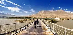
Ishkashim (Dari: اشکاشم; Pashto: اشکاشم; also transliterated Eshkashem or Ashkāsham) is a border town in Badakhshan Province of Afghanistan.[2][3] With a population of around 12,120 people,[4] the town serves as the capital of Ishkashim District. Another town by the same name is located on the other side of the Panj River in the Gorno-Badakhshan region of Tajikistan, although that town is normally transliterated Ishkoshim following Tajik practice. A bridge linking the two towns was reconstructed in 2006.[5]
Ishkashim | |
|---|---|
 A bridge over the Panj River at Ishkashim | |
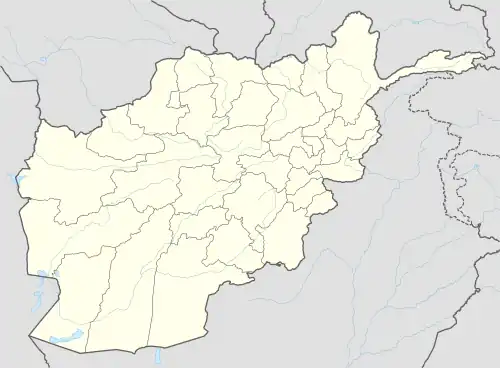
 Ishkashim Location in Afghanistan | |
| Coordinates: 36°42′33″N 71°34′26″E | |
| Country | |
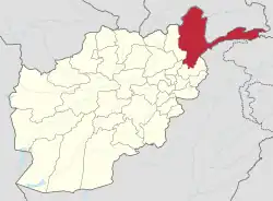
| Province | Badakhshan |
| District | Ishkashim |
| Elevation | 8,500 ft (2,600 m) |
| Population | |
| • Total | 12,120 |
| Time zone | + 4.30 |
Ishkashim lies in a fertile valley at an elevation of 3,037 m (9,964 ft) meters.[4] There are roughly 20 settlements in the valley, but, considering the cultivation in the valley is contiguous, it could also be considered one single, larger settlement. The valley has only one harvest per year. Wheat and barley are cultivated.[6] Poplar and chinar trees grow as well, but there is little firewood.
Ishkashim is connected by road with Fayzabad in the northwest, through the town of Baharak. It is also connected to the towns of Zebak in the southwest and Khandud in the northeast. The valley lies in an important strategic area, as it commands the only route between Fayzabad, Shighnan, and Wakhan accessible during the winter. It has a number of small shops, hotels, guest houses, schools and government buildings, including a base for the Afghan Border Police.
History
Ishkashim and Wakhan became an Islamic region during the Samanid Empire. It fell to the Ghaznavids followed by the Ghurids and others. It officially became part of the modern state of Afghanistan after rulers of the Qing dynasty of China signed a treaty with Ahmad Shah Durrani, the founder of the last Afghan Empire.[7] It was reshaped during the rule of Abdur Rahman Khan in the late 19th century after he agreed on the Durand Line with Mortimer Durand. Afghanistan as a whole became a buffer state between what was then the Russian Empire and British India.[8][9] It is currently patrolled by forces of the Islamic Emirate of Afghanistan, which took over responsibility from the previous NATO-trained Afghan National Security Forces.[10][11]
Climate
The climate is generally cold, but much warmer than that of neighboring areas, such as Wakhan District.[1] According to the Köppen climate classification, Ishkashim has a warm-summer humid continental climate (Dsb) with pleasant summers and cold winters. The average annual temperature in Ishkashim is 4.3 °C (39.7 °F). About 569 mm (22.40 in) of precipitation falls annually.
| Climate data for Ishkashim | |||||||||||||
|---|---|---|---|---|---|---|---|---|---|---|---|---|---|
| Month | Jan | Feb | Mar | Apr | May | Jun | Jul | Aug | Sep | Oct | Nov | Dec | Year |
| Average high °C (°F) | −4.7 (23.5) |
−3.6 (25.5) |
2.0 (35.6) |
9.1 (48.4) |
13.9 (57.0) |
19.6 (67.3) |
22.7 (72.9) |
22.8 (73.0) |
18.9 (66.0) |
12.3 (54.1) |
4.9 (40.8) |
−1.5 (29.3) |
9.7 (49.4) |
| Daily mean °C (°F) | −9.4 (15.1) |
−7.8 (18.0) |
−2.2 (28.0) |
4.3 (39.7) |
8.4 (47.1) |
13.4 (56.1) |
16.3 (61.3) |
16.2 (61.2) |
11.9 (53.4) |
6.1 (43.0) |
0.0 (32.0) |
−5.5 (22.1) |
4.3 (39.8) |
| Average low °C (°F) | −14.1 (6.6) |
−12.1 (10.2) |
−6.4 (20.5) |
−0.5 (31.1) |
3.0 (37.4) |
7.2 (45.0) |
9.9 (49.8) |
9.7 (49.5) |
4.9 (40.8) |
−0.1 (31.8) |
−4.9 (23.2) |
−9.5 (14.9) |
−1.1 (30.1) |
| Average precipitation mm (inches) | 56 (2.2) |
73 (2.9) |
101 (4.0) |
94 (3.7) |
69 (2.7) |
19 (0.7) |
14 (0.6) |
11 (0.4) |
8 (0.3) |
29 (1.1) |
39 (1.5) |
56 (2.2) |
569 (22.3) |
| Source: weather2visit.com[12] | |||||||||||||
Demographics
Dari is the official language in Ishkashim, Afghanistan.[6] The people in the area are mostly Tajiks and Uzbeks. Historically, there have also been many followers of Nizari Isma'ilism in the area,[6] who are called Ishkashimis. Some of whom may speak the Ishkashimi language in addition to Dari.[1]
References
- Adamec, Ludwig W., ed. (1972). Historical and Political Gazetteer of Afghanistan. Vol. 1. Graz, Austria: Akadamische Druck-u. Verlangsanstalt. p. 85.
- "Analysts Predict Decrease in Govt Revenue as Border Town Falls". TOLOnews. 7 August 2021. Retrieved 2022-12-21.
- "NGA GeoName Database". National Geospatial-Intelligence Agency. Archived from the original on 2008-05-22. Retrieved 2008-05-27.
- Population of Ashkāsham, Afghanistan Archived 2009-07-03 at the Wayback Machine
- "News: Aga Khan and President Rahmonov inaugurate reconstructed bridge in Ishkashim". Asia-Plus. October 31, 2006. Archived from the original on 2007-09-27. Retrieved 2009-05-07.
- Salopek, Paul (October 16, 2017). "Walking the Wild Rim of War". National Geographic. Retrieved October 17, 2017.
- Dupree, Nancy Hatch (1970). An Historical Guide to Afghanistan. Vol. First Edition. Kabul: Afghan Air Authority, Afghan Tourist Organization. p. 263. Retrieved 2022-12-21.
- Shahrani, M. Nazif (2002). The Kirghiz and Wakhi of Afghanistan: Adaptation to Closed Frontiers and War (2nd ed.). University of Washington Press. ISBN 978-0-295-98262-5.
- "In Central Asia's forbidding highlands, a quiet newcomer: Chinese troops". The Washington Post. February 18, 2019. Retrieved 2022-12-21.
- "Over 1,000 ANA soldiers in Badakhshan flee to Tajikistan". Pajhwok Afghan News. 5 July 2021. Retrieved 2022-12-21.
- Pascual Juanola, Marta (23 July 2021). "The Taliban conquest of a thin strip of land could change Afghanistan". Sydney Morning Herald. Retrieved 5 August 2021.
- "Ashkāsham monthly weather averages". Retrieved 31 May 2023.
External links
![]() Media related to Ishkashim, Afghanistan at Wikimedia Commons
Media related to Ishkashim, Afghanistan at Wikimedia Commons
- Badakhsan Ishkashim, کابل تا بدخشان، گزارش ضیا، اشکاشم ۱۷ on YouTube
- "Ishkashim Border Crossing Between Tajikistan & Afghanistan". Nicole L. Smoot. Retrieved 2022-12-21.
- Satellite map at Maplandia.com
- "Eshkashem". Google Earth.
