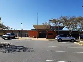
Aubin Grove, Western Australia
Aubin Grove is a suburb of Perth, Western Australia in the City of Cockburn. The suburb was approved in 2003.
| Aubin Grove Perth, Western Australia | |||||||||||||||
|---|---|---|---|---|---|---|---|---|---|---|---|---|---|---|---|
 Aubin Grove Sport and Community Facility | |||||||||||||||
| Coordinates | 32.169°S 115.864°E | ||||||||||||||
| Population | 6,786 (SAL 2021)[1] | ||||||||||||||
| Established | 2003 | ||||||||||||||
| Postcode(s) | 6164 | ||||||||||||||
| Area | 2.5 km2 (1.0 sq mi)[2] | ||||||||||||||
| LGA(s) | City of Cockburn | ||||||||||||||
| State electorate(s) | Kwinana | ||||||||||||||
| Federal division(s) | Fremantle | ||||||||||||||
| |||||||||||||||
Aubin Grove was formerly part of the rural locality of Banjup. It is named after Henry John Aubin, who leased agricultural land in the area in 1897.[3]
It has grown rapidly, from a population of 351 at the 2006 census[4] to 6,324 at the 2016 census.[5]
Transport
Aubin Grove railway station in neighbouring Atwell opened on 23 April 2017.[6]
References
- Australian Bureau of Statistics (28 June 2022). "Aubin Grove (Suburb and Locality)". Australian Census 2021 QuickStats. Retrieved 28 June 2022.
- Australian Bureau of Statistics (27 June 2017). "2016 Community Profiles: Aubin Grove (State Suburb)". 2016 Census of Population and Housing. Retrieved 3 December 2021.
- "History of metropolitan suburb names – A". Western Australian Land Information Authority. Archived from the original on 16 March 2022. Retrieved 15 May 2007.
- Australian Bureau of Statistics (25 October 2007). "Aubin Grove (State Suburb)". 2006 Census QuickStats. Retrieved 5 October 2008.
- Australian Bureau of Statistics (27 June 2017). "Aubin Grove (State Suburb)". 2016 Census QuickStats. Retrieved 14 January 2018.
- Fact Sheet Archived 22 January 2015 at the Wayback Machine Public Transport Authority With A local School And With Good Kids
This article is issued from Wikipedia. The text is licensed under Creative Commons - Attribution - Sharealike. Additional terms may apply for the media files.