Avalanche Lake (Flathead County, Montana)
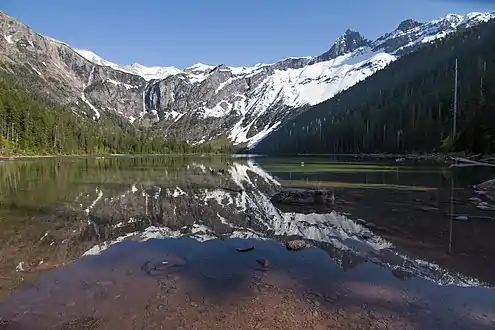
Avalanche Lake is located in Glacier National Park, in the U. S. state of Montana. Avalanche Lake is southwest of Bearhat Mountain and receives meltwater from Sperry Glacier.[2] Avalanche Lake is a 2 miles (3.2 km) hike from the trailhead along the Trail of the Cedars.[3] When measured in August 1910, the maximum depth of the lake was 63 feet near the upper end.[4]
| Avalanche Lake | |
|---|---|
 Avalanche Lake (Little Matterhorn to right) | |
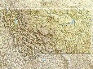
 Avalanche Lake  Avalanche Lake | |
| Location | Glacier National Park, Flathead County, Montana, US |
| Coordinates | 48°39′23″N 113°47′08″W[1] |
| Type | Natural |
| Primary outflows | Avalanche Creek |
| Basin countries | United States |
| Max. length | .60 mi (0.97 km) |
| Max. width | .20 mi (0.32 km) |
| Surface elevation | 3,905 ft (1,190 m) |
History
Avalanche Lake was named in 1895 by a party including Dr. Lyman Sperry, namesake of the Sperry Glacier, who witnessed many avalanches during their stay.[5]
Nature
Though most lakes of similar size and elevation in Glacier National Park do not have fish, Avalanche Lake is a popular fishing location among anglers.[6] Yellowstone cutthroat trout are native to the lake.[7]
References
- "Avalanche Lake". Geographic Names Information System. United States Geological Survey, United States Department of the Interior. Retrieved 2011-02-20.
- "Mount Cannon, MT" (Map (USGS Quad)). TopoQuest. Retrieved 2011-02-20.
- "Day Hikes" (pdf). Plan Your Visit. National Park Service. Retrieved 2011-02-20.
- "Glacier NP: Some Lakes of Glacier National Park". www.nps.gov. Retrieved 2021-06-09.
- "Glacier NP: Through The Years In Glacier National Park: An Administrative History (Chapter 1)". www.nps.gov. Retrieved 2021-06-09.
- "Glacier NP: Some Lakes of Glacier National Park". npshistory.com. Retrieved 2021-06-09.
- "FISHMT :: Waterbody Details". myfwp.mt.gov. Retrieved 2021-06-09.
This article is issued from Wikipedia. The text is licensed under Creative Commons - Attribution - Sharealike. Additional terms may apply for the media files.