Avignon Regional County Municipality
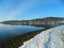
Avignon is a regional county municipality located in the Gaspésie–Îles-de-la-Madeleine region of Quebec, Canada. Its seat and largest city is Carleton-sur-Mer.[2]
Avignon | |
|---|---|
 | |
| Coordinates: 48°06′N 66°51′W[1] | |
| Country | |
| Province | |
| Region | Gaspésie– Îles-de-la-Madeleine |
| Effective | March 18, 1981 |
| County seat | Carleton-sur-Mer |
| Government | |
| • Type | Prefecture |
| • Prefect | Bertrand Berger |
| Area | |
| • Total | 3,479.40 km2 (1,343.40 sq mi) |
| • Land | 3,487.51 km2 (1,346.54 sq mi) |
| There is an apparent contradiction between two authoritative sources | |
| Population (2016)[3] | |
| • Total | 14,461 |
| • Density | 4.1/km2 (11/sq mi) |
| • Change 2011-2016 | |
| • Dwellings | 7,340 |
| Time zone | UTC−5 (EST) |
| • Summer (DST) | UTC−4 (EDT) |
| Area codes | 418 and 581 |
| Website | www |
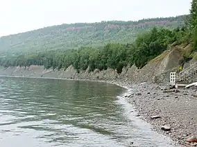
It is on the Gaspé Peninsula, along Chaleur Bay.
Subdivisions
There are 13 subdivisions and 2 native reserves within the RCM:[2]
|
|
|
|
|
Demographics
Population
Canada census – Avignon community profile
| 2021 | 2016 | 2011 | |
|---|---|---|---|
| Population | 13,415 (-7.2% from 2016) | 14,461 (-5.1% from 2011) | 15,246 (+4.1% from 2006) |
| Land area | 3,487.37 km2 (1,346.48 sq mi) | 3,487.51 km2 (1,346.54 sq mi) | 3,486.51 km2 (1,346.15 sq mi) |
| Population density | 3.8/km2 (9.8/sq mi) | 4.1/km2 (11/sq mi) | 4.4/km2 (11/sq mi) |
| Median age | 52.8 (M: 52.0, F: 54.0) | 49.9 (M: 48.7, F: 50.6) | 46.6 (M: 46.0, F: 47.2) |
| Private dwellings | 6,967 (total) 6,281 (occupied) | 7,340 (total) | 7,472 (total) |
| Median household income | $60,800 | $48,370 | $41,117 |
|
|
| |||||||||||||||||||||||||||
| [9][3] 2006 population excludes census data for one or more incompletely enumerated Indian reserves or settlements. | |||||||||||||||||||||||||||||
Language
| Canada Census Mother Tongue - Avignon Regional County Municipality, Quebec[9] | ||||||||||||||||||
|---|---|---|---|---|---|---|---|---|---|---|---|---|---|---|---|---|---|---|
| Census | Total | French |
English |
French & English |
Other | |||||||||||||
| Year | Responses | Count | Trend | Pop % | Count | Trend | Pop % | Count | Trend | Pop % | Count | Trend | Pop % | |||||
2016 |
14,260 |
11,550 | 81.0% | 2,025 | 14.2% | 105 | 0.7% | 580 | 4.1% | |||||||||
2011 |
15,050 |
11,675 | 77.57% | 2,555 | 16.98% | 115 | 0.76% | 705 | 4.68% | |||||||||
2006 |
14,415 |
11,955 | 82.93% | 1,685 | 11.69% | 60 | 0.42% | 715 | 4.96% | |||||||||
2001 |
14,960 |
11,860 | 79.28% | 2,260 | 15.10% | 100 | 0.67% | 740 | 4.95% | |||||||||
1996 |
15,560 |
12,700 | n/a | 81.62% | 1,970 | n/a | 12.66% | 80 | n/a | 0.51% | 810 | n/a | 5.21% | |||||
Transportation
Access Routes

Highways and numbered routes that run through the municipality, including external routes that start or finish at the county border:[10]
|
|
|
|
Attractions
- Battle of Restigouche National Historic Site (Pointe-à-la-Croix)
- Fort Listiguj (Pointe-à-la-Croix)
- Notre-Dame-du-Mont-St-Joseph Oratory (Carleton---Saint Omer)
Protected Areas
- Casualt ZEC
- Rivières-Matapédia et Patapédia Wildlife Reserve
- Miguasha Provincial Park
- Saint-Omer National Migratory Bird Sanctuary
References
- "Reference number 141120 in Banque de noms de lieux du Québec". toponymie.gouv.qc.ca (in French). Commission de toponymie du Québec.
- "Geographic code 060 in the official Répertoire des municipalités". www.mamh.gouv.qc.ca (in French). Ministère des Affaires municipales et de l'Habitation.
- "Census Profile, 2016 Census Avignon, Municipalité régionale de comté [Census division], Quebec". Statistics Canada. Retrieved November 29, 2019.
- "2021 Community Profiles". 2021 Canadian Census. Statistics Canada. February 4, 2022. Retrieved 2023-10-19.
- "2016 Community Profiles". 2016 Canadian Census. Statistics Canada. August 12, 2021. Retrieved 2019-11-29.
- "2011 Community Profiles". 2011 Canadian Census. Statistics Canada. March 21, 2019. Retrieved 2014-03-07.
- "2006 Community Profiles". 2006 Canadian Census. Statistics Canada. August 20, 2019.
- "2001 Community Profiles". 2001 Canadian Census. Statistics Canada. July 18, 2021.
- Statistics Canada: 1996, 2001, 2006, 2011 census
- Official Transport Quebec Road Map
External links
Adjacent Counties & Equivalent Territories | |
|---|---|
| Regional county municipalities and equivalent territories | |
|---|---|
| Municipalities | |
This article is issued from Wikipedia. The text is licensed under Creative Commons - Attribution - Sharealike. Additional terms may apply for the media files.