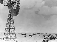
Avon Downs Station
Avon Downs is a pastoral station on the Barkly Tableland in the Northern Territory of Australia. It is located 260 kilometres northwest of Mount Isa.

Early history
Indigenous people have lived in the Barkly region for thousands of years. The first European to enter the area was William Landsborough in 1861. He reported the pastoral potential of the region describing it as the "finest pastoral country he had ever seen".[1]
In 1866, John and James Ranken, two cousins from old pastoral families in New South Wales, herded 4,000 sheep to the area from Queensland's Mackay district, escaping severe drought. They settled in the area now known as Avon Downs. Three watercourses are named after them, the Ranken River, James River and Lorne Creek. Other pastoralists moved to the area throughout the 1860s, but poor wool prices caused the Rankens and others to abandon the area.
In 1882 Thomas Guthrie purchased 1920 square km of the Barkly, expanding that later to more than 3600 square km, naming it Avon Downs after his merino stud 'Rich Avon' in Victoria. It took 12 months to transport the first sheep to the station. Within three decades he developed the property to have a carrying capacity of 70,000 merinos.[1][2] The station was sold in 1921 to the Peel River Company.[3]
Recent history
Avon Downs is now owned by the Australian Agricultural Company and is managed by Adam and Jordyn Ballantine.[4]
References
- Wagstaff, Carmel Wagstaff (1989). TAG Avon Downs Station 1882-1982. Darwin, N.T.: Northern Territory Dept. of Education. p. 6. ISBN 0724513035.
- "AVON DOWNS". The Daily Standard. No. 2713. Queensland. 10 September 1921. p. 4. Retrieved 16 January 2017 – via National Library of Australia.
- "SALE OF PASTORAL PROPERTY". The Northern Standard. No. 50. Northern Territory. 28 June 1921. p. 3. Retrieved 16 January 2017 – via National Library of Australia.
- "Avon & Austral Downs Station". Australian Agricultural Company. Australian Agricultural Company. Retrieved 16 January 2017.