Oberdorf, Nidwalden
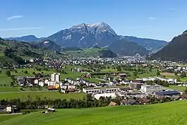
Oberdorf is a municipality in the canton of Nidwalden in Switzerland. It consists of the villages and hamlets of Wil, Ennerberg, Waltersberg, Büren nid dem Bach and Niederrickenbach.
Oberdorf | |
|---|---|
 | |
 Coat of arms | |
Location of Oberdorf | |
 Oberdorf  Oberdorf | |
| Coordinates: 46°57′N 8°23′E | |
| Country | Switzerland |
| Canton | Nidwalden |
| District | n.a. |
| Area | |
| • Total | 16.20 km2 (6.25 sq mi) |
| Elevation | 455 m (1,493 ft) |
| Population (31 December 2018)[2] | |
| • Total | 3,121 |
| • Density | 190/km2 (500/sq mi) |
| Time zone | UTC+01:00 (Central European Time) |
| • Summer (DST) | UTC+02:00 (Central European Summer Time) |
| Postal code(s) | 6370 |
| SFOS number | 1508 |
| Surrounded by | Beckenried, Buochs, Dallenwil, Stans, Wolfenschiessen |
| Website | www SFSO statistics |
The Benedictine convent of Maria-Rickenbach is located within the municipality, next to the hamlet of Niederrickenbach. The convent lies at an altitude of 1,150 m (3,770 ft) and is accessible by cable car.
History
Oberdorf is first mentioned in 1199 as Obirndorf. In 1275 it was mentioned as Oberndorf.[3]
Geography

Oberdorf has an area, as of 2006, of 16.2 square kilometers (6.3 sq mi). Of this area, 53% is used for agricultural purposes, while 38.3% is forested. Of the rest of the land, 6.7% is settled (buildings or roads) and the remainder (1.9%) is non-productive (rivers, glaciers or mountains).[4]
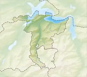
The municipality is located near and above the municipality of Stans. It consists of the villages and hamlets which are located above Stans (the so-called Upper village or in German Obere Dorf), which include Wil, Ennerberg and Waltersberg. Additionally the hamlets of Büren (nid dem Bach) and Niederrickenbach are included in the municipality.
Demographics
Oberdorf has a population (as of 31 December 2020) of 3,080.[5] As of 2007, 5.6% of the population was made up of foreign nationals.[6] Over the last 10 years the population has grown at a rate of 7.6%. Most of the population (as of 2000) speaks German (95.2%), with Albanian being second most common ( 0.8%) and English being third ( 0.7%).[4] As of 2008 the gender distribution of the population was 50.3% male and 49.7% female.
As of 2000 there are 1,054 households, of which 587 households (or about 55.7%) contain only one or two individuals. 151 or about 14.3% are large households, with at least five members.[7]
In the 2007 federal election the most popular party was the FDP which received 90.8% of the vote. Most of the rest of the votes went to small right-wing parties (8.6%).[4]
In Oberdorf about 70.6% of the population (between age 25-64) have completed either non-mandatory upper secondary education or additional higher education (either university or a Fachhochschule).[4]
Oberdorf has an unemployment rate of 1.09%. As of 2005, there were 214 people employed in the primary economic sector and about 77 businesses involved in this sector. 530 people are employed in the secondary sector and there are 35 businesses in this sector. 252 people are employed in the tertiary sector, with 40 businesses in this sector.[4]
The historical population is given in the following table:[3]
| year | population |
|---|---|
| 1850 | 971 |
| 1900 | 1,117 |
| 1950 | 1,455 |
| 1960 | 1,501 |
| 1970 | 1,783 |
| 1980 | 2,272 |
| 1990 | 2,663 |
| 2000 | 2,992 |
| 2005 | 2,961 |
| 2008 | 3,123 |
Sights
The main sight of Oberdorf is the pilgrimage chapel Niederrickenbach.
References
- "Arealstatistik Standard - Gemeinden nach 4 Hauptbereichen". Federal Statistical Office. Retrieved 13 January 2019.
- "Ständige Wohnbevölkerung nach Staatsangehörigkeitskategorie Geschlecht und Gemeinde; Provisorische Jahresergebnisse; 2018". Federal Statistical Office. 9 April 2019. Retrieved 11 April 2019.
- Oberdorf in German, French and Italian in the online Historical Dictionary of Switzerland.
- Swiss Federal Statistical Office accessed 04-Sep-2009
- "Ständige und nichtständige Wohnbevölkerung nach institutionellen Gliederungen, Geburtsort und Staatsangehörigkeit". bfs.admin.ch (in German). Swiss Federal Statistical Office - STAT-TAB. 31 December 2020. Retrieved 21 September 2021.
- Nidwalden Statistical Office-Population (in German) accessed 4 September 2009
- Nidwalden Statistical Office-Municipalities (in German) accessed 4 September 2009