Babang Township, Sichuan
Babang (Tibetan: Palpung; Chinese: 八邦乡; pinyin: Bābāng Xiāng) is a rural Tibetan township in Dêgê County, Garzê Prefecture, Sichuan, China.[1] The township is primarily concentrated around the Pal Chu (Chinese: 白曲; pinyin: Bái Qū) river in the western reaches of the Chola Mountains on the east side of the Jinsha River.[2] The township contains significant remaining tracts of the Hengduan conifer forests.

Palpung Monastery
Babang
八邦乡 | |
|---|---|
| Palpung | |
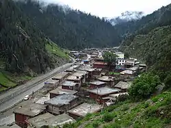 View of traditional log homes along the Pal Chu (river) in Babang Township | |
 Babang  Babang | |
| Coordinates: 31°38′36″N 98°47′49″E | |
| Country | China |
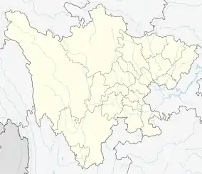
| Province | Sichuan |
| Prefecture | Garzê Tibetan Autonomous Prefecture |
| County | Dêgê County |
| Area | |
| • Total | 555.2 km2 (214.4 sq mi) |
| Elevation | 3,720 m (12,200 ft) |
| Population (2010)[1] | |
| • Total | 2,638 |
| Time zone | UTC+8 (CST) |
Babang is known for the 18th-century Palpung Monastery located on a ridge approximately 160 m (520 ft) above the centre of the township.
References
- "BĀBĀNG XIĀNG". City Population. www.citypopulation.de. Retrieved 3 January 2022.
- McCue, Gary (2010). Trekking Tibet: A Traveler's Guide. Seattle, WA: The Mountaineer's Books. ISBN 9781594852664.
| County-level divisions |  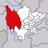 | |
|---|---|---|
| Towns and villages |
| |
| Geography | ||
| Landmarks | ||
This article is issued from Wikipedia. The text is licensed under Creative Commons - Attribution - Sharealike. Additional terms may apply for the media files.