Back Cove (Maine)
Back Cove is an estuary basin on the northern side of the downtown district of Portland, Maine. It is almost circular in form and about 1 mile (1.6 km) in diameter.
Back Cove | |
|---|---|
Cove | |
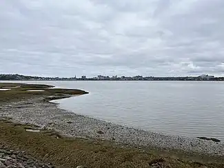 Looking south across the cove to the skyline of downtown Portland | |
| Coordinates: 43.6723309°N 70.268200°W | |
| Country | United States |
| State | Maine |
| County | Cumberland |
| Towns | Portland |
| Time zone | UTC-5 (Eastern (EST)) |
| • Summer (DST) | UTC-4 (EDT) |
Baxter Boulevard, a popular loop trail, runs around the circumference of the cove for 3.6 miles (5.8 km).[1][2]
Being tidal, Back Cove dries out to mud flats at low tide and is not commercially navigable. Its mouth is crossed by Interstate 295 and Tukey's Bridge, which the trail rises up to meet.[2]
 Back Cove (top) as seen in NASA photograph.
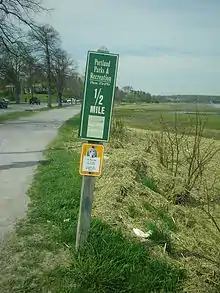 A distance marker on the western side of Baxter Boulevard.
References
- "Back Cove Trail". Portland Trails. Archived from the original on 2009-05-31. Retrieved 2009-04-24.
- "Back Cove Trail » Portland Trails". Portland Trails. Retrieved 2023-05-11.
This article is issued from Wikipedia. The text is licensed under Creative Commons - Attribution - Sharealike. Additional terms may apply for the media files.