Badlands Bombing Range
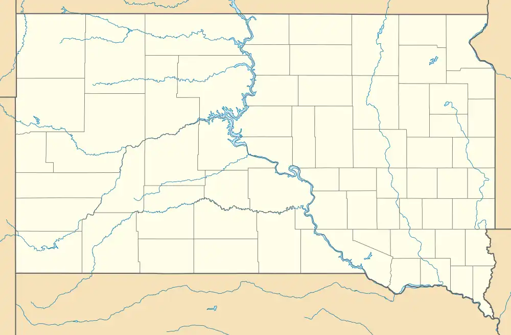
The Badlands Bombing Range (BBR) refers to Rapid City Army Air Base target ranges for World War II which included the current Air Force Retained Area, an inactive 2,486-acre (10.06 km2) United States Air Force site "20 miles southeast" of Scenic, South Dakota.[1] The retained area is the remainder of 341,726 acres (1,382.92 km2) federally acquired in 1942 under eminent domain at the Pine Ridge Indian Reservation (Oglala Sioux).[2] In addition to use by World War II aircraft, BBR was used for a post-war Army National Guard gunnery range and a Cold War Radar Bomb Scoring site.
| Badlands Bombing Range | |
|---|---|
| Near Pine Ridge Indian Reservation in United States | |
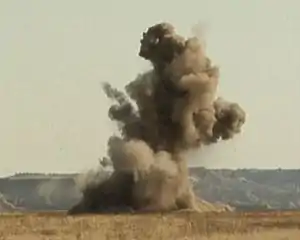
 Controlled explosion of unexploded ordnance at the Air Force Retained Area (October 3, 2011) | |
 Badlands Bombing Range | |
| Coordinates | 43°40′55″N 102°17′55″W |
| Type | Bombing range |
| Site information | |
| Operator | 1942–1945: United States Army c. 1946-59: North Dakota National Guard 1960–1968: Strategic Air Command 1968–present: United States Air Force |
| Status | Closed |
| Site history | |
| In use | 1942–1968 |
| Test information | |
| Other tests | Bombing range Gunnery range Bomb Plot Retained Area |
Rapid City AAB ranges
Rapid City AAB aircraft (e.g., for Bombardier training used the Butte County #1 Precision Bombing Range (Newell Bombing Range) 37 mi (60 km) North of the base, Rapid City #2 Precision Bombing Range (Pierre Bombing Range) 129 mi (208 km) East, the Air to Ground Range of 11,532 acres (46.67 km2)[3] & 33 mi (53 km) East-Northeast, and the Air to Air Range 33 mi (53 km) Southeast.[4] The "air-to-air and air-to-ground gunnery ranges" were on 337 acres (1.36 km2) of the Badlands National Monument.[2]
Badlands gunnery range
Post-war the South Dakota National Guard "used portions of the bombing range as an artillery range".[2] Firing took place within most of the present day Badlands National Park#Stronghold District#Stronghold District with old car bodies and 55 gallon drums painted bright yellow for targets. By 2008 the National Park Service had placed an interpretive sign for "The Badlands Gunnery Range".[5]
Badlands Bomb Plot
The Interior Radar Bomb Scoring Site (callsign Badlands Bomb Plot) opened in August 1960[6] on Hurley Butte (43.719846°N 102.14294°W) adjacent to the Pine Ridge Reservation and a few miles from Interior, South Dakota[7] to replace the Los Angeles Bomb Plot at Cheli AFS. Operated and maintained by Detachment 2 of the 11th Radar Bomb Scoring Squadron (initially by temporary duty personnel), the RBS site was 1 of ~14 that remained after the 1965-6 deployment of RBS site personnel for Vietnam Combat Skyspot. Family housing for the detachment "was on the western edge of Wall", a nearby town,[7] and barracks initially used for the station were shared by Boeing facility contractors for the Ellsworth Air Force Base 850th SMS's HGM-25A Titan I ICBMs. Concrete pads at Hurley Butte remain from when the RBS equipment and personnel transferred to Holbrook, Arizona (1968-1993,[8] merged w/ Det 19 Poplar MT[7] to move to Det 4 Harrison AR).[9] At the end of the Cold War, numerous nearby radar sites for RBS and electronic warfare simulation included those at the Alzada (2 sites), Ekalaka, & Hulett Mini-Mutes Radar Sites, the Clark & Colony Radar Bomb Scoring Sites, and the "Ellsworth Air Force Base" sites (Belle Fourche, Colmer, & Horman Radar Bomb Scoring Sites and the Antelope Butte Mini Mute Radar Bomb Scoring Site).[10]
Decommissioning and environmental mitigation
| External images | |
|---|---|
After the Badlands Bomb Plot closed, "the USAF declared most of the range excess property" in 1968, and Public Law 90-468 restored control of 202,357 acres (818.91 km2) to the Oglala Sioux Tribe. The Oglala Sioux protested the designation of 136,882 acres (553.94 km2) "of formerly held Tribal lands" as the Badlands National Monument[11] In 1999 at the "BBR 1" target, "40 M 38 practice bombs, 4 rocket bodies (2.25-inch SCAR) or rocket warheads (2.75-inch), [and] 33 pieces of ordnance scrap (mostly tail fins)" were recovered.[12] At the BBR 2 site used as an aerial gunnery target, 2.25-inch SCAR and 2.75-inch rockets were used and 28 "SCAR rocket bodies were recovered" along with 17 M38 bombs and 11 intact warheads from 2.75-inch rockets.[12]
A 2008 USAF & Oglala Sioux agreement initiated "a three-month $1.6 million project to remove unexploded ordnance" on the Air Force Retained Area. "The last four known munitions" were exploded on October 3, 2011.[1]
References
- Walker, Airman Kate (12 November 2011). "Ellsworth contractors work with tribe to destroy bombs". 28th Bomb Wing Public Affairs. Archived from the original (USAF news release) on 16 December 2013. Retrieved 2013-01-20.
- "World War II Comes to the Badlands" (PDF). NPS.com. Retrieved 2013-01-18.
The Badlands Gunnery Range
- "Practice bomb and target ranges". Archived from the original on 2013-02-15. Retrieved 2013-01-21.
- "Badlands Bombing Range". Archived from the original on 2013-02-15. Retrieved 2013-01-21.
- "Badlands Gunnery Range sign". 23 September 2008.
- MacDonald, Ray (29 January 2002). "1 CEVG/DET 2 History (A fluid Document)" (history anecdotes). 1CEVGA.com. Retrieved 2013-01-20.
1 CEVG/Det. 2 was moved from Wall, SD to Holbrook, AZ in 1968. We were up and running around the middle of April. …1990 when we became 99 ECRG/DET 2 . The last RBS/ECM sortie was on or about September 13, 1993. The last ECM-only sortie was on or about September 30, 1993. A B1-B from Dyes (not positive) flew the last RBS/ECM mission. A C-130 from Hulburt Field flew the last ECM mission. The period of time between October 1, 1993 and Christmas was used for decommissioning the systems
- "Combat Evaluation Group - A place for CEVG'ers and Range Rats to Meet" (Yahoo newsgroup). Citations in chronological order:
- Denning, B (January 23, 2002). "Re: History" (message 3215). Retrieved 2013-01-20.
Det. 2 moved from Los Angeles to South Dakota in 1960. The site was up and running in early October. ... It was on top of Hurley Butte, 6 miles west of Interior
- "Message 3257".
I was at Det 9 11th RBS '60 to '63 ... The family housing unit was on the western edge of Wall
- "Message 3279".
Interior RBSS, atop Hurley Butte ... Havre Trainig [sic] Site MT (Different place from the earlier Havre AFS air defense radar
- "Re: … Sites not found".
Det 19 was Dickinson ND. The site was actually Southeast of New England ND. Det 19 was merged with Holbrook AZ and moved to Harrison AR. Det 21 was Havre MT
- Withers, Daniel A. (January 30, 2005). "RE:…Oil Burner Routes". Retrieved 2013-01-21.
desolate outpost bordering the Pine Ridge Indian Reservation. In the early sixties, Detachment 2, 11th RBS...Badlands Bomb Plot
- Denning, B (January 23, 2002). "Re: History" (message 3215). Retrieved 2013-01-20.
- "Detachment 2 Holbrook, AZ" (history anecdote). 1CEVGA.com. 2007. Retrieved 2013-01-20.
1 CEVG/Det. 2 was moved from Wall, SD to Holbrook, AZ in 1968. We were up and running around the middle of April. The site remained in Holbrook until 1990 when we became 99 ECRG/DET 2 . The last RBS/ECM sortie was on or about September 13, 1993. The last ECM-only sortie was on or about September 30, 1993. A B1-B from Dyes (not positive) flew the last RBS/ECM mission. A C-130 from Hulburt Field flew the last ECM mission. The period of time between October 1, 1993 and Christmas was used for decommissioning the systems
- Except for the MPS-T1 all the systems from Holbrook, including the UHF radios and radio tower were shipped to Harrison, AR > -- control Holbrook AFS transferred to the Petrified NF).
- 2012 Boundary and Annexation Survey (BAS): Northern Cheyenne Indian Reservation and Off-Reservation Trust Land (PDF) (Map). Cartography by Geography Division. United States Census Bureau. October 22, 2011. Archived from the original (PDF) on August 12, 2014.
- Ingvalson, E.L (July 12, 1968). "Oglala Sioux Ranchers Protest Legislation on Gunnery Range" (summary listing). Rapid City Journal. Retrieved 2013-01-20.
- ESTCP Cost and Performance Report: Multi-Sensor Towed Array Detection System (MTADS) (Report). U.S. Department of Defense. September 1999.
The Reservation is located in the Southwest corner of South Dakota, with the largest part of the Bombing Range located in Shannon County. The Badlands Bombing Range (BBR) was a live fire range for over 30 years, and most recently was used as a training range for the Air National Guard. Since 1960, portions of the land have been returned to the Oglala Sioux Tribe (OST) in a step- wise fashion. In 1968, Congress enacted Public Law 90-468 returning 202,357 acres to the OST, and setting aside 136,882 acres of formerly held Tribal lands to form the Badlands National Monument, to be managed by the National Park Service. The U.S. Air Force still retains 2,486 acres of land on Bouquet Table within the Reservation boundaries. … BBR I is a highly visible circular target composed of a 500-foot diameter circular earthberm, with a cross-hair berm inside the circle. … BBR 1…within the National Park, is grassland currently grazed by both horses and cattle.