Bajool, Queensland
Bajool is a rural town and locality in the Rockhampton Region, Queensland, Australia.[2][3] In the 2016 census, the locality of Bajool had a population of 455 people.[1]
| Bajool Queensland | |||||||||||||||
|---|---|---|---|---|---|---|---|---|---|---|---|---|---|---|---|
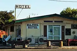
 Bajool Hotel, 2022 | |||||||||||||||
 Bajool | |||||||||||||||
| Coordinates | 23.6511°S 150.6419°E | ||||||||||||||
| Population | 455 (2016 census)[1] | ||||||||||||||
| • Density | 0.7733/km2 (2.0028/sq mi) | ||||||||||||||
| Postcode(s) | 4699 | ||||||||||||||
| Area | 588.4 km2 (227.2 sq mi) | ||||||||||||||
| Time zone | AEST (UTC+10:00) | ||||||||||||||
| Location |
| ||||||||||||||
| LGA(s) | Rockhampton Region | ||||||||||||||
| State electorate(s) | Mirani | ||||||||||||||
| Federal division(s) | Flynn | ||||||||||||||
| |||||||||||||||
Geography
Bajool is located on the Bruce Highway, 35 km south of Rockhampton and 74 km north of Gladstone. Eight-Mile Creek flows to the east of the town.
The North Coast railway line enters the locality from the west (Marmor) and exits to the north (Midgee) with two railway stations serving the locality (from north to south):
- Archer railway station (23.5839°S 150.5838°E)[4]
- Bajool railway station, serving the town (23.6517°S 150.6447°E) [4]
The Bruce Highway runs almost parallel and immediately south of the railway line, except that it bypasses the town to the west.[5]
The locality has the following mountains:
- Beschs Hill (23.8161°S 150.5509°E) 528 metres (1,732 ft)[6][7]
- Mount Gindiwarra (23.7756°S 150.7100°E) 398 metres (1,306 ft)[6][8]
- Mount Helen (23.8072°S 150.5936°E) 633 metres (2,077 ft)[6][9]
- Mount Hopeful (23.7299°S 150.5339°E) 634 metres (2,080 ft)[6][10]
- Mount Kelly (23.8012°S 150.6506°E) 310 metres (1,020 ft)[6][11]
- Mount Mccamley (23.8035°S 150.6556°E) 319 metres (1,047 ft)[6][12]
History
The town takes its name from the Bajool railway station which was named by the Queensland Railways Department in 1903 using the Aboriginal name for the lagoon on the Archer brothers' property Gracemere. The name of the lagoon has also been written as Padgole and Badul.[2] It has been suggested that the meaning of the name was Big Fella water hole [13] or stop here.[14]
A provisional school opened on 12 March 1888 at Eight Mile Creek under teacher Mr Beck (brother of J. Beck, chairman of the Fitzroy Shire Council); it closed in 1892. The school reopened on 30 September 1895 with teacher Michael Donovan, but closed again on 18 September 1896. On 5 February 1900, a part-time provisional school was established in a private home at a short-lived mining field called San Jose with 10 students under teacher William MacLean. On 2 September 1902, another part-time school was opened in conjunction at the home of Mr H. Cross in Bajool with 6 students.[15] In August 1903, the two part-time schools were combined into Bajool Provisional School with 31 students in another building on Cross's property. In 1903 the school closed for a while and the land it was using was resumed for the railway line from Gladstone to Rockhampton. However, the railway enabled Bajool to grow. The school re-opened on the southern side of Mill Street in late 1904, and became Bajool State School in 1909.[16][17][18]
Ulam Upper Provisional School opened circa 1892. On 1 January 1909, it became Ulam Upper State School. It closed circa 1961.[19]
Ulam South Provisional School opened on 22 January 1894. On 1 January 1909, it became Ulam South State School. It closed in 1925.[19]
In the 2011 census, Bajool had a population of 543 people.[20]
In the 2016 census, Bajool had a population of 455 people.[1]
Education

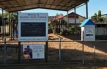
Bajool State School is a government primary (Prep-6) school for boys and girls at 54-60 Toonda Street (23.6523°S 150.6467°E).[21][22] In 2012, the school had 39 students and 2 teachers.[23] In 2018, the school had an enrolment of 40 students with 4 teachers (3 full-time equivalent) and 5 non-teaching staff (2 full-time equivalent).[24]
There are no secondary schools in Bajool. The nearest government secondary schools are Mount Larcom State School (to Year 10) in Mount Larcom to the south-east, Mount Morgan State High School (to Year 12) in Mount Morgan to the west, and Rockhampton State High School (to Year 12) in Wandal, Rockhampton, to the north.[5]
Facilities
Bajool is the site of one of four Queensland Government explosives reserves (also known as "magazines"). The magazine is about 29 kilometres (18 mi) by road from the shipping wharf at Port Alma.[25] From 1912 to 1986 a rail line ran from Bajool to Port Alma.[26]
Bajool Cemetery is at 18 School Road (23.6519°S 150.6485°E).[27]

References
- Australian Bureau of Statistics (27 June 2017). "Bajool (SSC)". 2016 Census QuickStats. Retrieved 20 October 2018.
- "Bajool – town in Rockhampton Region (entry 1259)". Queensland Place Names. Queensland Government. Retrieved 7 March 2022.
- "Bajool – locality in Rockhampton Region (entry 48503)". Queensland Place Names. Queensland Government. Retrieved 7 March 2022.
- "Railway stations and sidings - Queensland". Queensland Open Data. Queensland Government. 2 October 2020. Archived from the original on 5 October 2020. Retrieved 5 October 2020.
- "Queensland Globe". State of Queensland. Retrieved 14 July 2022.
- "Mountain peaks and capes - Queensland". Queensland Open Data. Queensland Government. 12 November 2020. Archived from the original on 25 November 2020. Retrieved 25 November 2020.
- "Beschs Hill – mountain in Rockhampton Region (entry 2398)". Queensland Place Names. Queensland Government. Retrieved 25 November 2020.
- "Mount Gindiwarra – mountain in Rockhampton Region (entry 13821)". Queensland Place Names. Queensland Government. Retrieved 25 November 2020.
- "Mount Helen – mountain in Rockhampton Region (entry 15660)". Queensland Place Names. Queensland Government. Retrieved 25 November 2020.
- "Mount Hopeful – mountain in Rockhampton Region (entry 16126)". Queensland Place Names. Queensland Government. Retrieved 25 November 2020.
- "Mount Kelly – mountain in Rockhampton Region (entry 17890)". Queensland Place Names. Queensland Government. Retrieved 25 November 2020.
- "Mount Mccamley – mountain in Rockhampton Region (entry 21307)". Queensland Place Names. Queensland Government. Retrieved 25 November 2020.
- "WHERE AND WHEN: CENTRAL QUEENSLAND". The Central Queensland Herald. Rockhampton, Qld. 24 August 1950. p. 15. Archived from the original on 14 July 2022. Retrieved 2 July 2014 – via National Library of Australia.
- "SKETCHER". The Queenslander. 28 March 1914. p. 8. Archived from the original on 2 December 2020. Retrieved 2 July 2014 – via National Library of Australia.
- "2012 School Annual Report" (PDF). Bajool State School. Archived (PDF) from the original on 14 July 2014. Retrieved 2 July 2014.
- "Opening and closing dates of Queensland Schools". Queensland Government. Retrieved 18 April 2019.
- "Agency ID 4808, Bajool State School". Queensland State Archives. Retrieved 2 July 2012.
- "Historical Society Ulam-Langmorn History". The Morning Bulletin. Rockhampton, Qld. 7 May 1951. p. 2. Archived from the original on 14 July 2022. Retrieved 2 July 2014 – via National Library of Australia.
- Queensland Family History Society (2010), Queensland schools past and present (Version 1.01 ed.), Queensland Family History Society, ISBN 978-1-921171-26-0
- Australian Bureau of Statistics (31 October 2012). "Bajool (SSC)". 2011 Census QuickStats. Retrieved 2 July 2014.
- "State and non-state school details". Queensland Government. 9 July 2018. Archived from the original on 21 November 2018. Retrieved 21 November 2018.
- "Bajool State School". Bajool State School. 15 March 2019. Archived from the original on 22 June 2012. Retrieved 14 July 2022.
- "2012 School Annual Report" (PDF). Bajool State School. Archived (PDF) from the original on 14 July 2014. Retrieved 2 July 2014.
- "ACARA School Profile 2018". Australian Curriculum, Assessment and Reporting Authority. Archived from the original on 27 August 2020. Retrieved 28 January 2020.
- "Queensland Government explosives reserves and security". Business Queensland. 11 September 2017. Archived from the original on 30 September 2017. Retrieved 30 September 2017.
- "Rockhampton's Ports" (PDF). QldRailHeritage.com. July 2009. Archived from the original (PDF) on 28 February 2016. Retrieved 30 September 2017.
- "Cemetery Areas - Queensland". Queensland Open Data. Queensland Government. 12 November 2020. Archived from the original on 15 November 2020. Retrieved 12 November 2020.
Further reading
- Leahy, Daniel; Leahy, Daniel. Early settlement and development of the Ulam-Langmorn district; Melville, W. G. History of the Bajool district; Rockhampton and District Historical Society (2009), Early settlement and history of Ulam-Langmorn & Bajool districts, Rockhampton & District Historical Society
- Bajool State School (1988), Bajool State School centenary 1888-1988, Bajool State School
External links
- "Town of Bajool" (Map). Queensland Government. 1975.