Balangir Junction railway station
Balangir Junction railway station is a railway station which serves Balangir district in the Indian state of Odisha.[1]
Balangir Junction | ||||||||||||||||
|---|---|---|---|---|---|---|---|---|---|---|---|---|---|---|---|---|
| Indian Railway | ||||||||||||||||
 | ||||||||||||||||
| General information | ||||||||||||||||
| Location | Balangir, Odisha India | |||||||||||||||
| Coordinates | 20°42′N 83°30′E | |||||||||||||||
| Elevation | 185 m (607 ft) | |||||||||||||||
| Owned by | Indian Railways | |||||||||||||||
| Operated by | East Coast Railway | |||||||||||||||
| Line(s) | Jharsuguda–Vizianagaram line and Khurda Road–Bolangir line (under construction) | |||||||||||||||
| Platforms | 5 | |||||||||||||||
| Tracks | 5 ft 6 in (1,676 mm) broad gauge | |||||||||||||||
| Construction | ||||||||||||||||
| Structure type | Standard (on-ground station) | |||||||||||||||
| Parking | Available | |||||||||||||||
| Other information | ||||||||||||||||
| Status | Functioning | |||||||||||||||
| Station code | BLGR | |||||||||||||||
| Zone(s) | East Coast Railway | |||||||||||||||
| Division(s) | Sambalpur | |||||||||||||||
| History | ||||||||||||||||
| Opened | 1931 | |||||||||||||||
| Rebuilt | 2018 | |||||||||||||||
| Electrified | Yes | |||||||||||||||
| Previous names | Bengal Nagpur Railway | |||||||||||||||
| Passengers | ||||||||||||||||
| 75000 per day | ||||||||||||||||
| Services | ||||||||||||||||
| ||||||||||||||||
| Location | ||||||||||||||||
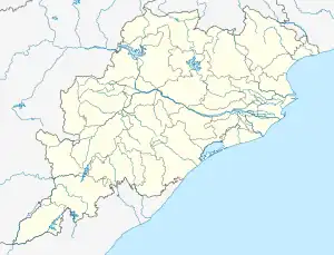
 Balangir Junction Location in Odisha  Balangir Junction Location in India | ||||||||||||||||
History
The 79 km (49 mi) Vizianagaram–Parvatipuram line was opened in 1908–09. The Parvatipuram–Raipur line was completed in 1931.[2] In 1960, Indian Railway took up three projects: the Kottavalasa–Koraput–Jeypore–Kirandaul line ( Dandakaranya Project ), the Titlagarh–Bolangir–Jharsuguda Project and the Rourkela–Kiriburu Project. All the three projects taken together were popularly known as the DBK Project or the Dandakaranya Bolangir Kiriburu Project.[3] The Sambalpur–Titlagarh line was opened to traffic in 1963.[2]
Railway reorganisation
The Bengal Nagpur Railway was nationalised in 1944.[4]Eastern Railway was formed on 14 April 1952 with the portion of East Indian Railway Company east of Mughalsarai and the Bengal Nagpur Railway.[5] In 1955, South Eastern Railway was carved out of Eastern Railway. It comprised lines mostly operated by BNR earlier.[5][6] Amongst the new zones started in April 2003 were East Coast Railway and South East Central Railway. Both these railways were carved out of South Eastern Railway.[5]
Khurda Road–Balangir rail link
The Khurda Balangir rail link was surveyed in 1945 but the project was sanctioned in 1994–95. The stretch of only 41.5 kilometres (25.8 mi) from Khurda Road to Rajsunakhala has been constructed out of the 289 kilometres (180 mi) project. The work on infrastructure started in 2007. The state government has signed Memorandum of Understanding with Indian railways to undertake some parts of the project on cost sharing basis.[7] The project which was initially estimated to be ₹1,000 crore (US$130 million) is now estimated to be nearly ₹2,000 crore (US$250 million) after almost 20 years of delay due to low budgetary provisions and issues of land acquisition. This rail line will link cities of Nayagarh, Boudh and Sonepur with Bhubaneswar and Balangir. Smaller towns like Dasapalla, Banigocha and Manipur will also be linked by this rail line. Work at Balangir side of this project has also started.[8]
Electrification
Electrification of the Titlagarh–Sambalpur–Jharsuguda was completed in 2018.[9]
References
- "BLGR/Bolangir (3 PFs) Railway Station – Train Arrival Timings". India Rail Info.
- "Major Events in the Formation of S.E. Railway". South Eastern Railway. Archived from the original on 1 April 2013. Retrieved 10 November 2012.
- Baral, Chitta. "History of Indian Railways in Orissa" (PDF). Retrieved 27 November 2012.
- "IR History: Part – III (1900–1947)". IRFCA. Retrieved 21 November 2012.
- "Geography – Railway Zones". IRFCA. Retrieved 21 November 2012.
- "IR History: Part – IV (1947–1970)". IRFCA. Retrieved 21 November 2012.
- "Khurdha-Balangir rail line – Kosal Discussion and Development Forum".
- "Phase 1: Train Finally Chugs on Khurda–Balangir Line". The New Indian Express.
- "PM Modi unveils slew of projects worth over Rs 1,550 cr in Odisha". The Economic Times.