Ballidon
Ballidon is a village and civil parish in the Derbyshire Dales district of Derbyshire, England, on the edge of the Peak District National Park.[1][2] According to the 2001 census it had a population of 79. The population at the 2011 Census remained less than 100. Details are maintained in the civil Parish of Aldwark, Derbyshire.
| Ballidon | |
|---|---|
.jpg.webp) | |
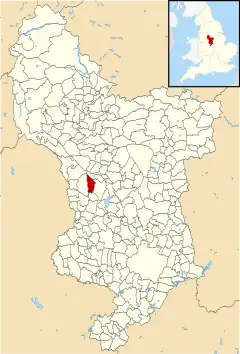
 Ballidon parish highlighted within Derbyshire | |
| Population | 79 (2001 Census) |
| OS grid reference | SK203545 |
| District | |
| Shire county | |
| Region | |
| Country | England |
| Sovereign state | United Kingdom |
| Post town | ASHBOURNE |
| Postcode district | DE6 |
| Police | Derbyshire |
| Fire | Derbyshire |
| Ambulance | East Midlands |
Ballidon was listed in the Domesday Book of 1086[3] and was a much larger village than seen today. That area now devastated by the Tilcon Quarry was a deep valley and the site of an ambush of troops of the Jacobite rising of 1745; skulls and weaponry were recovered on the west bank of the stream.
Ballidon sits at the foot of Ballidon Dale, which is a Site of Special Scientific Interest (SSSI).[4] At the head of the dale is Roystone Grange where there are remains of monuments from the Bronze Age, a Romano-British settlement and a medieval monastic grange.[5][6][7]
The Limestone Way long-distance footpath passes just south of the hamlet of Ballidon.[8]
See also
References
- Ordnance Survey: Landranger map sheet 119 Buxton & Matlock (Chesterfield, Bakewell & Dove Dale) (Map). Ordnance Survey. 2012. ISBN 9780319231890.
- "Ordnance Survey: 1:50,000 Scale Gazetteer" (csv (download)). www.ordnancesurvey.co.uk. Ordnance Survey. 1 January 2016. Retrieved 30 January 2016.
- Professor J.J.N.Palmer. "Open Doomsday: Ballidon". www.opendomesday.org. Anna Powell-Smith. Retrieved 31 January 2016.
- "Ballidon Dale SSSI" (PDF). Designated Sites. Natural England. Retrieved 12 December 2020.
- Historic England. "Prehistoric and Romano-British barrow and medieval animal pen, 450m south east of Roystone Grange (1018474)". National Heritage List for England. Retrieved 12 December 2020.
- Historic England. "Romano-British settlement and field system immediately north west of Roystone Grange (1018086)". National Heritage List for England. Retrieved 12 December 2020.
- Historic England. "Medieval grange and field system, 200m south of Royston Grange (1018088)". National Heritage List for England. Retrieved 12 December 2020.
- OL24 White Peak area (Map). 1:25000. Explorer. Southampton: Ordnance Survey. East sheet.