Baraba steppe
The Baraba steppe or Baraba Lowland[1] (Russian: Барабинская низменность), is a plain in western Siberia.[2]
Baraba Steppe
Baraba Lowland Барабинская низменность | |
|---|---|
Plains | |
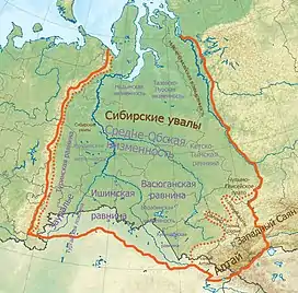 Map of the West Siberian Plain with the Baraba steppe in the southern part | |
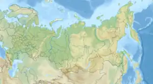 Baraba Steppe Location in Russia | |
| Coordinates: 55°45′N 78°0′E | |
| Location | Russia |
| Part of | West Siberian Plain |
| Area | |
| • Total | 117,000 km2 (45,000 sq mi) |
| Elevation | 100 meters (330 ft) to 150 meters (490 ft) |
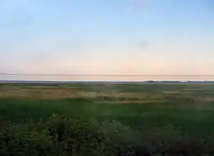
Baraba steppe as seen from the window of the Trans-Siberian railway.
The Baraba Lowland is an important Russian agricultural region.
Geography
It stretches for 117,000 km2 (45,000 sq mi) across the Omsk and Novosibirsk oblasts between the Irtysh and the Ob Rivers. Grassland steppe landscapes predominate, as well as sphagnum bogs and Solonchak grounds, although there are remnants of wooded areas. Barabinsk is the largest city in the lowland.
Lakes Chany, Ubinskoye, Sartlan and Tandovo, are located in the Baraba steppe.[2] The Kulunda Plain extends to the southeast. The border between both areas is not well defined.[3]
See also
References
- The history of agricultural development of the Baraba Lowland
- Haywood, A. (2012). Siberia: A Cultural History. Landscapes of the imagination. Signal Books. p. pt154. ISBN 978-1-908493-36-1. Retrieved June 7, 2019.
- "Лесной план Новосибирской области". 12 October 2011.
This article is issued from Wikipedia. The text is licensed under Creative Commons - Attribution - Sharealike. Additional terms may apply for the media files.