Barnaulka
The Barnaulka (Russian: Барнаулка) is a river in Altai Krai, Russia. The river is 207 kilometres (129 mi) long and has a catchment area of 5,720 square kilometres (2,210 sq mi).[1]
| Barnaulka Барнаулка | |
|---|---|
 View of the river | |
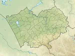
 Mouth location in Altai Krai, Russia | |
| Location | |
| Country | Russia |
| Physical characteristics | |
| Source | Lake Zerkalnoye |
| • coordinates | 52°33′21″N 81°57′10″E |
| Mouth | Ob |
• location | Barnaul |
• coordinates | 53°19′47″N 83°48′18″E |
| Length | 207 km (129 mi) |
| Basin size | 5,720 km2 (2,210 sq mi) |
| Basin features | |
| Progression | Ob→ Kara Sea |
The basin of the river is located in the Rebrikhinsky, Shipunovsky and Pavlovsky districts. The city of Barnaul is named after the river.[2] The Barnaulka suffers from the impact of pollutants released by industrial activity along its course.[3]
Course
The Barnaulka is a left tributary of the Ob river. It has its sources in Zerkalnoye, a lake with a 18 square kilometres (6.9 sq mi) surface lying 60 km (37 mi) to the west of Aleysk. The upper course of the river is a chain of lakes connected by marshy canals located in the Ob Plateau (Приобское плато). There are numerous swamps and smaller lakes in its basin. The Barnaulka flows in a roughly northeastern direction. Finally it meets the left bank of the Ob at Barnaul, 3,409 km (2,118 mi) from the Ob's mouth.[4]
See also
References
- "Река БАРНАУЛКА in the State Water Register of Russia". textual.ru (in Russian).
- "50 ФАКТОВ О БАРНАУЛЕ". 50factsbarnaul.amic.ru. Archived from the original on 2016-04-05. Retrieved 2016-03-06.
- Effect of Anthropogenic Pollution on Macrozoobenthos Structure in Barnaulka River (Upper Ob Basin)
- "N-44-Г Topographic Chart (in Russian)". Retrieved 23 June 2022.
- Google Earth