Barolo, Piedmont
Barolo is a comune (municipality) in the Province of Cuneo in the Italian region Piedmont, located about 50 kilometres (31 mi) southeast of Turin and about 40 kilometres (25 mi) northeast of Cuneo. As of 30 April 2009 it had a population of 750 and an area of 5.6 square kilometres (2.2 sq mi).[3]
Barolo | |
|---|---|
| Comune di Barolo | |
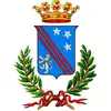 Coat of arms | |
Location of Barolo | |
 Barolo Location of Barolo in Italy 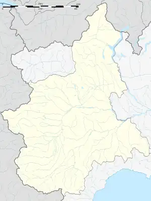 Barolo Barolo (Piedmont) | |
| Coordinates: 44°37′N 7°56′E | |
| Country | Italy |
| Region | Piedmont |
| Province | Province of Cuneo (CN) |
| Government | |
| • Mayor | Walter Mazzocchi |
| Area | |
| • Total | 5.6 km2 (2.2 sq mi) |
| Elevation | 213 m (699 ft) |
| Population (30 April 2009)[2] | |
| • Total | 750 |
| • Density | 130/km2 (350/sq mi) |
| Time zone | UTC+1 (CET) |
| • Summer (DST) | UTC+2 (CEST) |
| Postal code | 12060 |
| Dialing code | 0173 |
| Website | Official website |
Barolo borders the following municipalities: Castiglione Falletto, La Morra, Monforte d'Alba, Narzole, and Novello. Barolo is an important wine-producing area noted for its Barolo wine of the same name, and many wineries such as Poderi Colla have vineyards here.
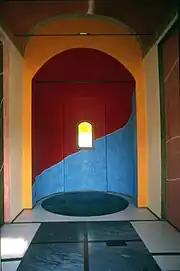
The interior of the Chapel of Barolo
Barolo is home to the multi colored art project The Chapel of Barolo by American artist Sol LeWitt and English artist David Tremlett created in 1999.
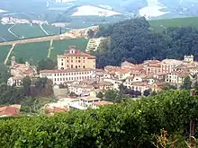 The village and castle of Barolo
 View from th castle of Barolo
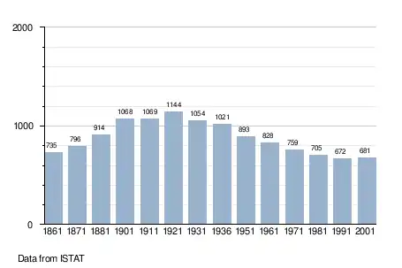
Demographic evolution
References
Wikivoyage has a travel guide for Barolo.
- "Superficie di Comuni Province e Regioni italiane al 9 ottobre 2011". Italian National Institute of Statistics. Retrieved 16 March 2019.
- "Popolazione Residente al 1° Gennaio 2018". Italian National Institute of Statistics. Retrieved 16 March 2019.
- All demographics and other statistics: Italian statistical institute Istat.
This article is issued from Wikipedia. The text is licensed under Creative Commons - Attribution - Sharealike. Additional terms may apply for the media files.