Barringer Slough

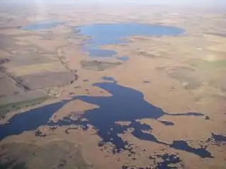
An aerial photo of Barringer Slough.
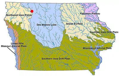
Barringer Slough is a rich wetland area located in north east Clay County in northwestern Iowa. This area is a reconstructed remnant of the Des Moines lobe, a region of Iowa which was once covered by interconnected prairie wetlands. This wetland marsh and the surrounding public uplands cover 1,526 acres (6.18 km2).[1] Vegetation includes cattails, coontail, sedges, marsh marigold, and duck weed. Muskrats, herons, pelicans, and ducks are also plentiful. In the winter pheasants and deer migrate onto the slough to take advantage of the vegetative cover.[2] During periods of high water it is possible to canoe from Lost Island Lake on the north side to the outlet on the south end through a narrow channel.
References
- Iowa Department of Natural Resources map: "Archived copy" (PDF). Archived from the original (PDF) on 2009-03-04. Retrieved 2009-03-09.
{{cite web}}: CS1 maint: archived copy as title (link) - Iowa State University Extension: http://www.extension.iastate.edu/Publications/IAN204.pdf

Barringer Slough (red) on landform map of Iowa.
See also
This article is issued from Wikipedia. The text is licensed under Creative Commons - Attribution - Sharealike. Additional terms may apply for the media files.