Bawdsey
Bawdsey is a village and civil parish in Suffolk, eastern England. Located on the other side of the river Deben from Felixstowe, it had an estimated population of 340 in 2007, reducing to 276 at the Census 2011.
| Bawdsey | |
|---|---|
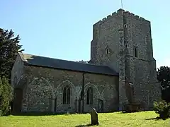
 Saint Mary's Church, Bawdsey | |
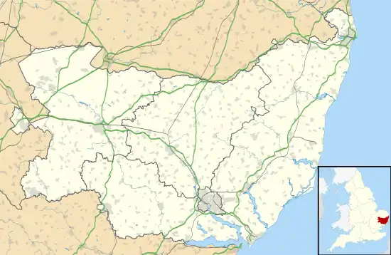
 Bawdsey Location within Suffolk | |
| Population | 276 (2011)[1] |
| OS grid reference | TM348400 |
| District | |
| Shire county | |
| Region | |
| Country | England |
| Sovereign state | United Kingdom |
| Post town | Woodbridge |
| Postcode district | IP12 |
Bawdsey Manor is notable as the place where radar research took place early in World War II, before moving to Worth Matravers near Swanage in May 1940, and from there to Malvern, Worcestershire in 1942. Bawdsey had both Chain Home and Chain Home Low early warning radar stations during World War II.
The World War Two defences constructed around Bawdsey Point have been documented. They included a number of pillboxes, landmines and flame fougasse installations. The beaches were protected with extensive barriers of scaffolding.[2]
Bawdsey Cliff SSSI
Bawdsey Cliff is a Site of Special Scientific Interest noted for its geological importance. It is 23.3 hectares (58 acres) in size and provides over 2 kilometres (1.2 mi) of exposed Gelasian (early Pleistocene) Red Crag, the most significant exposure of Red Crag in England.[3]
References
- "Civil Parish population 2011". Neighbourhood Statistics. Office for National Statistics. Archived from the original on 12 October 2016. Retrieved 16 August 2016.
- Foot, William (2006). Beaches, fields, streets, and hills ... the anti-invasion landscapes of England, 1940. Council for British Archaeology. p. 105. ISBN 1-902771-53-2.
- Bawdsey Cliff Archived 5 May 2015 at the Wayback Machine, SSSI citation, Natural England. Retrieved 2013-01-25.