Beaver Creek Airport
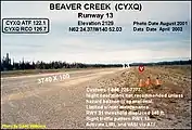
Beaver Creek Airport (IATA: YXQ, ICAO: CYXQ) is located 1 nautical mile (1.9 km; 1.2 mi) northwest of Beaver Creek, Yukon, Canada, and is operated by the Yukon government. The gravel runway is 3,745 by 100 ft (1,141 by 30 m), and is at an elevation of 2,131 ft (650 m).[1]
Beaver Creek Airport | |||||||||||
|---|---|---|---|---|---|---|---|---|---|---|---|
 | |||||||||||
| Summary | |||||||||||
| Airport type | Public | ||||||||||
| Operator | Government of Yukon | ||||||||||
| Location | Beaver Creek, Yukon | ||||||||||
| Time zone | MST (UTC−07:00) | ||||||||||
| Elevation AMSL | 2,131 ft / 650 m | ||||||||||
| Coordinates | 62°24′37″N 140°52′08″W | ||||||||||
| Map | |||||||||||
 CYXQ Location in Yukon | |||||||||||
| Runways | |||||||||||
| |||||||||||
| Statistics (2010) | |||||||||||
| |||||||||||
The airport is classified as an airport of entry by Nav Canada and is staffed by the Canada Border Services Agency (CBSA). CBSA officers at this airport can handle general aviation aircraft only, with no more than 15 passengers.[1]
Beaver Creek Airport is the westernmost airport in Canada.
Construction
Jack Stalberg built this airport in the 1960s. He leased the land from the government and cleared a dirt airstrip out of the bush so he could pursue his love of flying. In 2000, the community of Beaver Creek dedicated the airstrip to Stalberg, thanking him for his effort and dedication. The monument at the airport reads, "The Yukon has always been home to pioneers and people of rare vision. These words are to recognize Jack Stalberg as one such person. Through his vision, and the determination to make that vision a reality, the Beaver Creek Airport was born. Thank you, Jack. The community of Beaver Creek and the general flying public are in your debt."
 Runway 13
 Runway 31
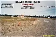
 Taxiway/ramp
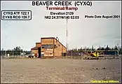
 Terminal/ramp
References
- Canada Flight Supplement. Effective 0901Z 16 July 2020 to 0901Z 10 September 2020.
- Total aircraft movements by class of operation
External links
- Yukon Government Airports/Aerodromes
- Past three hours METARs, SPECI and current TAFs for Beaver Creek Airport from Nav Canada as available.
- Accident history for YXQ at Aviation Safety Network