Beaver Run (Catawissa Creek tributary)
Beaver Run is a tributary of Catawissa Creek in Columbia County, Pennsylvania, in the United States. It is approximately 6.2 miles (10.0 km) long and flows through Beaver Township.[1] The stream's watershed has an area of 9.60 miles (15.45 km). Wetlands are present in the watershed. The stream was named by Alexander McCauley in 1774.
| Beaver Run | |
|---|---|
 | |
| Etymology | named after beavers |
| Physical characteristics | |
| Source | |
| • location | valley in Beaver Township, Columbia County, Pennsylvaniavalley in Beaver Township, Columbia County, Pennsylvania |
| • elevation | 1,040 ft (320 m) |
| Mouth | |
• location | Catawissa Creek in Beaver Township, Columbia County, Pennsylvania |
• coordinates | 40°57′08″N 76°18′33″W |
• elevation | 649 ft (198 m) |
| Length | 6.2 mi (10.0 km) |
| Basin size | 9.60 sq mi (24.9 km2) |
| Basin features | |
| Progression | Catawissa Creek → Susquehanna River → Chesapeake Bay |
Course

Beaver Run begins in a valley in Beaver Township, a few hundred feet from the border between Columbia County and Luzerne County. The stream flows north for a short distance before turning west, flows west and slightly south for several miles between McCauley Mountain and Buck Mountain, eventually turns northwest and then southwest less than a mile later. A short distance downstream, it turns west and crosses Pennsylvania Route 339, then reaches its confluence with Catawissa Creek.[1]
Beaver Run joins Catawissa Creek 13.02 miles (20.95 km) upstream of its mouth.[2]
Tributaries
While Beaver Run has no named tributaries, it has two numbered tributaries: Trib 27552 and Trib 27553.[3]
Geography and geology
The elevation near the mouth of Beaver Run is 649 feet (198 m) above sea level.[4] The elevation of the stream's source is just over 1,040 feet (320 m) above sea level.[1]
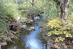
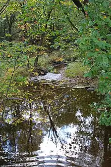
Beaver Run is a fairly slow-moving stream. It is also relatively wide in some places.[5]
The watershed of Beaver Run is mostly or entirely on rock of the Mauch Chunk Formation. The soil in the watershed is Leck Kill soil.[3]
Watershed
The watershed of Beaver Run has an area of 9.60 miles (15.45 km).[2] Most of the watershed is in Beaver Township, Columbia County, but a small portion extends into Luzerne County.[3] The wetlands on the creek's upper reaches[5] are the largest and most biologically diverse wetlands in Columbia County.[3]
Much of the watershed of Beaver Run is in agricultural land.[3] The stream's valley is fairly narrow and situated between Buck Mountain and McCauley Mountain.[6]
The community of Shumans is near the stream's mouth. Main roads in its watershed are Pennsylvania Route 339, Beaver Valley Road and Mountain Shadow Lane.[3]
History
Scotch Run was most likely named by Alexander McCauley in 1774. A legend says that he named the stream so after watching a group of beavers construct a dam on it.[7] Beaver Township is in turn named after the stream.[6]
In the late 1800s the Beaver Valley Post Office was near the mouth of Beaver Run.[8]
Two bridges longer than 20 feet (6.1 m) have been built over Beaver Run. The first, a concrete slab bridge built in 1930, is 21.0 feet (6.4 m) long. The second, a steel stringer bridge built in 1934, is 29.9 feet (9.1 m) long.[9]
Biology
The wetlands of Beaver Run are listed as a "locally significant site" in the Columbia County Natural Areas Inventory. They rank in the inventory at 4 on a scale of 1 to 5, with 1 being the most important.[5]
The wetlands of Beaver Run are a highbush blueberry / meadowsweet shrub swamp which includes trees and shrubs such as red elderberry, black ash, poison sumac, speckled alder, buttonbush, steeple-bush, and mountain holly. Other plants inhabiting these wetlands include various ferns and sedges and skunk cabbage, cattails, yellow pond lilies, smooth goldenrod, swamp candles, woolgrass, and several other plants.[5]
A red maple / yellow birch / eastern hemlock palustrine forest is also found in the vicinity of Beaver Run, as is a buttonbush / highbush blueberry shrub swamp. Both of these habitats contain several plants not found in the highbush blueberry / meadowsweet shrub swamp.[5]
A number of bird species have been observed in the Beaver Run wetlands. These include common yellowthroat, gray catbird, house wren, ovenbird, swamp sparrow, and yellow warbler. A dragonfly species known as the spangled skimmer also occurs in the wetlands.[5] Beaver Run is considered by the Pennsylvania Department of Environmental Protection to be a coldwater fishery.[3]
See also
- Long Hollow (Catawissa Creek), next tributary of Catawissa Creek going upstream
- Mine Gap Run, next tributary of Catawissa Creek going downstream
- List of tributaries of Catawissa Creek
References
- United States Geological Survey, The National Map Viewer, archived from the original on March 29, 2012, retrieved September 9, 2014
- Pennsylvania Gazetteer of Streams (PDF), November 2, 2001, retrieved September 9, 2014
- Pennsylvania Environmental Council (December 9, 2010), CATAWISSA CREEK WATERSHED RIVERS CONSERVATION PLAN (PDF), archived from the original (PDF) on September 23, 2015, retrieved September 10, 2014
- Topographic Map Stream Features in Columbia County, Pennsylvania, retrieved September 9, 2014
- The Pennsylvania Science Office of The Nature Conservancy (2004), Columbia County Natural Areas Inventory 2004 (PDF), retrieved September 9, 2014
- J.H. Battle, ed. (1887), History of Columbia and Montour Counties, Pennsylvania, p. 294
- Walter M. Brasch (1982), Columbia County place names, p. 10, ISBN 9780880230285
- John Gosse Freeze (1888), A History of Columbia County, Pennsylvania: From the Earliest Times, p. 47
- Columbia County, archived from the original on September 15, 2014, retrieved September 10, 2014
External links
- Map of the Catawissa Creek watershed Archived 2014-10-13 at the Wayback Machine