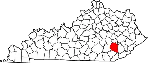
Beech Creek (Clay County, Kentucky)
Beech Creek is a tributary of Goose Creek in Clay County in the U.S. state of Kentucky.[1][2] It is just under 6 miles (9.7 km) long and joins the Goose approximately 1⁄2 mile (0.80 km) below the mouth of Laurel Creek.[2]
| Beech Creek | |
|---|---|
| Location | |
| Country | United States |
| State | Kentucky |
| County | Clay |
| Physical characteristics | |
| Source | Combs Lake |
| • coordinates | 37°10′05″N 83°42′33″W |
| Mouth | Goose Creek |
• coordinates | 37°12′46″N 83°42′15″W |
Its headwaters are at Combs Lake in the Beech Creek Wildlife Area.[3]
Tributaries and post offices
The Mount Welcome postoffice was established on 1849-08-29 by postmaster Reuben May, and closed in July 1852.[2]
The Tankersley postoffice was established on 1882-07-31 by husband and wife postmasters James Franklin Tankersley and Drucilla Tankersley.[2] It was not named for themselves but for James' father, John M. Tankersley (born in 1810 and whose surname was spelled Tankisley in the 1870 census).[2] Initially it was opposite the mouth of Beech Creek, moving downstream along Goose by 1.5 miles (2.4 km) to Houchell Bend, and back up to Beech some time before the 1950s.[2] It was back at Beech Creek by the time of its closure in 1977.[2]
The Cedral postoffice was established on 1901-04-10 by postmaster Thomas Jefferson Houchell.[3] Initially 3.5 miles (5.6 km) upstream along Beech, it moved downstream by 1⁄4 mile (0.40 km), closed in 1905, reopened on 1909-12-09 by postmaster Lucy Hounchell 1⁄2 mile (0.80 km) upstream, and closed again in November 1913.[3]
Wildlife Area
The 232-acre (94 ha) Beech Creak Wildlife area surrounding Bert T. Combs Lake at the headwaters of Beech Creek is adjacent to the Daniel Boone National Forest and is accessed by road from Littleton, Kentucky, although there are no roads within the wildlife area itself.[4][5]
It is 94% forest, 4% open land, and 2% open water.[5]
See also
References
- "Beech Creek". Geographic Names Information System. United States Geological Survey, United States Department of the Interior. Retrieved June 23, 2021.
- Rennick 2000c, p. 14.
- Rennick 2000c, p. 15.
- USDA 2003, p. 71.
- KDFW, pp. 1–2.
Sources
- Rennick, Robert M. (2000c). "Clay County — Post Offices". County Histories of Kentucky. Morehead State University (176).
- United States Bureau of Chemistry and Soils (2003). "Clay County, Kentucky". Soil Survey. United States Department of Agriculture.
- "Burchell-Beech Creek Wildlife Management Area" (PDF). Kentucky Department of Fish and Wildlife.
Further reading
- Rennick, Robert M.; United States Geological Survey (January 1954). "Bearcreek Quadrangle (1954)". Robert M. Rennick Topographical Map Collection. Morehead State University (33).
