Beiji, Heilongjiang
Beiji (Chinese: 北极镇), formerly Mohe Township, is a town located in Mohe, Daxing'anling Prefecture. It is the northernmost town in China.
Beiji
北极镇 | |
|---|---|
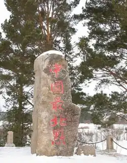 "Northernmost Place in China" marker | |
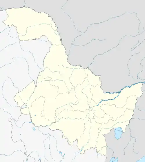 Beiji Location in Heilongjiang | |
| Coordinates: 53°28′41″N 122°21′12″E | |
| Country | China |
| Province | Heilongjiang |
| Prefecture-level city | Mohe |
| Prefecture | Daxing'anling Prefecture |
| Area | |
| • Total | 2,380 km2 (920 sq mi) |
| Population | |
| • Total | 3,000 |
| • Density | 1/km2 (3/sq mi) |
| Time zone | UTC+8 (China Standard) |
| License plate | 黑P |
Beiji is most famous for its tourism. There are three villages in Beiji: Beiji Village (the northernmost village in China and seat of government), Beihong Village, Luoguhe Village, and Oroqen Ethnic Village. Beiji has a population of about 3,000, and a population density of 1/sq km. Beiji is 2,380 sq km large.[1]
Climate
| Climate data for Beiji Village, Mohe (2002–2020 normals) | |||||||||||||
|---|---|---|---|---|---|---|---|---|---|---|---|---|---|
| Month | Jan | Feb | Mar | Apr | May | Jun | Jul | Aug | Sep | Oct | Nov | Dec | Year |
| Average high °C (°F) | −19.6 (−3.3) |
−11.9 (10.6) |
−1.0 (30.2) |
9.3 (48.7) |
18.2 (64.8) |
25.4 (77.7) |
26.8 (80.2) |
23.9 (75.0) |
17.3 (63.1) |
5.5 (41.9) |
−10.2 (13.6) |
−20.9 (−5.6) |
5.2 (41.4) |
| Daily mean °C (°F) | −27.9 (−18.2) |
−23.2 (−9.8) |
−11.4 (11.5) |
1.5 (34.7) |
10.2 (50.4) |
17.2 (63.0) |
19.6 (67.3) |
16.5 (61.7) |
9.0 (48.2) |
−2.0 (28.4) |
−17.9 (−0.2) |
−27.4 (−17.3) |
−3.0 (26.6) |
| Average low °C (°F) | −34.1 (−29.4) |
−31.4 (−24.5) |
−21.0 (−5.8) |
−6.3 (20.7) |
2.2 (36.0) |
9.4 (48.9) |
13.5 (56.3) |
11.1 (52.0) |
3.1 (37.6) |
−7.9 (17.8) |
−23.9 (−11.0) |
−32.8 (−27.0) |
−9.8 (14.3) |
| Average precipitation mm (inches) | 4.2 (0.17) |
4.2 (0.17) |
5.1 (0.20) |
21.7 (0.85) |
45.4 (1.79) |
69.8 (2.75) |
105.8 (4.17) |
97.0 (3.82) |
51.7 (2.04) |
24.9 (0.98) |
13.4 (0.53) |
6.3 (0.25) |
449.5 (17.72) |
| Average precipitation days (≥ 0.1 mm) | 6.2 | 5.5 | 3.9 | 5.9 | 11.3 | 13.7 | 15.6 | 15.7 | 11.7 | 7.7 | 8.9 | 7.6 | 113.7 |
| Average snowy days | 7.4 | 6.2 | 4.3 | 4.5 | 0.3 | 0.1 | 0 | 0.1 | 0.7 | 6.7 | 10.3 | 9.4 | 50 |
| Average relative humidity (%) | 68 | 65 | 60 | 53 | 58 | 71 | 78 | 81 | 76 | 71 | 74 | 70 | 69 |
| Mean monthly sunshine hours | 148.7 | 182.0 | 254.0 | 254.7 | 235.2 | 264.2 | 234.8 | 213.2 | 186.1 | 163.5 | 139.5 | 120.7 | 2,396.6 |
| Percent possible sunshine | 59 | 65 | 68 | 60 | 47 | 52 | 46 | 47 | 50 | 51 | 55 | 52 | 54 |
| Source: China Meteorological Administration[2][3] | |||||||||||||
References
- "黑龙江大兴安岭市漠河市北极镇地名介绍". www.tcmap.com.cn. Retrieved 2021-03-26.
- 中国气象数据网 – WeatherBk Data (in Simplified Chinese). China Meteorological Administration. Retrieved 8 October 2023.
- 中国气象数据网 (in Simplified Chinese). China Meteorological Administration. Retrieved 8 October 2023.
This article is issued from Wikipedia. The text is licensed under Creative Commons - Attribution - Sharealike. Additional terms may apply for the media files.