Belitsa Peninsula
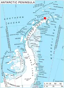
Belitsa Peninsula (Bulgarian: полуостров Белица, romanized: poluostrov Belitsa, IPA: [poɫuˈɔstrov bɛˈlit͡sɐ]) is the 13-km wide peninsula projecting 8.5 km in northwest direction from Trinity Peninsula, Antarctic Peninsula. Bounded by Bone Bay to the northeast, Charcot Bay to the southwest and Bransfield Strait to the northwest. Trapezoid in form, its west and north extremities are formed by Cape Kjellman and Notter Point respectively. Beaver Rocks are a group of rocks lying 2 nautical miles (4 km) off Belitsa Peninsula at a point midway between Notter Point and Cape Kjellman.

The peninsula is named after the town of Belitsa in southwestern Bulgaria.
Location
Belitsa Peninsula is located at 63°44′00″S 59°14′00″W. German-British mapping in 1996.
Maps
- Trinity Peninsula. Scale 1:250000 topographic map No. 5697. Institut für Angewandte Geodäsie and British Antarctic Survey, 1996.
- Antarctic Digital Database (ADD). Scale 1:250000 topographic map of Antarctica. Scientific Committee on Antarctic Research (SCAR), 1993–2016.
References
- Bulgarian Antarctic Gazetteer. Antarctic Place-names Commission. (details in Bulgarian, basic data in English)
- Belitsa Peninsula. SCAR Composite Antarctic Gazetteer
External links
- Belitsa Peninsula. Copernix satellite image
This article includes information from the Antarctic Place-names Commission of Bulgaria which is used with permission.