Belsar's Hill
Belsar's Hill is a hillfort near Willingham, Cambridgeshire, England.
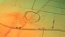
.jpg.webp) Belsar's Hill: earthwork and ditch | |
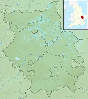
 Map of Cambridgeshire showing the location of Belsar's Hill | |
| Location | Cambridgeshire, England |
|---|---|
| Coordinates | 52°18′43.6″N 0°5′10.0″E |
| Type | Hillfort |
| Area | 6 acres (24,000 m2) |
| History | |
| Founded | Iron Age |
Description
Belsar's Hill is an oval-shaped area, 265–220 metres (869–722 ft), enclosing 6 acres (24,000 m2).[1][2] At the time of its construction, it would have constituted an island of firm soil surrounded by waterlogged fens.[1] The defences are believed to have consisted of a single 10–15 metres (33–49 ft) wide, 1.5 metres (4.9 ft) ditch, and a rampart on a 2–4 metres (6.6–13.1 ft) high bank.[1][2] The hill was situated along the Aldreth Causeway, and is transected by a 19th-century track, believed to be a redirection of the original Causeway.[1]
History
The location of the fortification, on the boundary between the tribal lands of the Iceni and Catuvellauni, and a similarity to other Iron Age hillforts such as Arbury Banks or Wandlebury, suggests an Iron Age provenance.[1][3]
It is believed that the structure was reoccupied during the Norman Conquest.[1][2] During this time period the Norman forces were combating a local revolt under Hereward the Wake, and the hillfort would have been strategically located on the Aldreth Causway, the main road to Ely.[1][2] A postulated name of "Belassise", from the Old French "bel assis" (meaning well seated/placed), also suggests a Norman link.[4][5] An alternative suggested etymology, stemming from the Norman general named "Belasius", also suggests Norman involvement.[6] The importance of this location in the defence of Ely has led some to suggest that the ringfort may have been the Castle of Aldreth.[5]

According to the recorded history of the revolt led by Hereward the Wake at the turn of the 11th century, Hereward's troops retreated to the Isle of Ely, surrounded by fenland which was impassable to the Norman cavalry. An attempt was made to build a mile-long causeway, but the weight of the Norman armour caused the causeway to sink. Eventually, the Norman troops bribed a local monk to show them a safe passage across the fen.[1][7]
References
- "Belsar's Hill – Eastern England – Castles, Forts and Battles". castlesfortsbattles.co.uk. Retrieved 9 September 2017.
- Historic England. "Belsar's Hill ringwork, Willingham (1010368)". National Heritage List for England. Retrieved 9 September 2017.
- Haseler, Mike; White, Kevan (30 January 2016). "BELSAR'S HILL". roman-britain.co.uk. Archived from the original on 10 September 2017. Retrieved 9 September 2017.
- "BELSARS HILL, WILLINGHAM". gatehouse-gazetteer.info/. Retrieved 9 September 2017.
- Creighton, Oliver; Wright, Duncan (2017). Anarchy: War and Status in 12th-Century Landscapes of Conflict. Oxford University Press. p. 258. ISBN 9781781383698. Retrieved 9 September 2017.
- Hartshorne, Charles Henry (1841). Salopia Antiqua or an Enquiry from Personal Survey into the 'Druidical', Military, and other early Remains in Shropshire and the North Welsh Borders; with observations upon the names of places, and a glossary of words used in the country of Salop. Parker. p. 243. Retrieved 9 September 2017.
Belsar's Hill.
- McKenny Hughes, T. (2012). Cambridgeshire. Cambridge University Press. p. 140. ISBN 9781107651579. Retrieved 9 September 2017.