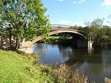
North Claines
North Claines is a civil parish in Wychavon district, Worcestershire, England, immediately north of the city of Worcester. It includes the settlements of Fernhill Heath, Bevere,[1] Lower Town,[2] and Hawford.[3] It is bordered to the west and north west by the River Severn and the River Salwarpe, with the Droitwich Canal running parallel to the Salwarpe.

The parish was formed in 1885 when the southern part of the parish of Claines was incorporated into Worcester under the Worcester Incorporation Act.[3]
At the 2021 census the parish had a population of 4,460.[4] The area of the parish was stated as 6.480 square kilometres (2.502 sq mi).[4]
The parish has a parish council, the lowest level of local government.[5] It is part of Lovett and North Claines ward (which had a 2021 population of 7,647[6]) for elections to Wychavon district council.
As of January 2022 there are 30 listed buildings in the parish: Bevere House[7] and the Mill Hall[8] at grade II* and 28 including bridges, houses and a canal lock, at grade II.[9]
References
- "About Bevere". North Claines Parish Council. Retrieved 9 January 2022.
- "About Lower Town". North Claines Parish Council. Retrieved 9 January 2022.
- "Parish History". North Claines Parish Council. Retrieved 9 January 2022.
- "North Claines (Parish)". City population. Retrieved 12 December 2022.
- "North Claines Parish Council Website". Retrieved 9 January 2022.
- "Lovett and North Claines (Ward)". City population. Retrieved 12 December 2022.
- Historic England. "Bevere House (1081163)". National Heritage List for England.
- Historic England. "Mill Hall (1296503)". National Heritage List for England.
- To view the full list, go to https://historicengland.org.uk/listing/the-list/advanced-search?searchType=nhleadvancedsearch and enter "North Claines" as "Parish"
Further reading
- North Claines Neighbourhood Plan 2015 - 2030, adopted April 2017 (PDF). North Claines Parish Council.