Bhetua
Bhetua is a village in Amethi tehsil of Amethi district, Uttar Pradesh, India.[2] As of 2011, it has a population of 1,680 people, in 260 households.[2] It has one primary school and no healthcare facilities and does not host a weekly haat or permanent market.[2] Bhetua serves as the headquarters of a community development block, which includes 71 rural villages as well as the census town of Korwa.[2] It also serves as the headquarters of a nyaya panchayat that also includes 14 other villages.[3]
Bhetua | |
|---|---|
Village | |
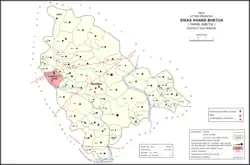 Map showing Bhetua (#060) in Bhetua CD block | |
 Bhetua Location in Uttar Pradesh, India | |
| Coordinates: 26.165668°N 81.876862°E[1] | |
| Country | |
| State | Uttar Pradesh |
| Division | Faizabad division |
| District | Amethi |
| Area | |
| • Total | 2.881 km2 (1.112 sq mi) |
| Population (2011)[2] | |
| • Total | 1,680 |
| • Density | 580/km2 (1,500/sq mi) |
| Languages | |
| • Official | Hindi, Urdu |
| Time zone | UTC+5:30 (IST) |
The 1951 census recorded Bhetua (as "Bhetwa Mafi") as comprising 20 hamlets, with a total population of 1,148 people (559 male and 589 female), in 248 households and 238 physical houses.[4] The area of the village was given as 747 acres.[4] 100 residents were literate, all male.[4] The village was listed as belonging to the pargana of Amethi and the thana of Raipur.[4]
The 1961 census recorded Bhetua (as "Bhetuwa Muafi") as comprising 14 hamlets, with a total population of 1,231 people (571 male and 660 female), in 252 households and 243 physical houses.[5] The area of the village was given as 747 acres.[5]
The 1981 census recorded Bhetua (as "Bhetuwa") as having a population of 1,747 people, in 338 households, and having an area of 307.57 hectares.[6] The main staple foods were listed as wheat and rice.[6]
The 1991 census recorded Bhetua (as "Bhetuwa") as having a total population of 2,067 people (1,052 male and 1,015 female), in 380 households and 375 physical houses.[3] The area of the village was listed as 208.00 hectares.[3] Members of the 0-6 age group numbered 372, or 18% of the total; this group was 49% male (183) and 51% female (189).[3] Members of scheduled castes numbered 399, or 19% of the village's total population, while no members of scheduled tribes were recorded.[3] The literacy rate of the village was 48% (629 men and 186 women, counting only people age 7 and up).[3] 644 people were classified as main workers (491 men and 153 women), while 59 people were classified as marginal workers (all women); the remaining 1,364 residents were non-workers.[3] The breakdown of main workers by employment category was as follows: 297 cultivators (i.e. people who owned or leased their own land); 239 agricultural labourers (i.e. people who worked someone else's land in return for payment); 0 workers in livestock, forestry, fishing, hunting, plantations, orchards, etc.; 0 in mining and quarrying; 23 household industry workers; 9 workers employed in other manufacturing, processing, service, and repair roles; 1 construction worker; 28 employed in trade and commerce; 0 employed in transport, storage, and communications; and 47 in other services.[3]
Villages
Bhetua CD block has the following 71 villages:[2]
| Village name | Total land area (hectares) | Population (in 2011) |
|---|---|---|
| Kanak Singh Pur | 425.3 | 1,524 |
| Korari Lachchan Shah | 398.5 | 1,717 |
| Korari Heer Shah | 509.1 | 1,676 |
| Semra | 592.3 | 2,357 |
| Marerika | 328.3 | 2,133 |
| Sultanpur | 135.9 | 1,339 |
| Ghatampur | 262.5 | 1,447 |
| Bheera | 26.1 | 116 |
| Paschim Dwara | 307.8 | 1,280 |
| Dalshah Pur | 146.9 | 887 |
| Saruwanwa | 804.2 | 4,547 |
| Purab Dwara | 138.9 | 1,280 |
| Sanaha | 208.8 | 1,251 |
| Partosh Manik | 302.8 | 973 |
| Tulsi Pur | 111.5 | 526 |
| Bhu Siyanwa | 249.8 | 1,901 |
| Rangwaria | 101.1 | 385 |
| Koryani | 71.8 | 483 |
| Neoriya | 70.7 | 777 |
| Narsingh Bhanpur | 96.6 | 786 |
| Rajapur Kalyan | 157.6 | 1,249 |
| Dhanapur | 68 | 293 |
| Dharaimafi | 131.8 | 1,445 |
| Dalao | 61.8 | 428 |
| Sumerpur | 71.9 | 652 |
| Manirampur | 161.7 | 1,390 |
| Katra Rani | 165.6 | 837 |
| Bandoiya | 445.6 | 1,242 |
| Naugirwa | 110.8 | 1,168 |
| Peeparpur | 258.1 | 1,025 |
| Tikree | 900.2 | 7,165 |
| Ghorha | 422 | 1,177 |
| Shiv Garh Jalal Pur | 161.1 | 1,557 |
| Sandeela | 154.4 | 605 |
| Bhimi | 826.1 | 5,086 |
| Amey Maphi | 614.4 | 3,593 |
| Mayi | 651.8 | 2,430 |
| Sahri | 228.8 | 1,308 |
| Pure Kumar Shah | 135 | 383 |
| Saraiyya Mohan | 133.1 | 708 |
| Tikawar | 312.8 | 1,566 |
| Ghatkaur | 223.9 | 1,190 |
| Bashoo | 166.9 | 1,529 |
| Bas00 Pur | 37.9 | 365 |
| Khadhar | 99.1 | 826 |
| Heerapur | 93.8 | 1,005 |
| Mahnaa | 112 | 547 |
| Parshurampur | 58.7 | 315 |
| Madanpur | 12.2 | 231 |
| Gairik Pur | 272.4 | 1,754 |
| Kotwaa | 117.8 | 397 |
| Balchandra Pur | 54.8 | 273 |
| Haripur | 72.7 | 977 |
| Manga Gopalpur | 58.5 | 436 |
| Uskaa | 87.7 | 739 |
| Sakra Ramnagar | 116.3 | 360 |
| Thaura | 418.3 | 2,403 |
| Pindoriya | 657.1 | 3,744 |
| Kadergaon | 241.2 | 1,215 |
| Laukapur | 99.7 | 1,107 |
| Arsahni | 145.5 | 1,438 |
| Gangahuwa | 142.1 | 976 |
| Bhetuwa (block headquarters) | 288.1 | 1,680 |
| Alipur | 135.9 | 439 |
| Bhretha | 326.8 | 3,032 |
| Saraypan | 66.4 | 576 |
| Baisra | 187.2 | 1,872 |
| Gungwachh | 361.2 | 2,137 |
| Kamsin | 199 | 1,349 |
| Pathkhauli | 159.1 | 506 |
| Mathkanaegiri | 107.2 | 417 |
| Block total | 16,581 | 96,527 |
| Village name | Total land area (hectares) | Population (in 2011) |
References
- "Geonames Search". Do a radial search using these coordinates here.
- "Census of India 2011: Uttar Pradesh District Census Handbook - Sultanpur, Part A (Village and Town Directory)" (PDF). Census 2011 India. pp. 226–42. Retrieved 17 December 2021.
- Census 1991 Series-25 Uttar Pradesh Part-XII B Village & Townwise Primary Census Abstract District Census Handbook District Raebareli (PDF). 1992. pp. xxiv–xxviii, 138–9. Retrieved 17 December 2021.
- Census of India, 1951: District Census Handbook Uttar Pradesh (49 - Rae Bareli District) (PDF). Allahabad. 1955. pp. 94–5. Retrieved 17 December 2021.
{{cite book}}: CS1 maint: location missing publisher (link) - Census 1961: District Census Handbook, Uttar Pradesh (44 - Sultanpur District) (PDF). Lucknow. 1965. pp. l–li. Retrieved 17 December 2021.
{{cite book}}: CS1 maint: location missing publisher (link) - Census 1981 Uttar Pradesh: District Census Handbook Part XIII-A: Village & Town Directory, District Rae Bareli (PDF). 1982. pp. 106–7. Retrieved 17 December 2021.